Chest opened
+${chestReward.xp} XP
Explorer
NOUVEAU ×${chestReward.collectible.quantity}
tapez pour fermer

See the monuments around you in AR Open chests in the app

Around Us is built for your phone — point your camera at the streets and discover the monuments and places around you in augmented reality. Around Us is built for your phone — chests unlock when you walk, explore and capture nearby places.

Enable Location

We need your location to show you interesting places around you

Discover nearby places

Find interesting locations and hidden gems around you

Precise directions

Get accurate directions and distances to places

Your location is never shared with other users. It's only used when you tap the location button.

Log in to your account

Start exploring — it's free

Trusted by 86,847 travelers worldwide

Continue with Google
Continue with Apple
or

We will send you a code to connect

By continuing, you accept our Terms and Conditions and our Privacy Policy

Check your inbox

We've sent a pincode in your inbox. Please enter the code below.

Patuxent Branch Trail
Discussion Reviews Photo
1.6k Popularity

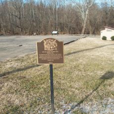
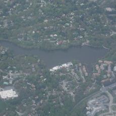
Patuxent Branch Trail, Rail trail in Howard County, Maryland, United States.

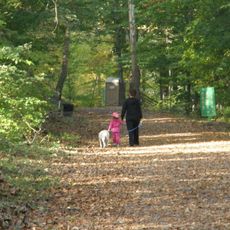
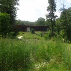
Patuxent Branch Trail is a rail trail running alongside the Little Patuxent River through Howard County, featuring a mix of crushed stone and asphalt surfaces. The path passes through natural settings with river views and wooded sections that draw both walkers and cyclists.

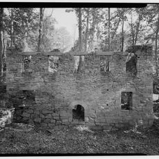
The trail follows the route of the Baltimore and Ohio Railroad Patuxent Branch, which operated from 1880 to 1928 to serve granite quarries and cotton mills. This rail line became the foundation for today's recreational pathway.

Local residents maintain the trail through volunteer efforts, organizing regular community events that promote outdoor recreation and environmental education.

The trail is easy to access, with parking areas at both endpoints and additional spots along the way. Visitors can start from either end depending on their preferred direction and distance.

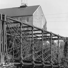
A historic Pratt Truss Bridge from 1902 stands at one of the trailheads, marking where the old industrial rail route meets today's recreational pathway. This distinctive steel structure catches the eye immediately upon arrival.

The community of curious travelers

AroundUs brings together thousands of curated places, local tips, and hidden gems, enriched daily by 60,000 contributors worldwide.
Start exploring
Location
GPS coordinates
39.16778,-76.85028
Latest update
September 15, 2026 14:26
Around this place
Merriweather Post Pavilion
United States of America

Merriweather Post Pavilion

3 mi
Bollman Truss Railroad Bridge
United States of America

Bollman Truss Railroad Bridge

2.7 mi
Lake Kittamaqundi
United States of America

Lake Kittamaqundi

3.4 mi
Savage Mill
United States of America

Savage Mill

2.5 mi
Blandair
United States of America

Blandair

3.2 mi
Oakland Manor
United States of America

Oakland Manor

3.8 mi
Ridgeline Roofers
United States of America

Ridgeline Roofers

2.5 mi
Savage Mill Trail
United States of America

Savage Mill Trail

2.7 mi
James and Anne Robinson Nature Center
United States of America

James and Anne Robinson Nature Center

2.9 mi
Athol Manor
United States of America

Athol Manor

1.8 mi
Laurel Museum
United States of America

Laurel Museum

4 mi
Christ Church Guilford
United States of America

Christ Church Guilford

1.7 mi
Savage Mill Historic District
United States of America

Savage Mill Historic District

2.5 mi
Trinity Church
United States of America

Trinity Church

4.4 mi
Old Laurel High School
United States of America

Old Laurel High School

4.2 mi
Avondale Mill
United States of America

Avondale Mill

4.2 mi
Simpsonville Mill
United States of America

Simpsonville Mill

2.8 mi
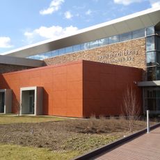
Laurel Branch Library
United States of America

Laurel Branch Library

4.5 mi
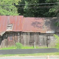
Oakland Mills Blacksmith House and Shop
United States of America

Oakland Mills Blacksmith House and Shop

3.7 mi
Curtis-Shipley Farmstead
United States of America

Curtis-Shipley Farmstead

4.2 mi
Howard County Center of African American Culture
United States of America

Howard County Center of African American Culture

3.8 mi
Asbury Methodist Episcopal Church
United States of America

Asbury Methodist Episcopal Church

3.1 mi
Mt. Moriah Lodge No. 7
United States of America

Mt. Moriah Lodge No. 7

3.1 mi
Hatfield Safe House
United States of America

Hatfield Safe House

2.7 mi
ROI Construction
United States of America

ROI Construction

2.2 mi
East Columbia Branch
United States of America

East Columbia Branch

1.6 mi
Savage Branch
United States of America

Savage Branch

2.6 mi
Wilde Lake
United States of America

Wilde Lake

3.9 mi
Show the full map
Reviews
Share your experience

No review yet

Discussions
Start a discussion...

No discussion yet

« Patuxent Branch Trail - Rail trail in Howard County, Maryland, United States » is provided by Around Us (aroundus.com). Images and texts are derived from Wikimedia project under a Creative Commons license. You are allowed to copy, distribute, and modify copies of this page, under the conditions set by the license, as long as this note is clearly visible.

Discover hidden gems everywhere you go!

From secret cafés to breathtaking viewpoints, skip the crowded tourist spots and find places that match your style. Our app makes it easy with voice search, smart filtering, route optimization, and insider tips from travelers worldwide. Download now for the complete mobile experience.
Around Us App Screenshot

A unique approach to discovering new places

Le Figaro

All the places worth exploring

France Info

A tailor-made excursion in just a few clicks

20 Minutes

Around Us
Travel Guide & Maps
Download

Send to your phone

QR Code
1

Open the camera app on your mobile.

2

Point at the QR code with your camera. A notification will appear.

3

Tap the notification to open the link.