Enable Location

We need your location to show you interesting places around you

Discover nearby places

Find interesting locations and hidden gems around you

Precise directions

Get accurate directions and distances to places

Your location is never shared with other users. It's only used when you tap the location button.

Howard County

Log in to your account

Start exploring — it's free

Trusted by 61,808 travelers worldwide

Continue with Google
Continue with Apple
or

We will send you a code to connect

By continuing, you accept our Terms and Conditions and our Privacy Policy

Check your inbox

We've sent a pincode in your inbox. Please enter the code below.

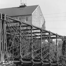
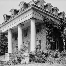
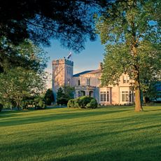
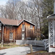
Howard County, Administrative county in Central Maryland, United States.

Description

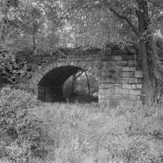
Howard County is an administrative area in Maryland that sits between Baltimore and the nation's capital. Rolling hills and two main rivers run through the territory, where developed neighborhoods mix with open land and wooded corridors.

History

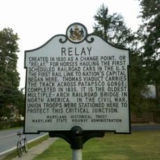
The area became a separate administrative unit in the first half of the 19th century after being carved from a larger neighboring territory. Its name honors an officer who fought in the Revolutionary War and later managed land holdings in the region.

Culture

The Howard County Public School System operates 71 educational institutions, serving 49,000 students and maintaining Maryland's highest-rated school district status.

Practical

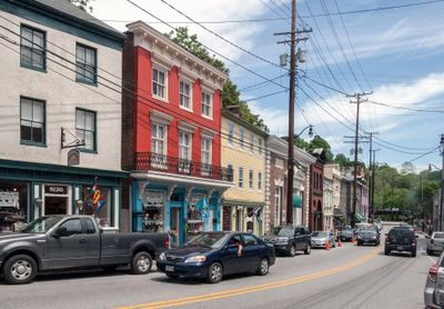
Several major highways cross the area and connect it to the two closest large cities. Visitors will find communities with shops and restaurants along the main roads.

Did you know?

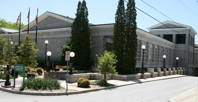
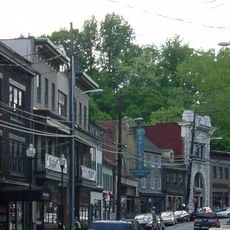
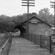
Unlike most areas in the region, this territory chose not to grant official status to any of its towns. Instead, a historic settlement serves as the administrative seat without having its own municipal government.

Location
Inception
1838
Capital city
Ellicott City
Part of
Baltimore metropolitan area
Shares border with
Anne Arundel County, Baltimore County, Carroll County, Frederick County, Prince George's County, Montgomery County
GPS coordinates
39.25000,-76.93000
Latest update
December 13, 2025 16:00

AroundUs brings together thousands of curated places, local tips, and hidden gems, enriched daily by 60,000 contributors worldwide. Discover all places nearby (Maryland).

Around this place
Merriweather Post Pavilion
United States of America

Merriweather Post Pavilion

7.3 km
National Cryptologic Museum
United States of America

National Cryptologic Museum

20.1 km
Patapsco Valley State Park
United States of America

Patapsco Valley State Park

13.2 km
Doughoregan Manor
United States of America

Doughoregan Manor

4.4 km
Thomas Viaduct
United States of America

Thomas Viaduct

18.9 km
Laurel Park
United States of America

Laurel Park

18.4 km
Bollman Truss Railroad Bridge
United States of America

Bollman Truss Railroad Bridge

15.7 km
Lake Kittamaqundi
United States of America

Lake Kittamaqundi

7.6 km
United States of America

Gwynn Oak Park

20.3 km
Savage Mill
United States of America

Savage Mill

15.6 km
Lake Needwood
United States of America

Lake Needwood

22.4 km
NSA Hall of Honor
United States of America

NSA Hall of Honor

20.1 km
Belmont Estate
United States of America

Belmont Estate

17.4 km
Patapsco Female Institute
United States of America

Patapsco Female Institute

11.7 km
Shrine of St. Anthony
United States of America

Shrine of St. Anthony

1.1 km
Glenelg Country School
United States of America

Glenelg Country School

2.7 km
Dickeyville Historic District
United States of America

Dickeyville Historic District

20.7 km
Ellicott City Historic District
United States of America

Ellicott City Historic District

11.7 km
Blandair
United States of America

Blandair

9.1 km
National Vigilance Park
United States of America

National Vigilance Park

20.4 km
United States of America

Patapsco Swinging Bridge

15.6 km
United States of America

Islamic Society of Baltimore

16.8 km
Oakland Manor
United States of America

Oakland Manor

7.1 km
St. Charles College, Maryland
United States of America

St. Charles College, Maryland

19.9 km
Relay, Maryland
United States of America

Relay, Maryland

19.1 km
Patterson Viaduct
United States of America

Patterson Viaduct

14.3 km
Joe Cannon Stadium
United States of America

Joe Cannon Stadium

21.2 km
Ellicott City Station
United States of America

Ellicott City Station

11.8 km
Show the full map
« Howard County - Administrative county in Central Maryland, United States » is provided by Around Us (aroundus.com). Images and texts are derived from Wikimedia project under a Creative Commons license. You are allowed to copy, distribute, and modify copies of this page, under the conditions set by the license, as long as this note is clearly visible.

Discover hidden gems everywhere you go!

From secret cafés to breathtaking viewpoints, skip the crowded tourist spots and find places that match your style. Our app makes it easy with voice search, smart filtering, route optimization, and insider tips from travelers worldwide. Download now for the complete mobile experience.

Around Us App Screenshot

A unique approach to discovering new places

Le Figaro

All the places worth exploring

France Info

A tailor-made excursion in just a few clicks

20 Minutes

Around Us
Travel Guide & Maps
Download

Send to your phone

QR Code
1

Open the camera app on your mobile.

2

Point at the QR code with your camera. A notification will appear.

3

Tap the notification to open the link.