Log in to your account

AroundUs is a community-driven map of interesting places, built by curious explorers like you. It grows with every review, story, and photo you share.
Connect to save your favorite spots, contribute locations, and create personalized routes.
Continue with Google
Continue with Apple
Continue with X
Continue with Facebook
Continue with email
By continuing, you accept our Terms and Conditions and our Privacy Policy
Create an account
Add to collection
Map
Suggest a change
Share

State Game Lands Number 31, Public game lands in Jefferson County, United States.

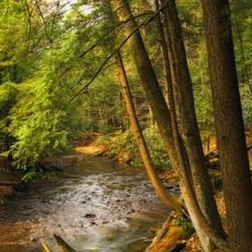
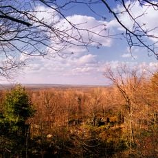
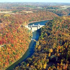
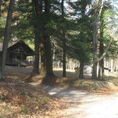
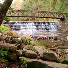
State Game Lands Number 31 is a public forest area covering more than 5,000 acres across several townships in Jefferson County, with mixed woodlands, open fields, and flowing streams throughout. The terrain includes elevation changes that support different types of forest growth and water systems flowing across the landscape.

This area was established as part of 1897 protection laws designed to preserve wildlife populations and create designated hunting zones. The creation followed growing awareness that natural areas needed management to protect animals and their habitats over time.

Pennsylvania Game Commission regularly organizes educational programs about wildlife management and conservation methods within these protected territories.

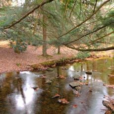
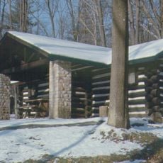
Several entry points with parking areas connect to a network of walking trails that let visitors explore different sections of the land across all seasons. The landscape changes noticeably through the year, so visiting at different times reveals different conditions and features.

The land sits in a transition zone between different forest types, so visitors encounter varied plant and animal communities within a relatively compact area. This diversity makes it a rewarding place for observing different species of plants and wildlife.

Location: Jefferson County

Location: Pennsylvania

GPS coordinates: 41.03556,-79.01722

Latest update: December 14, 2025 18:01

Photos
Around this place
Cook Forest State Park
United States of America

Cook Forest State Park

34.3 km
Clear Creek State Park
United States of America

Clear Creek State Park

33.1 km
Clear Creek State Forest
United States of America

Clear Creek State Forest

31.9 km
Mahoning Creek Dam
United States of America

Mahoning Creek Dam

25.3 km
Brookville Historic District
United States of America

Brookville Historic District

14.9 km
Brookville Presbyterian Church and Manse
United States of America

Brookville Presbyterian Church and Manse

15 km
John B. McCormick House
United States of America

John B. McCormick House

23.5 km
United States Post Office
United States of America

United States Post Office

10.8 km
Irvin-Patchin House
United States of America

Irvin-Patchin House

31.1 km
McGees Mills Covered Bridge
United States of America

McGees Mills Covered Bridge

27.4 km
T. M. Kurtz House
United States of America

T. M. Kurtz House

11 km
Christian Miller House
United States of America

Christian Miller House

10.9 km
DuBois Historic District
United States of America

DuBois Historic District

23.3 km
Phillip Taylor House
United States of America

Phillip Taylor House

13.9 km
Thomas Marshall House
United States of America

Thomas Marshall House

25.6 km
Joseph E. Hall House
United States of America

Joseph E. Hall House

15 km
Herpel Brothers Foundry and Machine Shop
United States of America

Herpel Brothers Foundry and Machine Shop

12.4 km
Gray-Taylor House
United States of America

Gray-Taylor House

15.2 km
Sen. Joseph O. Clark House
United States of America

Sen. Joseph O. Clark House

29.1 km
Colwell Cut Viaduct
United States of America

Colwell Cut Viaduct

31.1 km
Bridge in Greenwood Township
United States of America

Bridge in Greenwood Township

34 km
Bridge between Madison and Mahoning Townships
United States of America

Bridge between Madison and Mahoning Townships

33.3 km
Redferd Segers House
United States of America

Redferd Segers House

31.5 km
Cook Forest State Park River Cabin District
United States of America

Cook Forest State Park River Cabin District

35.5 km
Clear Creek State Park Day Use District
United States of America

Clear Creek State Park Day Use District

32.5 km
Clear Creek State Park Family Cabin District
United States of America

Clear Creek State Park Family Cabin District

34 km
Punxsutawney Weather Discovery Center
United States of America

Punxsutawney Weather Discovery Center

10.8 km
Laurel Mountain Winery
United States of America

Laurel Mountain Winery

24.7 km
Show the full map
Reviews

Visited this place? Tap the stars to rate it and share your experience / photos with the community! Try now! You can cancel it anytime.

« State Game Lands Number 31 - Public game lands in Jefferson County, United States » is provided by Around Us (aroundus.com). Images and texts are derived from Wikimedia project under a Creative Commons license. You are allowed to copy, distribute, and modify copies of this page, under the conditions set by the license, as long as this note is clearly visible.

Discover hidden gems everywhere you go!

From secret cafés to breathtaking viewpoints, skip the crowded tourist spots and find places that match your style. Our app makes it easy with voice search, smart filtering, route optimization, and insider tips from travelers worldwide. Download now for the complete mobile experience.

Around Us App Screenshot

A unique approach to discovering new places

Le Figaro

All the places worth exploring

France Info

A tailor-made excursion in just a few clicks

20 Minutes