Enable Location

We need your location to show you interesting places around you

Discover nearby places

Find interesting locations and hidden gems around you

Precise directions

Get accurate directions and distances to places

Your location is never shared with other users. It's only used when you tap the location button.

Log in to your account

Start exploring — it's free

Trusted by 63,783 travelers worldwide

Continue with Google
Continue with Apple
or

We will send you a code to connect

By continuing, you accept our Terms and Conditions and our Privacy Policy

Check your inbox

We've sent a pincode in your inbox. Please enter the code below.

State Game Lands Number 44
Discussion Reviews Photo
1.2k Popularity

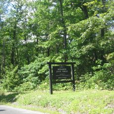
State Game Lands Number 44, Wildlife conservation area in Elk County, Pennsylvania

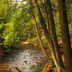
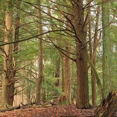
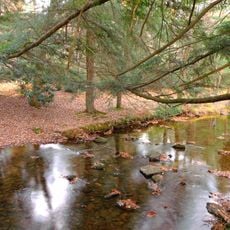
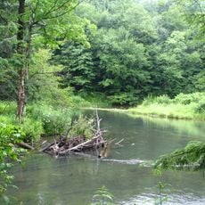
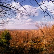
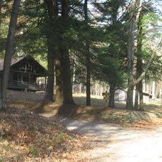
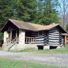
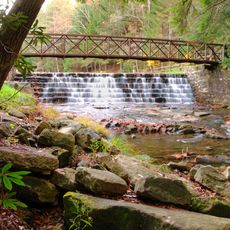
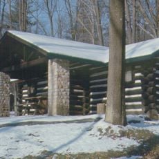
State Game Lands Number 44 is a wildlife conservation area covering about 40,000 acres of forests, wetlands, and open fields spread across multiple townships in Elk County. The land sits at elevations ranging from about 1,300 to 2,300 feet and is managed by the Pennsylvania Game Commission.

The Pennsylvania Game Commission established this area as part of conservation efforts to protect wildlife and natural resources. It received official recognition in 1979 and has operated as a hunting and conservation area since then.

Local hunters practice seasonal traditions for deer, turkey, and small game on these lands following state regulations. The hunting calendar shapes the rhythm of outdoor life in the surrounding communities.

The area is accessible through multiple entry points, though hunters need permits for seasonal activities. Visitors should check current hunting regulations and take proper safety precautions, especially during hunting season.

The land spans across multiple township boundaries, creating a connected patchwork of different forests and open areas that support diverse animal populations. This variety of habitats makes it possible to observe wildlife species that are rarely seen elsewhere in the region.

The community of curious travelers

AroundUs brings together thousands of curated places, local tips, and hidden gems, enriched daily by 60,000 contributors worldwide.

Start exploring
Location
Location
GPS coordinates
41.33667,-78.81667
Latest update
December 14, 2025 18:05
Around this place
Cook Forest State Park
United States of America

Cook Forest State Park

29.1 km
Parker Dam State Park
United States of America

Parker Dam State Park

29.8 km
Moshannon State Forest
United States of America

Moshannon State Forest

24.7 km
Clear Creek State Park
United States of America

Clear Creek State Park

22.8 km
Gomez Mill House
United States of America

Gomez Mill House

31 km
Bendigo State Park
United States of America

Bendigo State Park

26.8 km
Clear Creek State Forest
United States of America

Clear Creek State Forest

20.1 km
Brookville Historic District
United States of America

Brookville Historic District

29.7 km
Brookville Presbyterian Church and Manse
United States of America

Brookville Presbyterian Church and Manse

29.7 km
Parker Dam State Park Beach
United States of America

Parker Dam State Park Beach

30.1 km
O.B. Grant House
United States of America

O.B. Grant House

11 km
St. Marys Historic District
United States of America

St. Marys Historic District

23.5 km
DuBois Historic District
United States of America

DuBois Historic District

24.6 km
Ridgway Historic District
United States of America

Ridgway Historic District

11.9 km
Phillip Taylor House
United States of America

Phillip Taylor House

30.2 km
Joseph E. Hall House
United States of America

Joseph E. Hall House

29.8 km
John E. Weidenboerner House
United States of America

John E. Weidenboerner House

23.6 km
Gray-Taylor House
United States of America

Gray-Taylor House

29.6 km
Bonifels
United States of America

Bonifels

10.6 km
Johnsonburg Commercial Historic District
United States of America

Johnsonburg Commercial Historic District

20.7 km
Redferd Segers House
United States of America

Redferd Segers House

10.8 km
Swedish Lutheran Parsonage
United States of America

Swedish Lutheran Parsonage

28.8 km
DuBois Lanes
United States of America

DuBois Lanes

24.3 km
Cook Forest State Park River Cabin District
United States of America

Cook Forest State Park River Cabin District

31.4 km
Parker Dam State Park Family Cabin District
United States of America

Parker Dam State Park Family Cabin District

29.6 km
Clear Creek State Park Day Use District
United States of America

Clear Creek State Park Day Use District

22 km
Clear Creek State Park Family Cabin District
United States of America

Clear Creek State Park Family Cabin District

23.9 km
Laurel Mountain Winery
United States of America

Laurel Mountain Winery

16.2 km
Show the full map
Reviews
Share your experience

No review yet

Discussions
Start a discussion...

No discussion yet

« State Game Lands Number 44 - Wildlife conservation area in Elk County, Pennsylvania » is provided by Around Us (aroundus.com). Images and texts are derived from Wikimedia project under a Creative Commons license. You are allowed to copy, distribute, and modify copies of this page, under the conditions set by the license, as long as this note is clearly visible.

Discover hidden gems everywhere you go!

From secret cafés to breathtaking viewpoints, skip the crowded tourist spots and find places that match your style. Our app makes it easy with voice search, smart filtering, route optimization, and insider tips from travelers worldwide. Download now for the complete mobile experience.

Around Us App Screenshot

A unique approach to discovering new places

Le Figaro

All the places worth exploring

France Info

A tailor-made excursion in just a few clicks

20 Minutes

Around Us
Travel Guide & Maps
Download

Send to your phone

QR Code
1

Open the camera app on your mobile.

2

Point at the QR code with your camera. A notification will appear.

3

Tap the notification to open the link.