Enable Location

We need your location to show you interesting places around you

Discover nearby places

Find interesting locations and hidden gems around you

Precise directions

Get accurate directions and distances to places

Your location is never shared with other users. It's only used when you tap the location button.

Bendigo State Park

Log in to your account

Start exploring — it's free

Trusted by travelers worldwide

Continue with Google
Continue with Apple
or

We will send you a code to connect

By continuing, you accept our Terms and Conditions and our Privacy Policy

Check your inbox

We've sent a pincode in your inbox. Please enter the code below.

Bendigo State Park

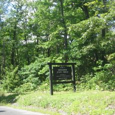
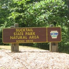
Bendigo State Park, State park in Jones Township, Pennsylvania, US

Description

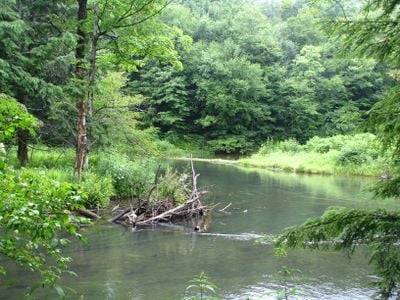
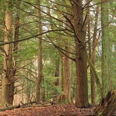
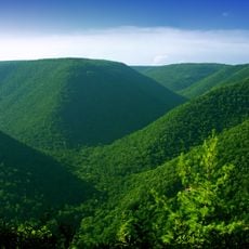
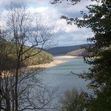
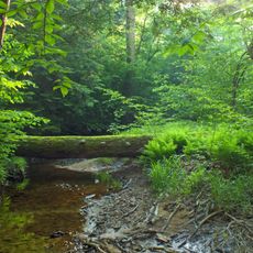
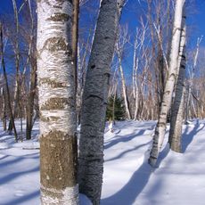
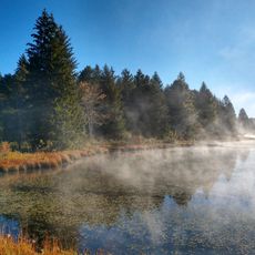
Bendigo State Park is a protected area in a valley along the East Branch Clarion River with mixed hardwood forests of beech, birch, cherry, and maple. The grounds feature multiple picnic areas and recreational spaces spread throughout the property.

History

This state park was established in 1959 and named after William Thompson Bendigo, an Irish tavern keeper and prizefighter who settled in northwestern Pennsylvania. The creation reflected a broader effort to preserve green spaces in the region.

Culture

The park reflects a period in the 1920s when Johnsonburg borough first opened the land for public use. Visitors today can sense this connection to early community development in the way the space is organized and maintained.

Practical

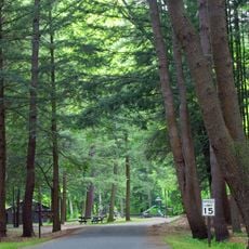
Visitors will find more than 150 picnic tables spread throughout the grounds, making it convenient for families and groups. A swimming pool operates during warmer months and makes the location ideal for a day trip when temperatures rise.

Did you know?

The property divides clearly into two parts: a smaller section with developed facilities and paths, while the larger portion remains as dense, undeveloped forest. This balance allows visitors to enjoy both organized recreation and quiet walks through nature.

Location
Inception
1959
GPS coordinates
41.53140,-78.62810
Latest update
December 13, 2025 11:45

AroundUs brings together thousands of curated places, local tips, and hidden gems, enriched daily by 60,000 contributors worldwide. Discover all places nearby (Pennsylvania).

Around this place
Kinzua Bridge State Park
United States of America

Kinzua Bridge State Park

25.2 km
Parker Dam State Park
United States of America

Parker Dam State Park

38 km
Moshannon State Forest
United States of America

Moshannon State Forest

36.2 km
Elk State Forest
United States of America

Elk State Forest

35.7 km
Gomez Mill House
United States of America

Gomez Mill House

30.1 km
Elk State Park
United States of America

Elk State Park

8.5 km
Allegheny National Recreation Area
United States of America

Allegheny National Recreation Area

36.4 km
Bucktail State Park Natural Area
United States of America

Bucktail State Park Natural Area

34.2 km
Tionesta Scenic and Research Natural Areas
United States of America

Tionesta Scenic and Research Natural Areas

28.6 km
Sizerville State Park
United States of America

Sizerville State Park

36.8 km
East Branch Clarion River Lake
United States of America

East Branch Clarion River Lake

7.7 km
Marion Brooks Natural Area
United States of America

Marion Brooks Natural Area

40.2 km
Anoatok
United States of America

Anoatok

20.5 km
Thomas L. Kane Memorial Chapel
United States of America

Thomas L. Kane Memorial Chapel

20.6 km
Parker Dam State Park Beach
United States of America

Parker Dam State Park Beach

38.6 km
O.B. Grant House
United States of America

O.B. Grant House

15.9 km
St. Marys Historic District
United States of America

St. Marys Historic District

12.6 km
Cameron County Courthouse
United States of America

Cameron County Courthouse

32.7 km
Ridgway Historic District
United States of America

Ridgway Historic District

14.9 km
John E. Weidenboerner House
United States of America

John E. Weidenboerner House

12.6 km
Bonifels
United States of America

Bonifels

16.3 km
Johnsonburg Commercial Historic District
United States of America

Johnsonburg Commercial Historic District

6.2 km
Redferd Segers House
United States of America

Redferd Segers House

33.7 km
Swedish Lutheran Parsonage
United States of America

Swedish Lutheran Parsonage

7 km
Parker Dam State Park Family Cabin District
United States of America

Parker Dam State Park Family Cabin District

38.3 km
Laurel Mountain Winery
United States of America

Laurel Mountain Winery

40.8 km
Beaver Meadows Lake
United States of America

Beaver Meadows Lake

39.9 km
Elk County Courthouse
United States of America

Elk County Courthouse

14.9 km
Show the full map
« Bendigo State Park - State park in Jones Township, Pennsylvania, US » is provided by Around Us (aroundus.com). Images and texts are derived from Wikimedia project under a Creative Commons license. You are allowed to copy, distribute, and modify copies of this page, under the conditions set by the license, as long as this note is clearly visible.

Discover hidden gems everywhere you go!

From secret cafés to breathtaking viewpoints, skip the crowded tourist spots and find places that match your style. Our app makes it easy with voice search, smart filtering, route optimization, and insider tips from travelers worldwide. Download now for the complete mobile experience.

Around Us App Screenshot

A unique approach to discovering new places

Le Figaro

All the places worth exploring

France Info

A tailor-made excursion in just a few clicks

20 Minutes

Around Us
Travel Guide & Maps
Download

Send to your phone

QR Code
1

Open the camera app on your mobile.

2

Point at the QR code with your camera. A notification will appear.

3

Tap the notification to open the link.