Enable Location

We need your location to show you interesting places around you

Discover nearby places

Find interesting locations and hidden gems around you

Precise directions

Get accurate directions and distances to places

Your location is never shared with other users. It's only used when you tap the location button.

East Branch Clarion River Lake

Log in to your account

Start exploring — it's free

Trusted by 62,478 travelers worldwide

Continue with Google
Continue with Apple
or

We will send you a code to connect

By continuing, you accept our Terms and Conditions and our Privacy Policy

Check your inbox

We've sent a pincode in your inbox. Please enter the code below.

East Branch Clarion River Lake

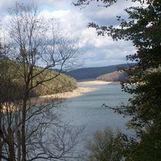
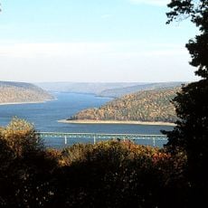
East Branch Clarion River Lake, body of water

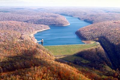
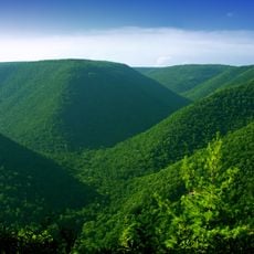
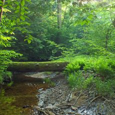
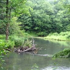
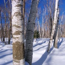
East Branch Clarion River Lake is a large reservoir in Elk County, Pennsylvania, created by a dam across the East Branch of the Clarion River. The water covers about 1,160 acres (470 hectares) and stretches nearly 6 miles (10 kilometers) through a forested region with calm, deep water surrounded by wooded shores.

The lake was created in 1952 when a dam was completed across the East Branch of the Clarion River to control flooding in the region. The construction was part of a broader effort to protect communities from flood damage, and since its completion, the structure has prevented millions in damages during major storm events.

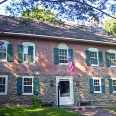
The lake bears the name of the East Branch of the Clarion River, the waterway from which it was formed. Today, fishing and boating bring together visitors who share a connection to outdoor recreation and the natural landscape of northeastern Pennsylvania.

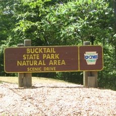
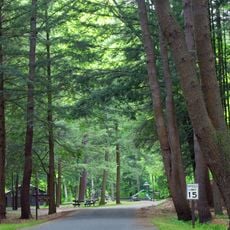
The lake is accessible year-round for fishing from shore or boats, with no horsepower restrictions on motors. Visitors can swim in summer months, try ice fishing in winter, and find marked trails for hiking around portions of the lake as well as picnic areas along the water.

During Tropical Storm Agnes in 1972, the lake prevented over 20 million dollars in flood damages to the surrounding area, demonstrating the critical role it plays in protection. This single event proved how valuable the structure remains to the region decades later.

The community of curious travelers

AroundUs brings together thousands of curated places, local tips, and hidden gems, enriched daily by 60,000 contributors worldwide.

Start exploring
Location
GPS coordinates
41.58083,-78.56385
Latest update
February 9, 2026 08:22
Around this place
Kinzua Bridge State Park
United States of America

Kinzua Bridge State Park

19.5 km
Moshannon State Forest
United States of America

Moshannon State Forest

41.5 km
Elk State Forest
United States of America

Elk State Forest

35.7 km
Gomez Mill House
United States of America

Gomez Mill House

34.8 km
Elk State Park
United States of America

Elk State Park

976 m
Allegheny National Recreation Area
United States of America

Allegheny National Recreation Area

39.8 km
Bucktail State Park Natural Area
United States of America

Bucktail State Park Natural Area

29.8 km
Tionesta Scenic and Research Natural Areas
United States of America

Tionesta Scenic and Research Natural Areas

31.9 km
Sizerville State Park
United States of America

Sizerville State Park

30.8 km
Lynn Hall
United States of America

Lynn Hall

34.7 km
Bendigo State Park
United States of America

Bendigo State Park

7.7 km
Marion Brooks Natural Area
United States of America

Marion Brooks Natural Area

41 km
Anoatok
United States of America

Anoatok

21.7 km
Thomas L. Kane Memorial Chapel
United States of America

Thomas L. Kane Memorial Chapel

22.1 km
O.B. Grant House
United States of America

O.B. Grant House

23.5 km
St. Marys Historic District
United States of America

St. Marys Historic District

16.9 km
Cameron County Courthouse
United States of America

Cameron County Courthouse

28.3 km
Bradford Downtown Historic District
United States of America

Bradford Downtown Historic District

42.3 km
Ridgway Historic District
United States of America

Ridgway Historic District

22.5 km
John E. Weidenboerner House
United States of America

John E. Weidenboerner House

16.9 km
Bonifels
United States of America

Bonifels

24 km
Johnsonburg Commercial Historic District
United States of America

Johnsonburg Commercial Historic District

13.8 km
Redferd Segers House
United States of America

Redferd Segers House

40.9 km
Swedish Lutheran Parsonage
United States of America

Swedish Lutheran Parsonage

10.3 km
Bradfords Main Street Movie House
United States of America

Bradfords Main Street Movie House

42.3 km
Allegheny National Forest Visitors Bureau
United States of America

Allegheny National Forest Visitors Bureau

42.2 km
St. Bernard Roman Catholic Church
United States of America

St. Bernard Roman Catholic Church

42.2 km
Elk County Courthouse
United States of America

Elk County Courthouse

22.5 km
Show the full map
« East Branch Clarion River Lake - body of water » is provided by Around Us (aroundus.com). Images and texts are derived from Wikimedia project under a Creative Commons license. You are allowed to copy, distribute, and modify copies of this page, under the conditions set by the license, as long as this note is clearly visible.

Discover hidden gems everywhere you go!

From secret cafés to breathtaking viewpoints, skip the crowded tourist spots and find places that match your style. Our app makes it easy with voice search, smart filtering, route optimization, and insider tips from travelers worldwide. Download now for the complete mobile experience.

Around Us App Screenshot

A unique approach to discovering new places

Le Figaro

All the places worth exploring

France Info

A tailor-made excursion in just a few clicks

20 Minutes

Around Us
Travel Guide & Maps
Download

Send to your phone

QR Code
1

Open the camera app on your mobile.

2

Point at the QR code with your camera. A notification will appear.

3

Tap the notification to open the link.