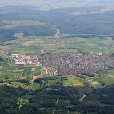
Steinhirt, Mountain summit in Baden-Württemberg, Germany
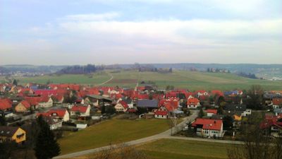
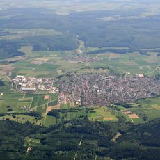
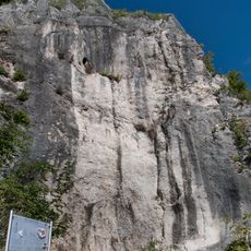
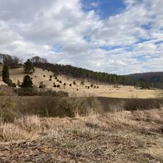
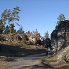
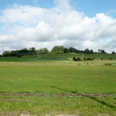
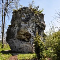
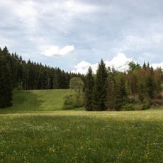
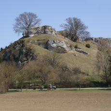
Steinhirt is a mountain summit in Baden-Württemberg topped by the Wäldlesfels, an eight-meter limestone rock formation that rises sharply above the surrounding terrain. The peak offers views across forested hills and can be reached from several approaches.
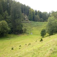
The hill formed approximately 14 to 15 million years ago through ground rebound following a meteorite impact that created the Steinheimer Basin. The rock formation has remained relatively unchanged since this ancient geological event.
The place holds significance for the climbing community, who regularly gather here to practice their skills. Today visitors can see chalk marks and climbing gear scattered around the rock, showing how actively this formation is used.
The rock is a popular training ground for climbers with routes of varying difficulty levels. Visitors should wear sturdy footwear and watch the weather, as the limestone becomes slippery when wet.
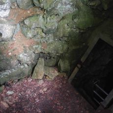
The limestone surface contains drill holes left by ancient marine mollusks, revealing that an old reef once thrived here. These traces remind visitors that the meteorite crater was once filled with water.
Location: Baden-Württemberg
Elevation above the sea: 578.4 m
GPS coordinates: 48.68544,10.06706
Latest update: December 14, 2025 09:41
Steinheim crater
204 m
Hellenstein Castle
6.1 km
Rommel Monument
5.5 km
Naturtheater Heidenheim
5.9 km
Pauluskirche
6.5 km
Meteorkratermuseum
895 m
Brunnenmühlenquelle
6.5 km
Heidenschmiede
6.2 km
New City Library Heidenheim
6.3 km
Kunstmuseum Heidenheim
6.4 km
Konzerthaus Heidenheim
6.3 km
Museum Hellenstein castle
6.1 km
Schreiberhöhle
3.4 km
St. Michael's Church
6.3 km
Museum für Kutschen, Chaisen, Karren
6.2 km
Ugentalsperre
4.4 km
Hochwasserrückhaltebecken Wental
3.2 km
Bullenberg-Dudelberg-Stockhau
4.9 km
Wental mit Seitentälern und Feldinsel Klösterle
4.6 km
Steinheimer Becken mit Schäfhalde, Teilen des Stuben- und Zwerchstubentales mit Nebentälern und angrenzenden Geländeteilen (ausgenommen Ortsbereiche von Steinheim und Sontheim)
361 m
Marienkirche
6.4 km
Steinheimer Becken
2.3 km
Steinheimer Becken
1.4 km
Schloßfelsen
6.2 km
Ugental zwischen Ochsenhau und Buchhalde
4.5 km
Wental
4 km
Piercing
6.4 km
Felsgruppe des Burgstalles
1.2 kmVisited this place? Tap the stars to rate it and share your experience / photos with the community! Try now! You can cancel it anytime.
Discover hidden gems everywhere you go!
From secret cafés to breathtaking viewpoints, skip the crowded tourist spots and find places that match your style. Our app makes it easy with voice search, smart filtering, route optimization, and insider tips from travelers worldwide. Download now for the complete mobile experience.
A unique approach to discovering new places❞
— Le Figaro
All the places worth exploring❞
— France Info
A tailor-made excursion in just a few clicks❞
— 20 Minutes