Ibrahimiya Canal, Ancient irrigation canal in Middle Egypt.
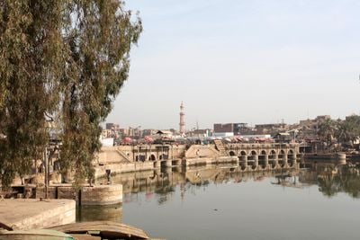
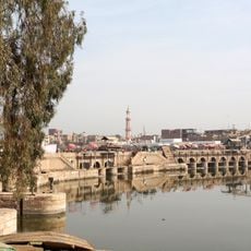
The Ibrahimiya Canal is an artificial waterway in Middle Egypt that stretches from Assiut for roughly 350 kilometers, running parallel to the Nile River at a distance of about 4 to 5 kilometers. Near Dairut, it divides into several branches, including the Bahr Yussef Canal, which distributes water through six different channels to the surrounding agricultural areas.
The canal was constructed in 1873 under Khedive Ismail Pasha as part of the nation's first major water management infrastructure program. This project transformed farming in the region by enabling irrigation of new lands and significantly increasing agricultural productivity.
The waterway has been the foundation of farming in this region since it opened, shaping how local farmers water their fields and plan their harvests. Villages along its path live according to the rhythm of irrigation, with daily routines tied to water availability and seasonal needs.
The waterway is accessible from several roads, and the best time to visit is during the dry season when water levels are more stable and the surroundings easier to explore. It helps to use local guides to understand the different sections and safely navigate through the agricultural lands.
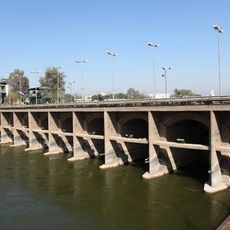
The waterway draws from the Nile without inlet structures or weirs at its connection point, relying entirely on natural river flow to feed its system. This simple design allows water to move continuously, making it one of Egypt's longest artificial channels that operates without complex control mechanisms.
The community of curious travelers
AroundUs brings together thousands of curated places, local tips, and hidden gems, enriched daily by 60,000 contributors worldwide.