Green Crag

Log in to your account

AroundUs is a community-driven map of interesting places, built by curious explorers like you. It grows with every review, story, and photo you share.
Connect to save your favorite spots, contribute locations, and create personalized routes.
Continue with Google
Continue with Apple
Continue with X
Continue with Facebook
Continue with email
By continuing, you accept our Terms and Conditions and our Privacy Policy
Create an account
Add to collection
Map
Suggest a change
Share

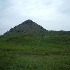
Green Crag, Mountain summit in Cumbria, England

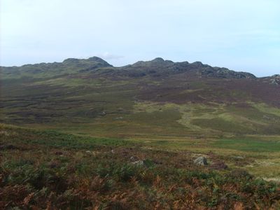
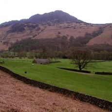
Green Crag rises to 489 meters (1,604 feet) between Eskdale and Duddon Valley, featuring rocky northern slopes with a distinct jagged skyline visible from several vantage points. The fell provides a clear visual reference point across the surrounding valleys and moorland.

The summit gained recognition through its inclusion in Alfred Wainwright's Pictorial Guide to the Lakeland Fells, marking a significant boundary for regional fell walking territories. This guidebook opened the area to wider exploration and influenced how visitors navigate the Lake District.

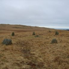
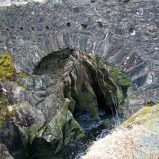
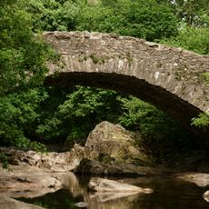
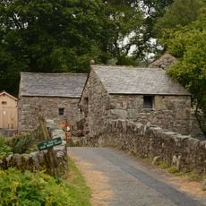
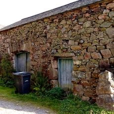
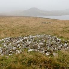
The fell contains remnants from the 1880s industrial period, including the Gate Gill iron mine that extracted haematite during Victorian times. These traces shape how visitors experience the landscape and understand the area's past uses.

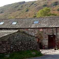
Access from Birker Fell Road offers parking areas, while marked trails through conifer plantations provide routes from the Duddon Valley side. The paths are well-marked, though conditions vary depending on weather and recent maintenance.

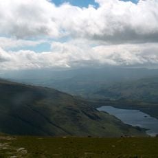
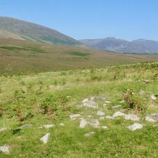
The summit features exposed rock formations from the Borrowdale Volcanic Group, requiring basic scrambling skills to reach the top. From this vantage point, views extend toward the southern fells and reveal the geological layers that define this landscape.

Location: Cumbria

Elevation above the sea: 489 m

GPS coordinates: 54.37372,-3.23277

Latest update: December 14, 2025 14:42

Photos
Around this place
Hardknott Roman Fort
United Kingdom

Hardknott Roman Fort

3.8 km
Harter Fell
United Kingdom

Harter Fell

2.4 km
Cairnfield including a prehistoric enclosure, 5 stone circles, 10 funerary cairns, 6 stone banks, 2 stone walls, a lynchet and a
United Kingdom

Cairnfield including a prehistoric enclosure, 5 stone circles, 10 funerary cairns, 6 stone banks, 2 stone walls, a lynchet and a

5 km
Seathwaite Tarn
United Kingdom

Seathwaite Tarn

5.1 km
Birks Bridge
United Kingdom

Birks Bridge

3.6 km
Stickle Pike
United Kingdom

Stickle Pike

5.6 km
St Catherine's Church, Boot
United Kingdom

St Catherine's Church, Boot

3.1 km
Holy Trinity Church, Seathwaite
United Kingdom

Holy Trinity Church, Seathwaite

3.6 km
Eskdale Centre
United Kingdom

Eskdale Centre

6 km
St Bega's Church
United Kingdom

St Bega's Church

6.1 km
Eskdale Mill
United Kingdom

Eskdale Mill

3.7 km
Church of St John
United Kingdom

Church of St John

5 km
Bridge Over Whillan Beck To South West Of Corn Mill
United Kingdom

Bridge Over Whillan Beck To South West Of Corn Mill

3.7 km
Doctor Bridge
United Kingdom

Doctor Bridge

2.7 km
Eskdale War Memorial
United Kingdom

Eskdale War Memorial

3.7 km
Forge House With Attached Barn, Stable And Byres
United Kingdom

Forge House With Attached Barn, Stable And Byres

5.4 km
K6 Telephone Kiosk
United Kingdom

K6 Telephone Kiosk

3.1 km
Bridge End Farmhouse
United Kingdom

Bridge End Farmhouse

3.7 km
Boot House And Whillanside
United Kingdom

Boot House And Whillanside

3.7 km
Dalegarth Hall
United Kingdom

Dalegarth Hall

3.5 km
Barn West Of Forge House
United Kingdom

Barn West Of Forge House

5.4 km
Building To South West Of Corn Mill On East Side Of Road At North End Of Bridge
United Kingdom

Building To South West Of Corn Mill On East Side Of Road At North End Of Bridge

3.7 km
Barn To South West Of Whillanside
United Kingdom

Barn To South West Of Whillanside

3.7 km
Barn To North West Of Bridge End Farmhouse
United Kingdom

Barn To North West Of Bridge End Farmhouse

3.7 km
Ulpha Bridge (That Part In Dunnerdale With Seathwaite Cp)
United Kingdom

Ulpha Bridge (That Part In Dunnerdale With Seathwaite Cp)

5.3 km
Prehistoric cairnfield, associated field system and hut circle      east of Water Crag
United Kingdom

Prehistoric cairnfield, associated field system and hut circle east of Water Crag

4.5 km
Prehistoric enclosure, hut circle and adjacent cairnfield east of Whillan Beck, Burnmoor
United Kingdom

Prehistoric enclosure, hut circle and adjacent cairnfield east of Whillan Beck, Burnmoor

5.2 km
Eskdale Corn Mill
United Kingdom

Eskdale Corn Mill

3.7 km
Show the full map
Reviews

Visited this place? Tap the stars to rate it and share your experience / photos with the community! Try now! You can cancel it anytime.

« Green Crag - Mountain summit in Cumbria, England » is provided by Around Us (aroundus.com). Images and texts are derived from Wikimedia project under a Creative Commons license. You are allowed to copy, distribute, and modify copies of this page, under the conditions set by the license, as long as this note is clearly visible.

Discover hidden gems everywhere you go!

From secret cafés to breathtaking viewpoints, skip the crowded tourist spots and find places that match your style. Our app makes it easy with voice search, smart filtering, route optimization, and insider tips from travelers worldwide. Download now for the complete mobile experience.

Around Us App Screenshot

A unique approach to discovering new places

Le Figaro

All the places worth exploring

France Info

A tailor-made excursion in just a few clicks

20 Minutes