Enable Location

We need your location to show you interesting places around you

Discover nearby places

Find interesting locations and hidden gems around you

Precise directions

Get accurate directions and distances to places

Your location is never shared with other users. It's only used when you tap the location button.

Nagasaki Ropeway

Log in to your account

Start exploring — it's free

Trusted by 61,664 travelers worldwide

Continue with Google
Continue with Apple
or

We will send you a code to connect

By continuing, you accept our Terms and Conditions and our Privacy Policy

Check your inbox

We've sent a pincode in your inbox. Please enter the code below.

Nagasaki Ropeway

Nagasaki Ropeway, Aerial tramway at Mount Inasa, Nagasaki, Japan

Description

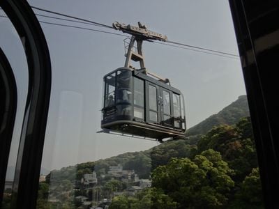
The Nagasaki Ropeway connects the base station to the summit of Mount Inasa at 333 meters (1,093 feet) elevation, offering views of the city and harbor during the journey. Gondolas travel back and forth regularly, with each ascent taking roughly 6 minutes.

History

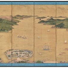
The ropeway opened in 1959 and was among the first cable systems in Japan designed to quickly bring tourists to a mountain summit without a long hike. The project emerged during Nagasaki's postwar rebuilding period, when the city sought new attractions to welcome visitors.

Culture

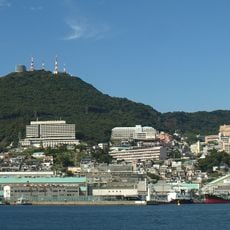
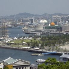
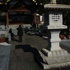
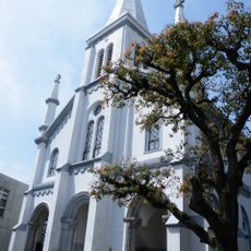
The summit offers views showing how the city blends temples, churches, and modern buildings across different neighborhoods, reflecting Nagasaki's long history as a port open to outside influence. You can see how locals and visitors use the viewing areas to take in these layers of the urban landscape.

Practical

The cabins are spacious and designed with good views outward, so you can photograph during the ride. At the summit you find resting areas, a restaurant, and restrooms, making it easy to spend several hours at the top if you wish.

Did you know?

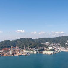
On clear days, the summit view extends far enough to show Mount Unzen and the Goto Islands in the distance, revealing how Nagasaki sits within a broader geography. These distant views underscore the city's role as a historic port in a larger regional landscape.

Location
Inception
1958
Official opening
October 4, 1959
Accessibility
Wheelchair inaccessible
Opening Hours
09:00-22:00
GPS coordinates
32.75642,129.85531
Latest update
December 10, 2025 20:07

AroundUs brings together thousands of curated places, local tips, and hidden gems, enriched daily by 60,000 contributors worldwide. Discover all places nearby (Nagasaki).

« Nagasaki Ropeway - Aerial tramway at Mount Inasa, Nagasaki, Japan » is provided by Around Us (aroundus.com). Images and texts are derived from Wikimedia project under a Creative Commons license. You are allowed to copy, distribute, and modify copies of this page, under the conditions set by the license, as long as this note is clearly visible.

Discover hidden gems everywhere you go!

From secret cafés to breathtaking viewpoints, skip the crowded tourist spots and find places that match your style. Our app makes it easy with voice search, smart filtering, route optimization, and insider tips from travelers worldwide. Download now for the complete mobile experience.

Around Us App Screenshot

A unique approach to discovering new places

Le Figaro

All the places worth exploring

France Info

A tailor-made excursion in just a few clicks

20 Minutes

Around Us
Travel Guide & Maps
Download

Send to your phone

QR Code
1

Open the camera app on your mobile.

2

Point at the QR code with your camera. A notification will appear.

3

Tap the notification to open the link.