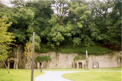
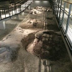
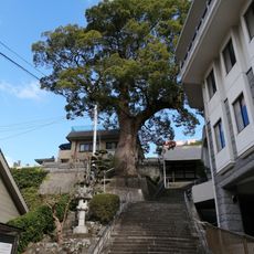
Tateyama Air-raid Shelter, World War II air-raid shelter near History Museum, Nagasaki, Japan.
Tateyama Air-raid Shelter is an underground tunnel system in Nagasaki, built as a wartime command center for city government staff, with several connected rooms reinforced with concrete and metal supports. The tunnel runs beneath a hillside and the interior is dimly lit, with low ceilings and narrow corridors that give a clear sense of the confined space.
The tunnel system was built in the early 1940s to protect city government workers from air raids. On August 9, 1945, the day the atomic bomb was dropped on Nagasaki, officials inside this shelter began coordinating the city's emergency response from underground.
The shelter shows how local government workers continued their duties underground while the city above them was in ruins. Walking through the rooms gives a concrete sense of what it meant to make decisions in total darkness and uncertainty.
The shelter is in the Tateyama area of Nagasaki and can be reached on foot or by tram from the city center. Inside, the ground is uneven and the lighting is low, so sturdy shoes and a moment to let your eyes adjust are a good idea.
The shelter sat about 1.7 miles (2.7 kilometers) from the point of the atomic explosion, close enough that the blast shook the walls and knocked people off their feet. Some of the original handwritten notes and radio equipment used on that day are still on display inside.
The community of curious travelers
AroundUs brings together thousands of curated places, local tips, and hidden gems, enriched daily by 60,000 contributors worldwide.