·

Enable Location

We need your location to show you interesting places around you

Discover nearby places

Find interesting locations and hidden gems around you

Precise directions

Get accurate directions and distances to places

Your location is never shared with other users. It's only used when you tap the location button.

Log in to your account

Start exploring — it's free

Trusted by 62,754 travelers worldwide

Continue with Google
Continue with Apple
or

We will send you a code to connect

By continuing, you accept our Terms and Conditions and our Privacy Policy

Check your inbox

We've sent a pincode in your inbox. Please enter the code below.

千丈渓

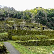
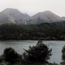
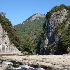
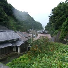
千丈渓, 島根県邑南町・江津市にある渓谷

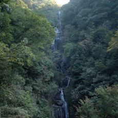
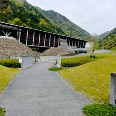
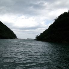
Senjokei is a valley with steep rock walls and clear flowing water along the Hiyori River. The walking path stretches about 4.8 kilometers through the valley, passing waterfalls, smooth rock faces, and boulders of various sizes that water has shaped over time.

The valley has been known as an important place in the landscape since ancient times and was visited by travelers and residents. Over centuries, flowing water has gradually carved the rock walls and formations into their present shapes.

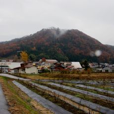
The name refers to the towering rock wall that resembles a cliff of immense height. Local residents have long used this valley for walks and gatherings, showing how the place holds meaning as part of their everyday connection with nature.

The valley is best reached by car along Route 261 from the center of Gotsu city, taking about 30 minutes. The walking path is well maintained, but there are some steep stairs, so wear comfortable shoes and take your time if the weather is hot.

The place is known for 24 special viewpoints, with the Shirafuji Waterfall being the highest and most striking among them, dropping about 40 meters and spreading 8 meters across. After rain or during snowmelt, the waterfall becomes particularly powerful and creates a dramatic sight against the surrounding rocks.

The community of curious travelers

AroundUs brings together thousands of curated places, local tips, and hidden gems, enriched daily by 60,000 contributors worldwide.

Start exploring
Location
Location
GPS coordinates
34.91722,132.35525
Latest update
February 9, 2026 07:46
« 千丈渓 - 島根県邑南町・江津市にある渓谷 » is provided by Around Us (aroundus.com). Images and texts are derived from Wikimedia project under a Creative Commons license. You are allowed to copy, distribute, and modify copies of this page, under the conditions set by the license, as long as this note is clearly visible.

Discover hidden gems everywhere you go!

From secret cafés to breathtaking viewpoints, skip the crowded tourist spots and find places that match your style. Our app makes it easy with voice search, smart filtering, route optimization, and insider tips from travelers worldwide. Download now for the complete mobile experience.

Around Us App Screenshot

A unique approach to discovering new places

Le Figaro

All the places worth exploring

France Info

A tailor-made excursion in just a few clicks

20 Minutes

Around Us
Travel Guide & Maps
Download

Send to your phone

QR Code
1

Open the camera app on your mobile.

2

Point at the QR code with your camera. A notification will appear.

3

Tap the notification to open the link.