Enable Location

We need your location to show you interesting places around you

Discover nearby places

Find interesting locations and hidden gems around you

Precise directions

Get accurate directions and distances to places

Your location is never shared with other users. It's only used when you tap the location button.

Flat Brook

Log in to your account

Start exploring — it's free

Trusted by 63,554 travelers worldwide

Continue with Google
Continue with Apple
or

We will send you a code to connect

By continuing, you accept our Terms and Conditions and our Privacy Policy

Check your inbox

We've sent a pincode in your inbox. Please enter the code below.

Flat Brook
Discussion Reviews 1 Photos
2.1k Popularity

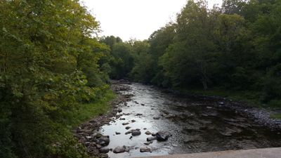
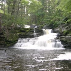
Flat Brook, Tributary of Delaware River in Sussex County, US

Flat Brook is a tributary of the Delaware River that winds through the hilly terrain of Sussex County before joining the main river at Walpack Township. The water flows through varied landscapes of forests, meadows, and rocky outcrops that define the valley.

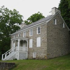
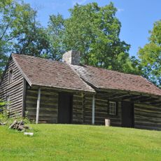
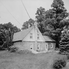
The stream flows through a region settled for centuries, where early colonists harnessed the water to power mills and farms. Over the decades, the valley experienced growth and change while keeping its role as a vital water source.

The valley shaped by this waterway held deep importance for Lenape communities who used its resources for hunting and gathering. Today, visitors walking through the area can sense how central water has remained to life in this region.

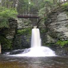
The stream is surrounded by state parks and forest lands that can be explored on natural trails, especially in fall and spring. The banks are mostly accessible, but water can rise quickly after rain, so caution is wise.

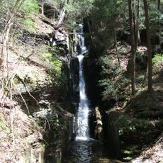
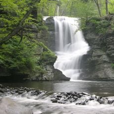
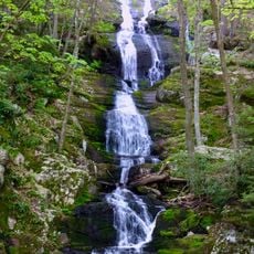
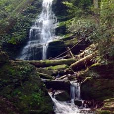
The name Flat Brook is deceptive because the water is almost always moving and creates small rapids and cascades along much of its course. The geology beneath the water is quite varied with slate deposits that give the streambed a rough texture.

The community of curious travelers

AroundUs brings together thousands of curated places, local tips, and hidden gems, enriched daily by 60,000 contributors worldwide.

Start exploring
Location
GPS coordinates
41.18870,-74.84710
Latest update
December 14, 2025 09:46
Around this place
Delaware Water Gap National Recreation Area
United States of America

Delaware Water Gap National Recreation Area

6.8 km
Dingmans Falls
United States of America

Dingmans Falls

6 km
Stokes State Forest
United States of America

Stokes State Forest

4.2 km
Dingman's Ferry Bridge
United States of America

Dingman's Ferry Bridge

3.6 km
Space Farms Zoo and Museum
United States of America

Space Farms Zoo and Museum

13.1 km
Swartswood State Park
United States of America

Swartswood State Park

13 km
Silverthread Falls
United States of America

Silverthread Falls

5.7 km
Fulmer Falls
United States of America

Fulmer Falls

7.9 km
Deer Leap Falls
United States of America

Deer Leap Falls

7.8 km
Milford–Montague Toll Bridge
United States of America

Milford–Montague Toll Bridge

13.8 km
Van Campen's Inn
United States of America

Van Campen's Inn

4.6 km
Marie Zimmermann Farm
United States of America

Marie Zimmermann Farm

7.1 km
Factory Falls
United States of America

Factory Falls

8 km
Dingman's Ferry Dutch Reformed Church
United States of America

Dingman's Ferry Dutch Reformed Church

4.5 km
Brodhead Farm
United States of America

Brodhead Farm

7.5 km
Nyce Farm
United States of America

Nyce Farm

8.9 km
Buttermilk Falls
United States of America

Buttermilk Falls

6.8 km
Foster-Armstrong House
United States of America

Foster-Armstrong House

14.3 km
Old Mine Road Historic District
United States of America

Old Mine Road Historic District

14.7 km
Andrew Snable House
United States of America

Andrew Snable House

2.9 km
Rutan Farm
United States of America

Rutan Farm

8.8 km
Sussex County Fairgrounds
United States of America

Sussex County Fairgrounds

12.6 km
Walpack Methodist Church
United States of America

Walpack Methodist Church

4.3 km
Silver Spray Falls
United States of America

Silver Spray Falls

6.2 km
Wallpack Center Historic District
United States of America

Wallpack Center Historic District

4.3 km
Peters Valley Historic District
United States of America

Peters Valley Historic District

976 m
Westbrook-Bell House
United States of America

Westbrook-Bell House

10 km
Nyce-Depue Farm
United States of America

Nyce-Depue Farm

6.5 km
Show the full map
Reviews
Share your experience

No review yet

Discussions
Start a discussion...

No discussion yet

« Flat Brook - Tributary of Delaware River in Sussex County, US » is provided by Around Us (aroundus.com). Images and texts are derived from Wikimedia project under a Creative Commons license. You are allowed to copy, distribute, and modify copies of this page, under the conditions set by the license, as long as this note is clearly visible.

Discover hidden gems everywhere you go!

From secret cafés to breathtaking viewpoints, skip the crowded tourist spots and find places that match your style. Our app makes it easy with voice search, smart filtering, route optimization, and insider tips from travelers worldwide. Download now for the complete mobile experience.

Around Us App Screenshot

A unique approach to discovering new places

Le Figaro

All the places worth exploring

France Info

A tailor-made excursion in just a few clicks

20 Minutes

Around Us
Travel Guide & Maps
Download

Send to your phone

QR Code
1

Open the camera app on your mobile.

2

Point at the QR code with your camera. A notification will appear.

3

Tap the notification to open the link.