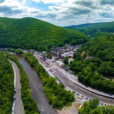
Lehigh Gap, Water gap in Blue Mountain, Pennsylvania.
Lehigh Gap is a passage cut through Blue Mountain where the Lehigh River flows between Carbon County to the north and Lehigh and Northampton counties to the south. The gap sits along Pennsylvania Route 248, which connects the Lehigh Valley cities of Allentown and Bethlehem to smaller communities further north.
Four railroad companies built lines through the gap in the 1800s to connect major northeastern cities, with the Lehigh Valley Railroad operating the main route. This rail infrastructure shaped regional development and made the passage a key transportation corridor for commerce and industry.
The nature center that opened in 2002 transformed a former industrial zone into a place for environmental education and research. Visitors today can walk trails through an area that has been reclaimed from industrial use.
The gap is accessible via the Appalachian Trail, local hiking routes, and Pennsylvania Route 248 passing through the area. Spring and fall offer pleasant conditions for walking the trails and exploring the natural features.
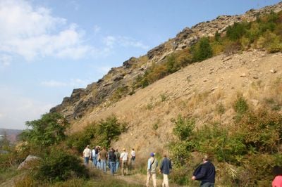
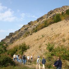
A striking rock formation called Devil's Pulpit draws hikers into the gap, while a section of the Appalachian Trail features an exposed rock scramble informally known as Dante's Inferno. These hiking features give visitors memorable moments when moving through this natural passage.
The community of curious travelers
AroundUs brings together thousands of curated places, local tips, and hidden gems, enriched daily by 60,000 contributors worldwide.