Enable Location

We need your location to show you interesting places around you

Discover nearby places

Find interesting locations and hidden gems around you

Precise directions

Get accurate directions and distances to places

Your location is never shared with other users. It's only used when you tap the location button.

Beltzville State Park

Log in to your account

Start exploring — it's free

Trusted by 61,353 travelers worldwide

Continue with Google
Continue with Apple
or

We will send you a code to connect

By continuing, you accept our Terms and Conditions and our Privacy Policy

Check your inbox

We've sent a pincode in your inbox. Please enter the code below.

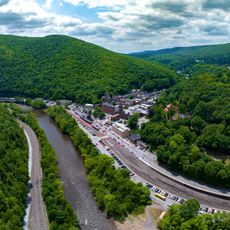
Beltzville State Park, State park in Carbon County, Pennsylvania, US

Description

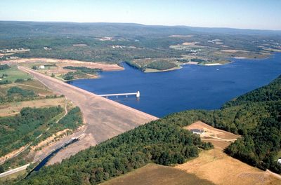
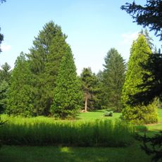
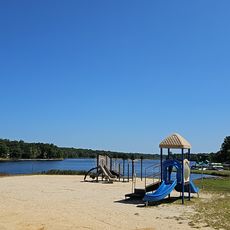
Beltzville State Park is a nature reserve covering around 3,000 acres in the Pocono foothills with a large lake, sandy swimming beach, and hiking trails. The property includes various landscapes and waterways that create different habitats throughout the grounds.

History

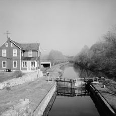
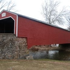
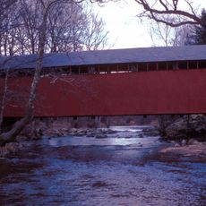
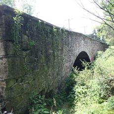
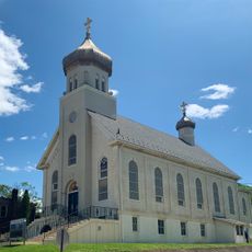
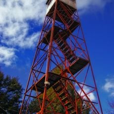
The park was established in 1972 by the U.S. Army Corps of Engineers as a reservoir and recreation area. Within its boundaries stands the Harrity Covered Bridge, built in 1841, which represents a link to the region's earlier transportation history.

Culture

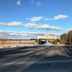
The park draws people seeking outdoor recreation and time by the water, with the sandy beach and lake serving as a social hub during warmer months. Families and fishing enthusiasts gather here regularly, making it a familiar destination for the local community.

Practical

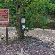
Two boat launches provide access to the lake, with designated zones where speed limits protect swimmers and other visitors. The grounds are easy to navigate with a maintained beach and clearly marked trails suitable for different activity levels.

Did you know?

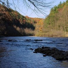
Pohopoco Creek runs through the grounds and is regularly stocked with trout, drawing fishing enthusiasts to its waters. The flowing stream supports a rich diversity of aquatic plants and wildlife that makes the area feel particularly alive.

Location
Inception
1972
Operator
Pennsylvania Bureau of State Parks
GPS coordinates
40.86830,-75.60810
Latest update
December 7, 2025 20:40

AroundUs brings together thousands of curated places, local tips, and hidden gems, enriched daily by 60,000 contributors worldwide. Discover all places nearby (Pennsylvania).

Around this place
Pocono Raceway
United States of America

Pocono Raceway

22.4 km
Hickory Run State Park
United States of America

Hickory Run State Park

19.7 km
Lehigh Canal
United States of America

Lehigh Canal

11 km
Lehigh Gorge State Park
United States of America

Lehigh Gorge State Park

16.7 km
Asa Packer Mansion
United States of America

Asa Packer Mansion

10.9 km
Harry Packer Mansion
United States of America

Harry Packer Mansion

10.9 km
Lehigh Gap
United States of America

Lehigh Gap

10.2 km
Carbon County Jail
United States of America

Carbon County Jail

11.7 km
Old Mauch Chunk Historic District
United States of America

Old Mauch Chunk Historic District

11.4 km
St. Mark's Episcopal Church
United States of America

St. Mark's Episcopal Church

11.1 km
Troxell-Steckel House
United States of America

Troxell-Steckel House

22.3 km
Lehigh Gap
United States of America

Lehigh Gap

10.2 km
Kreidersville Covered Bridge
United States of America

Kreidersville Covered Bridge

18.8 km
Little Gap Covered Bridge
United States of America

Little Gap Covered Bridge

8.3 km
Lee and Virginia Graver Arboretum
United States of America

Lee and Virginia Graver Arboretum

22 km
Fireman's Drinking Fountain
United States of America

Fireman's Drinking Fountain

13 km
Dimmick Memorial Library
United States of America

Dimmick Memorial Library

11.1 km
Slatington Historic District
United States of America

Slatington Historic District

13.4 km
Cold Spring Bridge
United States of America

Cold Spring Bridge

20.2 km
Vigilant Fire Company Firemen's Monument
United States of America

Vigilant Fire Company Firemen's Monument

14.4 km
Bridge in Heidelberg Township
United States of America

Bridge in Heidelberg Township

20.5 km
Palmerton Historic District
United States of America

Palmerton Historic District

7.2 km
H2Oooohh! Indoor Waterpark
United States of America

H2Oooohh! Indoor Waterpark

21.8 km
Jim Thorpe Lehigh River Access
United States of America

Jim Thorpe Lehigh River Access

10.7 km
Hickory Run Boulder Field
United States of America

Hickory Run Boulder Field

20.5 km
Stony Point Fire Tower
United States of America

Stony Point Fire Tower

17.6 km
Indain Mountain Lake Beach
United States of America

Indain Mountain Lake Beach

17.3 km
Glen Onoko Lehigh River Access
United States of America

Glen Onoko Lehigh River Access

12.9 km
Show the full map
« Beltzville State Park - State park in Carbon County, Pennsylvania, US » is provided by Around Us (aroundus.com). Images and texts are derived from Wikimedia project under a Creative Commons license. You are allowed to copy, distribute, and modify copies of this page, under the conditions set by the license, as long as this note is clearly visible.

Discover hidden gems everywhere you go!

From secret cafés to breathtaking viewpoints, skip the crowded tourist spots and find places that match your style. Our app makes it easy with voice search, smart filtering, route optimization, and insider tips from travelers worldwide. Download now for the complete mobile experience.

Around Us App Screenshot

A unique approach to discovering new places

Le Figaro

All the places worth exploring

France Info

A tailor-made excursion in just a few clicks

20 Minutes

Around Us
Travel Guide & Maps
Download

Send to your phone

QR Code
1

Open the camera app on your mobile.

2

Point at the QR code with your camera. A notification will appear.

3

Tap the notification to open the link.