Enable Location

We need your location to show you interesting places around you

Discover nearby places

Find interesting locations and hidden gems around you

Precise directions

Get accurate directions and distances to places

Your location is never shared with other users. It's only used when you tap the location button.

Log in to your account

Start exploring — it's free

Trusted by 61,421 travelers worldwide

Continue with Google
Continue with Apple
or

We will send you a code to connect

By continuing, you accept our Terms and Conditions and our Privacy Policy

Check your inbox

We've sent a pincode in your inbox. Please enter the code below.

Pillsbury State Forest

Pillsbury State Forest, State forest in Cass County, Minnesota, United States

Description

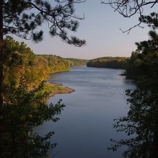
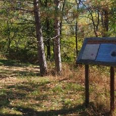
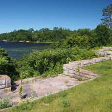
Pillsbury State Forest is a state-managed forest in Minnesota with lakes, streams, and dense woodlands throughout its terrain. The forest contains stands of northern hardwoods, white pine, and red pine distributed across the property.

History

The forest began in 1900 when former Minnesota Governor John S. Pillsbury donated land, creating the state's first state-managed forest. This founding marked the start of organized state forestry management in Minnesota.

Culture

The forest functions as a place where visitors can observe working forestry and see how certain areas are deliberately kept untouched to preserve older trees. These protected zones show how people balance using the land with protecting what grows there naturally.

Practical

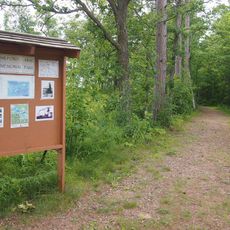
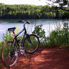
The forest has different trail lengths suited to different activities like mountain biking, horseback riding, hiking, and winter cross-country skiing. Visitors should prepare gear based on their chosen activity and check trail conditions that change with the seasons.

Did you know?

The forest hosts nesting areas for great blue herons and provides habitat for wild turkeys that travel between regions. These bird populations use the woods as a central stop along their seasonal migration routes.

Location
Inception
1900
GPS coordinates
46.41940,-94.43500
Latest update
December 14, 2025 18:44

AroundUs brings together thousands of curated places, local tips, and hidden gems, enriched daily by 60,000 contributors worldwide. Discover all places nearby (Cass County).

Around this place
Brainerd International Raceway
United States of America

Brainerd International Raceway

12.4 km
Paul Bunyan Land
United States of America

Paul Bunyan Land

31.9 km
Milford Mine
United States of America

Milford Mine

37.8 km
Fort Ripley
United States of America

Fort Ripley

27.6 km
Crow Wing State Park
United States of America

Crow Wing State Park

18.2 km
Cuyuna Country State Recreation Area
United States of America

Cuyuna Country State Recreation Area

35.9 km
Grand View Lodge
United States of America

Grand View Lodge

12.3 km
Minnesota Military Museum
United States of America

Minnesota Military Museum

38.3 km
Brainerd Water Tower
United States of America

Brainerd Water Tower

19.3 km
Old Wadena Historic District
United States of America

Old Wadena Historic District

30.3 km
Crow Wing County Courthouse and Jail
United States of America

Crow Wing County Courthouse and Jail

19.1 km
Brainerd Public Library
United States of America

Brainerd Public Library

19.4 km
Wilford H. Fawcett House
United States of America

Wilford H. Fawcett House

25.8 km
Camp Ripley Bridge
United States of America

Camp Ripley Bridge

39.2 km
Deerwood Auditorium
United States of America

Deerwood Auditorium

41.5 km
Franklin Junior High School
United States of America

Franklin Junior High School

19.7 km
Almond A. White House
United States of America

Almond A. White House

18.3 km
Cuyuna Iron Range Municipally-Owned Elevated Metal Water Tanks
United States of America

Cuyuna Iron Range Municipally-Owned Elevated Metal Water Tanks

37.8 km
Kenney Lake Overlook
United States of America

Kenney Lake Overlook

46.6 km
Parker Building
United States of America

Parker Building

19.4 km
Minnesota Highway 371 Bridge
United States of America

Minnesota Highway 371 Bridge

17.5 km
Cole Memorial Building
United States of America

Cole Memorial Building

22.5 km
Pine Tree Lumber Company Office Building
United States of America

Pine Tree Lumber Company Office Building

48.8 km
Washington Street Bridge
United States of America

Washington Street Bridge

18.5 km
Ironton Sintering Plant Complex
United States of America

Ironton Sintering Plant Complex

36.2 km
Pequot Fire Lookout Tower
United States of America

Pequot Fire Lookout Tower

23.1 km
Nimrod Fire Tower
United States of America

Nimrod Fire Tower

42.2 km
Northern Pacific Railroad Shops Historic District
United States of America

Northern Pacific Railroad Shops Historic District

20.4 km
Show the full map
« Pillsbury State Forest - State forest in Cass County, Minnesota, United States » is provided by Around Us (aroundus.com). Images and texts are derived from Wikimedia project under a Creative Commons license. You are allowed to copy, distribute, and modify copies of this page, under the conditions set by the license, as long as this note is clearly visible.

Discover hidden gems everywhere you go!

From secret cafés to breathtaking viewpoints, skip the crowded tourist spots and find places that match your style. Our app makes it easy with voice search, smart filtering, route optimization, and insider tips from travelers worldwide. Download now for the complete mobile experience.

Around Us App Screenshot

A unique approach to discovering new places

Le Figaro

All the places worth exploring

France Info

A tailor-made excursion in just a few clicks

20 Minutes

Around Us
Travel Guide & Maps
Download

Send to your phone

QR Code
1

Open the camera app on your mobile.

2

Point at the QR code with your camera. A notification will appear.

3

Tap the notification to open the link.