Enable Location

We need your location to show you interesting places around you

Discover nearby places

Find interesting locations and hidden gems around you

Precise directions

Get accurate directions and distances to places

Your location is never shared with other users. It's only used when you tap the location button.

Watts Mill Bridge

Log in to your account

Start exploring — it's free

Trusted by 61,864 travelers worldwide

Continue with Google
Continue with Apple
or

We will send you a code to connect

By continuing, you accept our Terms and Conditions and our Privacy Policy

Check your inbox

We've sent a pincode in your inbox. Please enter the code below.

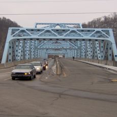
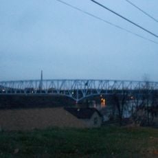
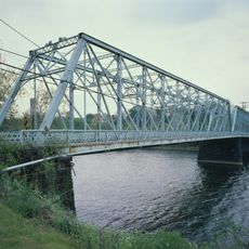
Watts Mill Bridge, Bridge in Cannelton, Pennsylvania

Description

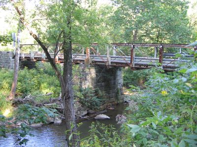
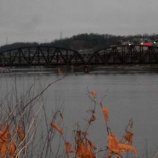
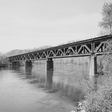
Watts Mill Bridge is a steel truss bridge crossing Little Beaver Creek in Cannelton, Pennsylvania. It features a Pratt pony truss design typical of late 19th-century bridge engineering and spans the creek with a narrow pedestrian passage.

History

The bridge was built in 1878 by the West Penn Bridge Company to serve communities during Pennsylvania's industrial expansion. It played an important role in connecting commerce and transportation across Little Beaver Creek during that era.

Culture

The bridge stands as the only structure in Beaver County individually recognized on the National Register of Historic Places for its engineering characteristics.

Practical

The bridge now serves as a pedestrian crossing and connects to the North Country National Scenic Trail network. Following its 2023 renovation, visitors can walk across to enjoy the surrounding creek landscape.

Did you know?

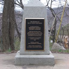
The bridge's rehabilitation occurred after its identification as a preservation priority by the Young Preservationists Association of Pittsburgh in 2004.

Location
GPS coordinates
40.79060,-80.49390
Latest update
December 14, 2025 17:40

AroundUs brings together thousands of curated places, local tips, and hidden gems, enriched daily by 60,000 contributors worldwide. Discover all places nearby (Pennsylvania).

Around this place
Beginning Point of the U.S. Public Land Survey
United States of America

Beginning Point of the U.S. Public Land Survey

16.6 km
Beaver Creek State Park
United States of America

Beaver Creek State Park

12.3 km
Fort McIntosh
United States of America

Fort McIntosh

19.6 km
Jennings Randolph Bridge
United States of America

Jennings Randolph Bridge

19.9 km
Montgomery Locks and Dam
United States of America

Montgomery Locks and Dam

18.1 km
Richard L. Cawood Residence
United States of America

Richard L. Cawood Residence

17.6 km
Matthew S. Quay House
United States of America

Matthew S. Quay House

19.3 km
Carnegie Free Library of Beaver Falls
United States of America

Carnegie Free Library of Beaver Falls

15.3 km
Merrick Art Gallery
United States of America

Merrick Art Gallery

16.8 km
William B. Dunlap Mansion
United States of America

William B. Dunlap Mansion

18.9 km
Shippingport Bridge
United States of America

Shippingport Bridge

19 km
Merrill Lock No. 6
United States of America

Merrill Lock No. 6

18.1 km
Eastvale Bridge
United States of America

Eastvale Bridge

15.1 km
Gaston's Mill-Lock No. 36, Sandy and Beaver Canal District
United States of America

Gaston's Mill-Lock No. 36, Sandy and Beaver Canal District

12.2 km
Vanport Bridge
United States of America

Vanport Bridge

18.5 km
Bridgewater Historic District
United States of America

Bridgewater Historic District

19.3 km
Fallston Bridge
United States of America

Fallston Bridge

17 km
Church Hill Road Covered Bridge
United States of America

Church Hill Road Covered Bridge

19.5 km
Salem Downtown Historic District
United States of America

Salem Downtown Historic District

17.6 km
Old Main
United States of America

Old Main

14.7 km
Rochester-Beaver Railroad Bridge
United States of America

Rochester-Beaver Railroad Bridge

20.1 km
Old Homestead
United States of America

Old Homestead

9.5 km
Hiram Bell Farmstead
United States of America

Hiram Bell Farmstead

15.6 km
Beaver River Railroad Bridge
United States of America

Beaver River Railroad Bridge

15.8 km
Jones-Bowman House
United States of America

Jones-Bowman House

19.1 km
Nicholas Eckis House
United States of America

Nicholas Eckis House

12.5 km
Beaver Historic District
United States of America

Beaver Historic District

19 km
Thomas J. Malone Bridge
United States of America

Thomas J. Malone Bridge

12.2 km
Show the full map
« Watts Mill Bridge - Bridge in Cannelton, Pennsylvania » is provided by Around Us (aroundus.com). Images and texts are derived from Wikimedia project under a Creative Commons license. You are allowed to copy, distribute, and modify copies of this page, under the conditions set by the license, as long as this note is clearly visible.

Discover hidden gems everywhere you go!

From secret cafés to breathtaking viewpoints, skip the crowded tourist spots and find places that match your style. Our app makes it easy with voice search, smart filtering, route optimization, and insider tips from travelers worldwide. Download now for the complete mobile experience.

Around Us App Screenshot

A unique approach to discovering new places

Le Figaro

All the places worth exploring

France Info

A tailor-made excursion in just a few clicks

20 Minutes

Around Us
Travel Guide & Maps
Download

Send to your phone

QR Code
1

Open the camera app on your mobile.

2

Point at the QR code with your camera. A notification will appear.

3

Tap the notification to open the link.