Enable Location

We need your location to show you interesting places around you

Discover nearby places

Find interesting locations and hidden gems around you

Precise directions

Get accurate directions and distances to places

Your location is never shared with other users. It's only used when you tap the location button.

Log in to your account

Start exploring — it's free

Trusted by 61,904 travelers worldwide

Continue with Google
Continue with Apple
or

We will send you a code to connect

By continuing, you accept our Terms and Conditions and our Privacy Policy

Check your inbox

We've sent a pincode in your inbox. Please enter the code below.

Westminster massacre

Westminster massacre, Revolutionary War site in Westminster, Vermont

The Westminster Massacre site marks the location where armed confrontation erupted between local settlers and New York authorities on March 13, 1775, resulting in the deaths of two unarmed farmers who had occupied the courthouse to prevent land seizures.

This violent clash occurred just over a month before Lexington and Concord, making it one of the earliest armed conflicts of the American Revolution when sheriff's deputies fired into a crowd of protesters defending their property rights.

The event became a rallying cry for Vermont independence movements and helped unite different settler groups against external control, ultimately contributing to the formation of the Green Mountain Boys militia and Vermont's path to statehood.

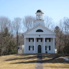
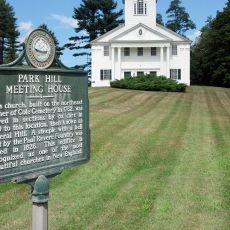
Visitors can find a historical marker along U.S. Route 5 in Westminster that commemorates the massacre, while the nearby cemetery contains the graves of William French and Daniel Houghton, the two men killed during the confrontation.

Despite involving only two deaths, the incident earned the name 'massacre' because it symbolized the intense resistance of frontier settlers against colonial authority and became Vermont's first act of revolutionary defiance.

The community of curious travelers

AroundUs brings together thousands of curated places, local tips, and hidden gems, enriched daily by 60,000 contributors worldwide.

Start exploring
Location
GPS coordinates
43.07240,-72.46250
Latest update
July 23, 2025 15:15
Around this place
Steamtown, U.S.A.
United States of America

Steamtown, U.S.A.

6.9 km
Arch Bridge
United States of America

Arch Bridge

7.4 km
Vilas Bridge
United States of America

Vilas Bridge

7.2 km
United States of America

Great Falls

7.3 km
Drewsville Mansion
United States of America

Drewsville Mansion

8.3 km
Hall Covered Bridge
United States of America

Hall Covered Bridge

7.4 km
Sacketts Brook Stone Arch Bridge
United States of America

Sacketts Brook Stone Arch Bridge

11.8 km
Bellows Falls Times Building
United States of America

Bellows Falls Times Building

7.1 km
Bellows Falls Neighborhood Historic District
United States of America

Bellows Falls Neighborhood Historic District

6.7 km
Walpole Academy
United States of America

Walpole Academy

3.1 km
Park Hill Meetinghouse
United States of America

Park Hill Meetinghouse

10.8 km
Stephen Rowe Bradley House
United States of America

Stephen Rowe Bradley House

2.7 km
Adams Gristmill Warehouse
United States of America

Adams Gristmill Warehouse

6.7 km
Prentiss Bridge
United States of America

Prentiss Bridge

10.6 km
East Putney Brook Stone Arch Bridge
United States of America

East Putney Brook Stone Arch Bridge

9.7 km
Old Brick Church
United States of America

Old Brick Church

11 km
Peck-Porter House
United States of America

Peck-Porter House

3 km
Theophilus Crawford House
United States of America

Theophilus Crawford House

10.2 km
William A. Hall House
United States of America

William A. Hall House

6.6 km
Westminster Terrace Historic District
United States of America

Westminster Terrace Historic District

6.3 km
Williams Street Extension Historic District
United States of America

Williams Street Extension Historic District

7.1 km
Sabin-Wheat Farm
United States of America

Sabin-Wheat Farm

9.9 km
George-Pine-Henry Street Historic District
United States of America

George-Pine-Henry Street Historic District

6.6 km
Rockingham Free Public Library
United States of America

Rockingham Free Public Library

6.7 km
Westminster Village Historic District
United States of America

Westminster Village Historic District

550 m
Tucker Toll Covered Bridge
United States of America

Tucker Toll Covered Bridge

7.2 km
Cheshire Railroad Connecticut River Covered Bridge
United States of America

Cheshire Railroad Connecticut River Covered Bridge

7.3 km
GMRC Bellows Falls Stone Arch Bridge
United States of America

GMRC Bellows Falls Stone Arch Bridge

7.3 km
Show the full map
« Westminster massacre - Revolutionary War site in Westminster, Vermont » is provided by Around Us (aroundus.com). Images and texts are derived from Wikimedia project under a Creative Commons license. You are allowed to copy, distribute, and modify copies of this page, under the conditions set by the license, as long as this note is clearly visible.

Discover hidden gems everywhere you go!

From secret cafés to breathtaking viewpoints, skip the crowded tourist spots and find places that match your style. Our app makes it easy with voice search, smart filtering, route optimization, and insider tips from travelers worldwide. Download now for the complete mobile experience.

Around Us App Screenshot

A unique approach to discovering new places

Le Figaro

All the places worth exploring

France Info

A tailor-made excursion in just a few clicks

20 Minutes

Around Us
Travel Guide & Maps
Download

Send to your phone

QR Code
1

Open the camera app on your mobile.

2

Point at the QR code with your camera. A notification will appear.

3

Tap the notification to open the link.