Chest opened
+${chestReward.xp} XP
Explorer
NOUVEAU ×${chestReward.collectible.quantity}
tapez pour fermer
Chest locked

Open chests in the app

Around Us is built for your phone — chests unlock when you walk, explore and capture nearby places.

Enable Location

We need your location to show you interesting places around you

Discover nearby places

Find interesting locations and hidden gems around you

Precise directions

Get accurate directions and distances to places

Your location is never shared with other users. It's only used when you tap the location button.

Log in to your account

Start exploring — it's free

Trusted by 72,896 travelers worldwide

Continue with Google
Continue with Apple
or

We will send you a code to connect

By continuing, you accept our Terms and Conditions and our Privacy Policy

Check your inbox

We've sent a pincode in your inbox. Please enter the code below.

Scott 150
Discussion Reviews Photo
1.8k Popularity

Scott 150, Transportation structure in Joliet, Illinois, US

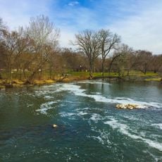
Scott 150 is a bridge that crosses the Des Plaines River in downtown Joliet, carrying traffic between the eastern and western parts of the city. The structure is a steel construction designed to handle both vehicle and pedestrian movement across the waterway.

The bridge was built in the early 1900s as part of Joliet's infrastructure development to connect with Chicago's southwestern suburbs. It was an important project to meet the growing demands of motorized traffic in the expanding city.

The bridge links residential neighborhoods to the east with commercial and entertainment areas to the west, serving as a gathering point for the community. It enables people to move easily between different parts of the city in their daily routines.

Vehicles and pedestrians can access the bridge from Scott Street, which connects to the main thoroughfares of downtown Joliet. Access is straightforward, and the structure is designed for everyday use in all weather conditions.

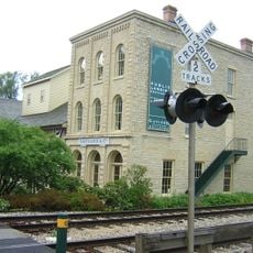
The bridge stands directly beside early 1900s commercial buildings that reflect the city's old trading landscape. This proximity shows how transportation infrastructure was woven into urban development during that era.

The community of curious travelers

AroundUs brings together thousands of curated places, local tips, and hidden gems, enriched daily by 60,000 contributors worldwide.

Start exploring
GPS coordinates
41.47483,-88.05710
Latest update
December 14, 2025 12:26
Around this place
Stateville Correctional Center
United States of America

Stateville Correctional Center

12 km
Joliet Correctional Center
United States of America

Joliet Correctional Center

8.2 km
Illinois and Michigan Canal
United States of America

Illinois and Michigan Canal

10.6 km
Chicagoland Speedway
United States of America

Chicagoland Speedway

4 m
Abraham Lincoln National Cemetery
United States of America

Abraham Lincoln National Cemetery

11.1 km
United States of America

Kankakee Torrent

14.2 km
Harrah's Joliet
United States of America

Harrah's Joliet

6.2 km
Rialto Square Theatre
United States of America

Rialto Square Theatre

6.1 km
Cathedral of St. Raymond Nonnatus
United States of America

Cathedral of St. Raymond Nonnatus

7.7 km
Hiram B. Scutt Mansion
United States of America

Hiram B. Scutt Mansion

6.4 km
United States of America

Argosy Empress Casino

7.3 km
Lockport Lock, Dam and Power House Historic District
United States of America

Lockport Lock, Dam and Power House Historic District

10.7 km
Joliet East Side Historic District
United States of America

Joliet East Side Historic District

5.1 km
Des Plaines State Fish and Wildlife Area
United States of America

Des Plaines State Fish and Wildlife Area

15.7 km
Channahon State Park
United States of America

Channahon State Park

15.3 km
Gaylord Building
United States of America

Gaylord Building

12.9 km
Brandon Road Lock and Dam
United States of America

Brandon Road Lock and Dam

5 km
Stone Manor
United States of America

Stone Manor

14.9 km
Christ Episcopal Church
United States of America

Christ Episcopal Church

6.1 km
Briscoe Mounds
United States of America

Briscoe Mounds

14.9 km
Joliet YMCA
United States of America

Joliet YMCA

6.6 km
Fitzpatrick House
United States of America

Fitzpatrick House

14 km
Upper Bluff Historic District
United States of America

Upper Bluff Historic District

6.9 km
United States Post Office
United States of America

United States Post Office

6.2 km
Lockport Historic District
United States of America

Lockport Historic District

12.8 km
Robert Milne House
United States of America

Robert Milne House

12.8 km
McGovney–Yunker Farmstead
United States of America

McGovney–Yunker Farmstead

15.7 km
John Heck House
United States of America

John Heck House

12.3 km
Show the full map
Reviews
Share your experience

No review yet

Discussions
Start a discussion...

No discussion yet

« Scott 150 - Transportation structure in Joliet, Illinois, US » is provided by Around Us (aroundus.com). Images and texts are derived from Wikimedia project under a Creative Commons license. You are allowed to copy, distribute, and modify copies of this page, under the conditions set by the license, as long as this note is clearly visible.

Discover hidden gems everywhere you go!

From secret cafés to breathtaking viewpoints, skip the crowded tourist spots and find places that match your style. Our app makes it easy with voice search, smart filtering, route optimization, and insider tips from travelers worldwide. Download now for the complete mobile experience.

Around Us App Screenshot

A unique approach to discovering new places

Le Figaro

All the places worth exploring

France Info

A tailor-made excursion in just a few clicks

20 Minutes

Around Us
Travel Guide & Maps
Download

Send to your phone

QR Code
1

Open the camera app on your mobile.

2

Point at the QR code with your camera. A notification will appear.

3

Tap the notification to open the link.