Enable Location

We need your location to show you interesting places around you

Discover nearby places

Find interesting locations and hidden gems around you

Precise directions

Get accurate directions and distances to places

Your location is never shared with other users. It's only used when you tap the location button.

Log in to your account

Start exploring — it's free

Trusted by 63,135 travelers worldwide

Continue with Google
Continue with Apple
or

We will send you a code to connect

By continuing, you accept our Terms and Conditions and our Privacy Policy

Check your inbox

We've sent a pincode in your inbox. Please enter the code below.

Discussion Reviews Photo
1.4k Popularity

Mattapany, Archaeological site at Naval Air Station Patuxent River, United States

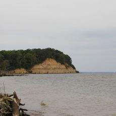
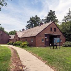
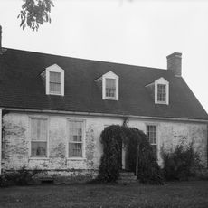
Mattapany is an archaeological site on a level plateau near the Patuxent River located on a military airbase. The grounds include wooded and open areas where researchers have uncovered remains from the colonial period.

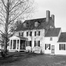
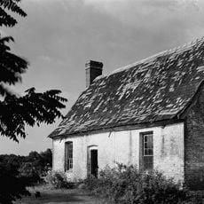
Charles Calvert, the 3rd Baron Baltimore, established this location as his residence and administrative center from 1666 to 1684. A rebellion in 1689 brought significant changes to Maryland's colonial governance and political structure.

Excavations reveal how people lived here during colonial times, what they grew, and how they organized their land. Visitors can learn about daily routines and family life through the artifacts found.

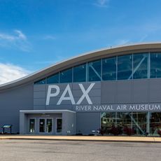
This site sits on a military base, so prior permission is needed before visiting. Contact the base administration to arrange access for research or educational purposes.

This location served as both a private residence and an administrative hub where colonial officials made decisions. This dual function makes the excavations particularly valuable for understanding colonial Maryland's governance.

The community of curious travelers

AroundUs brings together thousands of curated places, local tips, and hidden gems, enriched daily by 60,000 contributors worldwide.

Start exploring
Address
Saufley Rd, Patuxent River, MD 20670
GPS coordinates
38.28570,-76.42810
Latest update
December 14, 2025 16:41
Around this place
Calvert Cliffs State Park
United States of America

Calvert Cliffs State Park

12.9 km
Governor Thomas Johnson Bridge
United States of America

Governor Thomas Johnson Bridge

5.9 km
Patuxent River Naval Air Museum
United States of America

Patuxent River Naval Air Museum

3.3 km
Calvert Marine Museum
United States of America

Calvert Marine Museum

5.9 km
St. Ignatius Roman Catholic Church
United States of America

St. Ignatius Roman Catholic Church

15 km
Cove Point Light
United States of America

Cove Point Light

11.9 km
Drum Point Light
United States of America

Drum Point Light

5.9 km
Hooper Island Light
United States of America

Hooper Island Light

15.9 km
Porto Bello
United States of America

Porto Bello

12.6 km
Our Lady Star of the Sea Catholic Church
United States of America

Our Lady Star of the Sea Catholic Church

5.2 km
Jefferson Patterson Park & Museum
United States of America

Jefferson Patterson Park & Museum

14.4 km
Resurrection Manor
United States of America

Resurrection Manor

9.2 km
Greenwell State Park
United States of America

Greenwell State Park

12.8 km
William B. Tennison
United States of America

William B. Tennison

5.2 km
Tudor Hall
United States of America

Tudor Hall

18.1 km
Cedar Point Light
United States of America

Cedar Point Light

5.5 km
United States Colored Troops Memorial Monument
United States of America

United States Colored Troops Memorial Monument

3.3 km
West St. Mary's Manor
United States of America

West St. Mary's Manor

11.2 km
J. C. Lore Oyster House
United States of America

J. C. Lore Oyster House

5.1 km
Cross Manor
United States of America

Cross Manor

13.9 km
Morgan Hill Farm
United States of America

Morgan Hill Farm

14.5 km
Preston-on-the-Patuxent
United States of America

Preston-on-the-Patuxent

10.8 km
St. George's Episcopal Church
United States of America

St. George's Episcopal Church

13 km
Cecil's Mill Historic District
United States of America

Cecil's Mill Historic District

8.3 km
James P. Muldoon River Center
United States of America

James P. Muldoon River Center

10.8 km
Historic St. Mary's City
United States of America

Historic St. Mary's City

11.7 km
Drum Point Lighthouse
United States of America

Drum Point Lighthouse

5.9 km
Mulberry Fields
United States of America

Mulberry Fields

15.3 km
Show the full map
Reviews
Share your experience

No review yet

Discussions
Start a discussion...

No discussion yet

« Mattapany - Archaeological site at Naval Air Station Patuxent River, United States » is provided by Around Us (aroundus.com). Images and texts are derived from Wikimedia project under a Creative Commons license. You are allowed to copy, distribute, and modify copies of this page, under the conditions set by the license, as long as this note is clearly visible.

Discover hidden gems everywhere you go!

From secret cafés to breathtaking viewpoints, skip the crowded tourist spots and find places that match your style. Our app makes it easy with voice search, smart filtering, route optimization, and insider tips from travelers worldwide. Download now for the complete mobile experience.

Around Us App Screenshot

A unique approach to discovering new places

Le Figaro

All the places worth exploring

France Info

A tailor-made excursion in just a few clicks

20 Minutes

Around Us
Travel Guide & Maps
Download

Send to your phone

QR Code
1

Open the camera app on your mobile.

2

Point at the QR code with your camera. A notification will appear.

3

Tap the notification to open the link.