Log in to your account

AroundUs is a community-driven map of interesting places, built by curious explorers like you. It grows with every review, story, and photo you share.
Connect to save your favorite spots, contribute locations, and create personalized routes.
Continue with Google
Continue with Apple
Continue with X
Continue with Facebook
Continue with email
By continuing, you accept our Terms and Conditions and our Privacy Policy
Create an account

North Carolina–Tennessee–Virginia Corners

Add to collection
Map
Suggest a change
Share

North Carolina–Tennessee–Virginia Corners, Geographic tripoint in Iron Mountains between Virginia, North Carolina, and Tennessee, US.

The North Carolina-Tennessee-Virginia Corners is a geographic meeting point in the Iron Mountains where the borders of three southeastern states converge precisely. This location sits at an elevation where three state lines intersect at a single, well-defined spot.

The tripoint emerged from colonial-era land surveys dating to 1779 that created boundary disputes among the states. The U.S. Supreme Court later intervened to establish the precise location of the three state lines.

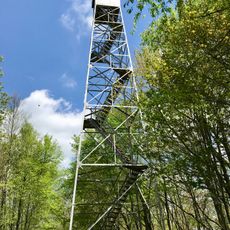
Multiple hiking paths near the tripoint connect visitors to regional features like the Virginia Creeper Trail and segments of the Appalachian Trail.

The site can be reached via local roads from Abingdon, Virginia, with the final stretch requiring a moderate walk through the mountains. Winter weather and rain can make the path slippery, so sturdy footwear and good timing are important.

This is one of the few places in North America where a person can stand in three states at the same time by positioning themselves at the exact convergence point. The spot is difficult to locate without GPS, as it lies deep in the wilderness with minimal marking.

Part of: North Carolina–Tennessee border, North Carolina–Virginia border, Tennessee–Virginia border

GPS coordinates: 36.58814,-81.67741

Latest update: December 10, 2025 15:46

Photos
Around this place
Mount Rogers
United States of America

Mount Rogers

14.3 km
Grayson Highlands State Park
United States of America

Grayson Highlands State Park

15.2 km
Whitetop Mountain
United States of America

Whitetop Mountain

8.6 km
Elk Knob State Park
United States of America

Elk Knob State Park

29 km
Mount Jefferson State Natural Area
United States of America

Mount Jefferson State Natural Area

28.4 km
Preston House
United States of America

Preston House

24.7 km
Abijah Thomas House
United States of America

Abijah Thomas House

22.8 km
Ripshin Farm
United States of America

Ripshin Farm

27.1 km
Lewis Fork Wilderness
United States of America

Lewis Fork Wilderness

14.3 km
United States of America

Mount Rogers Cluster

14.3 km
United States of America

Whitetop Mountain

8.7 km
Edmondson Hall
United States of America

Edmondson Hall

25.6 km
United States of America

Whitetop Laurel

6 km
Mount Rogers Crest Zone
United States of America

Mount Rogers Crest Zone

17.3 km
Ashe County Courthouse
United States of America

Ashe County Courthouse

26.3 km
Butler House
United States of America

Butler House

17.1 km
Brook Hall
United States of America

Brook Hall

22.3 km
Konnarock Training School
United States of America

Konnarock Training School

10.9 km
A.C. Beatie House
United States of America

A.C. Beatie House

23.4 km
Worth's Chapel
United States of America

Worth's Chapel

14.6 km
H.L. Bonham House
United States of America

H.L. Bonham House

23.1 km
William Waddell House
United States of America

William Waddell House

21.5 km
Downtown Chilhowie Historic District
United States of America

Downtown Chilhowie Historic District

23.4 km
John W. Tucker House
United States of America

John W. Tucker House

13.4 km
Miller Homestead
United States of America

Miller Homestead

15.2 km
Glade Spring Commercial Historic District
United States of America

Glade Spring Commercial Historic District

24.1 km
Kettlefoot Fire Lookout Tower
United States of America

Kettlefoot Fire Lookout Tower

24.7 km
Mount Rogers National Recreation Area
United States of America

Mount Rogers National Recreation Area

10.6 km
Show the full map
Reviews

Visited this place? Tap the stars to rate it and share your experience / photos with the community! Try now! You can cancel it anytime.

« North Carolina–Tennessee–Virginia Corners - Geographic tripoint in Iron Mountains between Virginia, North Carolina, and Tennessee, US » is provided by Around Us (aroundus.com). Images and texts are derived from Wikimedia project under a Creative Commons license. You are allowed to copy, distribute, and modify copies of this page, under the conditions set by the license, as long as this note is clearly visible.

Discover hidden gems everywhere you go!

From secret cafés to breathtaking viewpoints, skip the crowded tourist spots and find places that match your style. Our app makes it easy with voice search, smart filtering, route optimization, and insider tips from travelers worldwide. Download now for the complete mobile experience.

Around Us App Screenshot

A unique approach to discovering new places

Le Figaro

All the places worth exploring

France Info

A tailor-made excursion in just a few clicks

20 Minutes