Enable Location

We need your location to show you interesting places around you

Discover nearby places

Find interesting locations and hidden gems around you

Precise directions

Get accurate directions and distances to places

Your location is never shared with other users. It's only used when you tap the location button.

Log in to your account

Start exploring — it's free

Trusted by 61,977 travelers worldwide

Continue with Google
Continue with Apple
or

We will send you a code to connect

By continuing, you accept our Terms and Conditions and our Privacy Policy

Check your inbox

We've sent a pincode in your inbox. Please enter the code below.

Whitetop Laurel

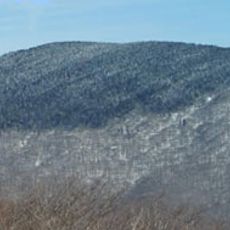
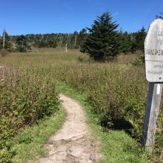
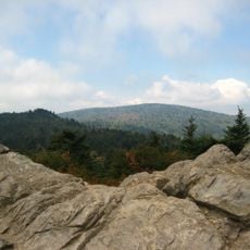
Whitetop Laurel, Protected wilderness area in George Washington and Jefferson National Forests, Virginia, United States.

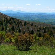
Whitetop Laurel is a protected wilderness area spanning the George Washington and Jefferson National Forests in Virginia. The landscape features a network of creeks and streams winding through hardwood forests thick with flowering rhododendrons and native shrubs.

A railroad operated through this region in the early 1900s to transport logs from a nearby sawmill, leaving a mark on the landscape for several decades. The forest has since regenerated, though traces of that industrial past remain visible to those who explore the trails.

The Virginia Creeper Trail and Appalachian Trail converge in this area, making it a central location for outdoor recreation and environmental education.

The area can be reached through several entry points along US Route 58 to the north and Virginia Route 726 to the south. Parking is available at the main access areas, and trails connect different sections for flexible route planning.

The creeks here hold a special water quality classification and provide habitat for hellbender salamanders, North America's largest salamander species. These rare creatures are rarely seen but indicate healthy water conditions in the streams.

The community of curious travelers

AroundUs brings together thousands of curated places, local tips, and hidden gems, enriched daily by 60,000 contributors worldwide.

Start exploring
GPS coordinates
36.63611,-81.70833
Latest update
December 14, 2025 18:46
Around this place
Mount Rogers
United States of America

Mount Rogers

14.9 km
Grayson Highlands State Park
United States of America

Grayson Highlands State Park

17.3 km
Barter Theatre
United States of America

Barter Theatre

25 km
United States of America

North Carolina–Tennessee–Virginia Corners

6 km
Whitetop Mountain
United States of America

Whitetop Mountain

9.2 km
Preston House
United States of America

Preston House

20.5 km
Abijah Thomas House
United States of America

Abijah Thomas House

19.7 km
Lewis Fork Wilderness
United States of America

Lewis Fork Wilderness

14.8 km
United States of America

Mount Rogers Cluster

14.9 km
United States of America

Whitetop Mountain

9.1 km
Mont Calm
United States of America

Mont Calm

25 km
Edmondson Hall
United States of America

Edmondson Hall

19.8 km
Abingdon Bank
United States of America

Abingdon Bank

24.8 km
Mount Rogers Crest Zone
United States of America

Mount Rogers Crest Zone

18.6 km
Preston House
United States of America

Preston House

26.6 km
Butler House
United States of America

Butler House

20.1 km
Konnarock Training School
United States of America

Konnarock Training School

9.5 km
Brook Hall
United States of America

Brook Hall

16.3 km
A.C. Beatie House
United States of America

A.C. Beatie House

18.2 km
Worth's Chapel
United States of America

Worth's Chapel

20.6 km
H.L. Bonham House
United States of America

H.L. Bonham House

17.9 km
William Waddell House
United States of America

William Waddell House

25.3 km
Dr. William H. Pitts House
United States of America

Dr. William H. Pitts House

24.7 km
Downtown Chilhowie Historic District
United States of America

Downtown Chilhowie Historic District

18.2 km
John W. Tucker House
United States of America

John W. Tucker House

18.9 km
Miller Homestead
United States of America

Miller Homestead

21 km
Glade Spring Commercial Historic District
United States of America

Glade Spring Commercial Historic District

18.1 km
Mount Rogers National Recreation Area
United States of America

Mount Rogers National Recreation Area

11.3 km
Show the full map
« Whitetop Laurel - Protected wilderness area in George Washington and Jefferson National Forests, Virginia, United States » is provided by Around Us (aroundus.com). Images and texts are derived from Wikimedia project under a Creative Commons license. You are allowed to copy, distribute, and modify copies of this page, under the conditions set by the license, as long as this note is clearly visible.

Discover hidden gems everywhere you go!

From secret cafés to breathtaking viewpoints, skip the crowded tourist spots and find places that match your style. Our app makes it easy with voice search, smart filtering, route optimization, and insider tips from travelers worldwide. Download now for the complete mobile experience.

Around Us App Screenshot

A unique approach to discovering new places

Le Figaro

All the places worth exploring

France Info

A tailor-made excursion in just a few clicks

20 Minutes

Around Us
Travel Guide & Maps
Download

Send to your phone

QR Code
1

Open the camera app on your mobile.

2

Point at the QR code with your camera. A notification will appear.

3

Tap the notification to open the link.