·

Enable Location

We need your location to show you interesting places around you

Discover nearby places

Find interesting locations and hidden gems around you

Precise directions

Get accurate directions and distances to places

Your location is never shared with other users. It's only used when you tap the location button.

LaPorte County

Log in to your account

Start exploring — it's free

Trusted by 62,678 travelers worldwide

Continue with Google
Continue with Apple
or

We will send you a code to connect

By continuing, you accept our Terms and Conditions and our Privacy Policy

Check your inbox

We've sent a pincode in your inbox. Please enter the code below.

LaPorte County

LaPorte County, County in Indiana, United States

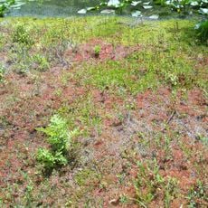
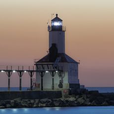
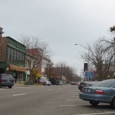
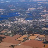
LaPorte County is a county in northern Indiana comprising over 600 square miles of land that ranges from urban centers to rural areas. The region sits along the southern shore of Lake Michigan and connects different landscape types within a relatively compact territory.

The county was established in 1832 and takes its name from French explorers who discovered a natural passage through dense forests. This early exploration shaped settlement and development of the region across generations.

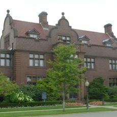
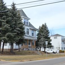
The communities in this county show strong connections to German, Irish, and Polish traditions, visible in local festivals and gatherings. These cultural roots shape daily life and create a sense of cohesion across the various towns.

The region is easily reached via Interstate 80, Interstate 90, and US Route 20, which connect to the Chicago area and eastern markets. Visitors should note that these main highways offer the best connections and make access to different parts of the county straightforward.

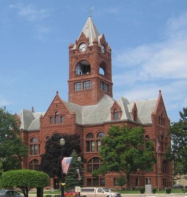
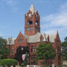
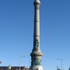
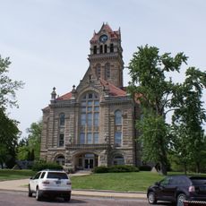
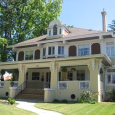
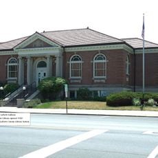
The LaPorte County Courthouse is listed on the National Register of Historic Places and displays architectural styles from the region's development era. This building reflects how communities designed their public spaces to express stability and authority.

The community of curious travelers

AroundUs brings together thousands of curated places, local tips, and hidden gems, enriched daily by 60,000 contributors worldwide.

Start exploring
Location
Inception
January 9, 1832
Capital city
La Porte
Shares border with
Berrien County, St. Joseph County, Porter County, Starke County, Jasper County
GPS coordinates
41.60000,-86.71667
Latest update
December 15, 2025 13:21
Around this place
Bendix Woods
United States of America

Bendix Woods

20.5 km
Hesston Steam Museum
United States of America

Hesston Steam Museum

17.4 km
Washington Park Zoo
United States of America

Washington Park Zoo

15.9 km
Pinhook Bog
United States of America

Pinhook Bog

11.1 km
John H. Barker Mansion
United States of America

John H. Barker Mansion

20.1 km
Michigan City East Light
United States of America

Michigan City East Light

21.7 km
Downtown LaPorte Historic District
United States of America

Downtown LaPorte Historic District

1.3 km
LaPorte County Courthouse
United States of America

LaPorte County Courthouse

1.3 km
Washington Park
United States of America

Washington Park

20.8 km
William Orr House
United States of America

William Orr House

5.2 km
Barker House
United States of America

Barker House

16.9 km
Marion Ridgeway Polygonal Barn
United States of America

Marion Ridgeway Polygonal Barn

1.6 km
Pinhook Methodist Church and Cemetery
United States of America

Pinhook Methodist Church and Cemetery

12.4 km
Hoover-Timme House
United States of America

Hoover-Timme House

19.8 km
John and Isabel Burnham House
United States of America

John and Isabel Burnham House

19.9 km
First Congregational Church of Michigan City
United States of America

First Congregational Church of Michigan City

20.2 km
Starke County Courthouse
United States of America

Starke County Courthouse

34.4 km
Everel S. Smith House
United States of America

Everel S. Smith House

16.4 km
Elston Grove Historic District
United States of America

Elston Grove Historic District

19.4 km
Lowell E. and Paula G. Jackson House
United States of America

Lowell E. and Paula G. Jackson House

19.8 km
Francis H. Morrison House
United States of America

Francis H. Morrison House

711 m
Franklin Street Commercial Historic District
United States of America

Franklin Street Commercial Historic District

19.9 km
Haskell and Barker Historic District
United States of America

Haskell and Barker Historic District

19.7 km
Starke County Bridge No. 39
United States of America

Starke County Bridge No. 39

34.3 km
Jeremiah Service House
United States of America

Jeremiah Service House

21.2 km
Indiana and Michigan Avenues Historic District
United States of America

Indiana and Michigan Avenues Historic District

618 m
George and Adele Jaworowski House
United States of America

George and Adele Jaworowski House

19.9 km
New Carlisle Historic District
United States of America

New Carlisle Historic District

20.8 km
Show the full map
Administrative divisions
« LaPorte County - County in Indiana, United States » is provided by Around Us (aroundus.com). Images and texts are derived from Wikimedia project under a Creative Commons license. You are allowed to copy, distribute, and modify copies of this page, under the conditions set by the license, as long as this note is clearly visible.

Discover hidden gems everywhere you go!

From secret cafés to breathtaking viewpoints, skip the crowded tourist spots and find places that match your style. Our app makes it easy with voice search, smart filtering, route optimization, and insider tips from travelers worldwide. Download now for the complete mobile experience.

Around Us App Screenshot

A unique approach to discovering new places

Le Figaro

All the places worth exploring

France Info

A tailor-made excursion in just a few clicks

20 Minutes

Around Us
Travel Guide & Maps
Download

Send to your phone

QR Code
1

Open the camera app on your mobile.

2

Point at the QR code with your camera. A notification will appear.

3

Tap the notification to open the link.