Chest opened
+${chestReward.xp} XP
Explorer
NOUVEAU ×${chestReward.collectible.quantity}
tapez pour fermer
Chest locked

Open chests in the app

Around Us is built for your phone — chests unlock when you walk, explore and capture nearby places.

Enable Location

We need your location to show you interesting places around you

Discover nearby places

Find interesting locations and hidden gems around you

Precise directions

Get accurate directions and distances to places

Your location is never shared with other users. It's only used when you tap the location button.

Log in to your account

Start exploring — it's free

Trusted by 73,011 travelers worldwide

Continue with Google
Continue with Apple
or

We will send you a code to connect

By continuing, you accept our Terms and Conditions and our Privacy Policy

Check your inbox

We've sent a pincode in your inbox. Please enter the code below.

Lake Jeanette State Forest
Discussion Reviews Photo
1.3k Popularity

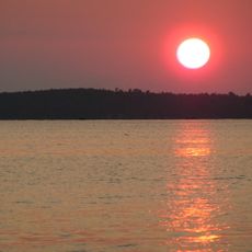
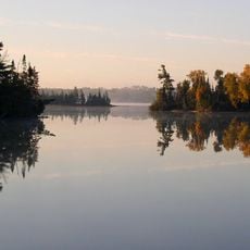
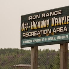
Lake Jeanette State Forest, State forest in St. Louis County, Minnesota.

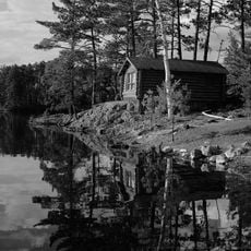
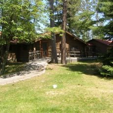
Lake Jeanette State Forest is a wooded area in St. Louis County in northern Minnesota with mixed forests of hardwoods and conifers surrounding a central lake. The landscape contains diverse terrain and natural features spread across its grounds.

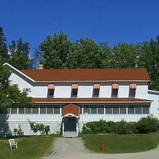
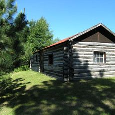
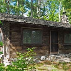
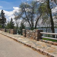
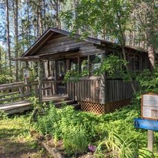
The forest took shape in the 1930s when the Civilian Conservation Corps built the main campground. That effort established the infrastructure that visitors still use today.

The forest operates under federal jurisdiction within the Superior National Forest's Boundary Waters Canoe Area Wilderness, maintaining natural resource preservation standards.

The area offers hiking trails, campsites, and water activities throughout the year. Visitors should prepare for varying weather and seasonal conditions when planning a trip.

The forest sits at an elevation of about 1,381 feet and contains forest types found specifically in this northern region. These ecological features make it of particular interest to nature watchers.

The community of curious travelers

AroundUs brings together thousands of curated places, local tips, and hidden gems, enriched daily by 60,000 contributors worldwide.

Start exploring
Location
GPS coordinates
48.13270,-92.28070
Latest update
December 14, 2025 18:14
Around this place
Voyageurs National Park
United States of America

Voyageurs National Park

60.5 km
Lake Vermilion
United States of America

Lake Vermilion

30.6 km
Lake Vermilion-Soudan Underground Mine State Park
United States of America

Lake Vermilion-Soudan Underground Mine State Park

34.6 km
Bear Head Lake State Park
United States of America

Bear Head Lake State Park

40.7 km
Hegman Lake Pictograph
United States of America

Hegman Lake Pictograph

29.4 km
Kettle Falls Hotel
United States of America

Kettle Falls Hotel

49.1 km
Burntside Lodge
United States of America

Burntside Lodge

33.9 km
Kettle Falls Historic District
United States of America

Kettle Falls Historic District

48.9 km
Listening Point
United States of America

Listening Point

32.2 km
Iron Range Off-Highway Vehicle State Recreation Area
United States of America

Iron Range Off-Highway Vehicle State Recreation Area

50 km
Stuntz Bay Boathouse Historic District
United States of America

Stuntz Bay Boathouse Historic District

34.3 km
Alex Seitaniemi Housebarn
United States of America

Alex Seitaniemi Housebarn

48.6 km
Alango School
United States of America

Alango School

55.3 km
Hartley Building
United States of America

Hartley Building

51.2 km
State Theater
United States of America

State Theater

40.3 km
Anna and Mikko Pyhala Farm
United States of America

Anna and Mikko Pyhala Farm

52.8 km
William Ingersoll Estate
United States of America

William Ingersoll Estate

28.5 km
Erick and Kristina Nelimark Sauna
United States of America

Erick and Kristina Nelimark Sauna

52.7 km
Orr Roadside Parking Area
United States of America

Orr Roadside Parking Area

41.7 km
Civilian Conservation Corps Camp S-52
United States of America

Civilian Conservation Corps Camp S-52

42 km
Waino Tanttari Field Hay Barn
United States of America

Waino Tanttari Field Hay Barn

47.8 km
Sturgeon River State Forest
United States of America

Sturgeon River State Forest

54.9 km
Dorothy Molter Museum
United States of America

Dorothy Molter Museum

42 km
Jasper Peak Fire Tower
United States of America

Jasper Peak Fire Tower

35.8 km
Ash River Lookout Tower
United States of America

Ash River Lookout Tower

48.4 km
Kabetogama Lookout Tower
United States of America

Kabetogama Lookout Tower

59.4 km
Ash River Visitor Center
United States of America

Ash River Visitor Center

54 km
Elephant Lake Lookout Tower
United States of America

Elephant Lake Lookout Tower

35.3 km
Show the full map
Reviews
Share your experience

No review yet

Discussions
Start a discussion...

No discussion yet

« Lake Jeanette State Forest - State forest in St. Louis County, Minnesota » is provided by Around Us (aroundus.com). Images and texts are derived from Wikimedia project under a Creative Commons license. You are allowed to copy, distribute, and modify copies of this page, under the conditions set by the license, as long as this note is clearly visible.

Discover hidden gems everywhere you go!

From secret cafés to breathtaking viewpoints, skip the crowded tourist spots and find places that match your style. Our app makes it easy with voice search, smart filtering, route optimization, and insider tips from travelers worldwide. Download now for the complete mobile experience.

Around Us App Screenshot

A unique approach to discovering new places

Le Figaro

All the places worth exploring

France Info

A tailor-made excursion in just a few clicks

20 Minutes

Around Us
Travel Guide & Maps
Download

Send to your phone

QR Code
1

Open the camera app on your mobile.

2

Point at the QR code with your camera. A notification will appear.

3

Tap the notification to open the link.