Chest opened
+${chestReward.xp} XP
Explorer
NOUVEAU ×${chestReward.collectible.quantity}
tapez pour fermer
Chest locked

Open chests in the app

Around Us is built for your phone — chests unlock when you walk, explore and capture nearby places.

Enable Location

We need your location to show you interesting places around you

Discover nearby places

Find interesting locations and hidden gems around you

Precise directions

Get accurate directions and distances to places

Your location is never shared with other users. It's only used when you tap the location button.

Log in to your account

Start exploring — it's free

Trusted by 72,900 travelers worldwide

Continue with Google
Continue with Apple
or

We will send you a code to connect

By continuing, you accept our Terms and Conditions and our Privacy Policy

Check your inbox

We've sent a pincode in your inbox. Please enter the code below.

Stonerside Stable
Discussion Reviews Photo
1.7k Popularity

Stonerside Stable, Horse stud farm in Bourbon County, Kentucky, US.

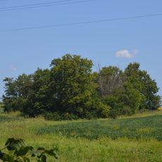
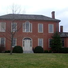
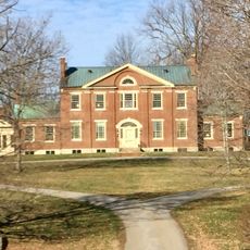
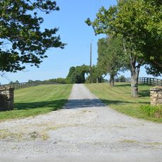
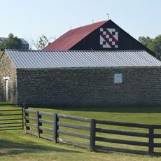
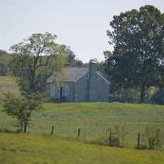
Stonerside Stable is a thoroughbred stud farm in Bourbon County that operates breeding and training facilities for racing horses. The property includes multiple barns with stalls and a training track beside Stoner Creek.

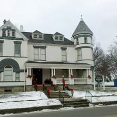
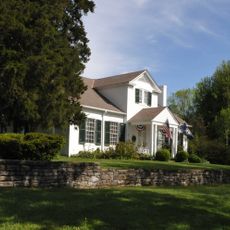
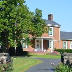
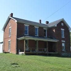
The property traces back to James Kenney, a Revolutionary War soldier who acquired the land in 1785 and built a residence there. What started as a small holding grew into a major breeding operation over subsequent generations.

The farm keeps alive Kentucky's tradition of breeding thoroughbreds that shape American horse racing. Visitors can observe how breeding work connects directly to the sport itself and understand the deep ties between this place and racing culture.

The property uses modern training facilities that allow year-round operations regardless of weather. Visitors should be prepared for a large, spread-out area where comfortable shoes are helpful for walking.

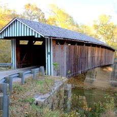
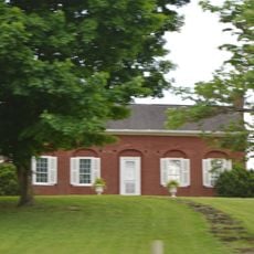
A covered bridge built in 1999 crosses Stoner Creek and was the first of its kind built in Kentucky after more than a century without any new ones. The bridge shows how traditional building techniques can find a place in modern times.

The community of curious travelers

AroundUs brings together thousands of curated places, local tips, and hidden gems, enriched daily by 60,000 contributors worldwide.

Start exploring
Location
Inception
1994
GPS coordinates
38.19800,-84.19600
Latest update
December 14, 2025 12:21
Around this place
United States of America

Mount Horeb Earthworks Complex

24 km
Paris Cemetery
United States of America

Paris Cemetery

6.1 km
Goshen Primitive Baptist Church
United States of America

Goshen Primitive Baptist Church

22.8 km
Confederate Monument in Cynthiana
United States of America

Confederate Monument in Cynthiana

23.1 km
The Grange
United States of America

The Grange

6.2 km
Bluegrass Heritage Museum
United States of America

Bluegrass Heritage Museum

23.2 km
Colville Covered Bridge
United States of America

Colville Covered Bridge

14.1 km
Confederate Monument of Mt. Sterling
United States of America

Confederate Monument of Mt. Sterling

28 km
Mound Hill Archaeological Site
United States of America

Mound Hill Archaeological Site

12.5 km
Forest Retreat
United States of America

Forest Retreat

19.2 km
Clark Mansion
United States of America

Clark Mansion

23.3 km
Clark County Court House
United States of America

Clark County Court House

22.9 km
KEAS Tabernacle Christian Methodist Episcopal Church
United States of America

KEAS Tabernacle Christian Methodist Episcopal Church

27.5 km
Enoch Smith House
United States of America

Enoch Smith House

26.1 km
William Hickman House
United States of America

William Hickman House

23.1 km
United States of America

Bourbon County Courthouse

5 km
Church of the Advent, Episcopal
United States of America

Church of the Advent, Episcopal

23.3 km
Methodist Episcopal Church South
United States of America

Methodist Episcopal Church South

27.2 km
Church of the Ascension
United States of America

Church of the Ascension

27.1 km
Walker Buckner House
United States of America

Walker Buckner House

5.6 km
Corinth Christian Methodist Episcopal Church
United States of America

Corinth Christian Methodist Episcopal Church

25.3 km
Harrison County Courthouse
United States of America

Harrison County Courthouse

23.1 km
Snow Hill
United States of America

Snow Hill

12.3 km
Stone Barn on Brushy Creek
United States of America

Stone Barn on Brushy Creek

18.6 km
Paris Courthouse Square Historic District
United States of America

Paris Courthouse Square Historic District

5 km
William Mathers House
United States of America

William Mathers House

18.4 km
Erasmus Riggs House
United States of America

Erasmus Riggs House

14.5 km
Thomas A. Dorsey Farmhouse
United States of America

Thomas A. Dorsey Farmhouse

19.6 km
Show the full map
Reviews
Share your experience

No review yet

Discussions
Start a discussion...

No discussion yet

« Stonerside Stable - Horse stud farm in Bourbon County, Kentucky, US » is provided by Around Us (aroundus.com). Images and texts are derived from Wikimedia project under a Creative Commons license. You are allowed to copy, distribute, and modify copies of this page, under the conditions set by the license, as long as this note is clearly visible.

Discover hidden gems everywhere you go!

From secret cafés to breathtaking viewpoints, skip the crowded tourist spots and find places that match your style. Our app makes it easy with voice search, smart filtering, route optimization, and insider tips from travelers worldwide. Download now for the complete mobile experience.

Around Us App Screenshot

A unique approach to discovering new places

Le Figaro

All the places worth exploring

France Info

A tailor-made excursion in just a few clicks

20 Minutes

Around Us
Travel Guide & Maps
Download

Send to your phone

QR Code
1

Open the camera app on your mobile.

2

Point at the QR code with your camera. A notification will appear.

3

Tap the notification to open the link.