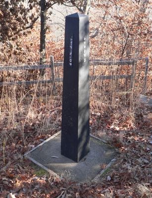
Site No. RH00-062, survey marker in Brown County, Doniphan County and Richardson County, United States
Site No. RH00-062 is a cast iron survey monument about 6 feet tall standing at the border where Nebraska and Kansas meet. The marker was positioned at the starting point of a large land survey along the 40th parallel north, helping to document and establish the historical boundaries between states.
The monument was established in 1855 by U.S. Deputy Surveyor Charles A. Manners when lands in the region were being mapped and divided. It was moved and displaced over the years, damaged in 1924, and later reset on a stronger foundation by Leo M. Petersen to protect it.
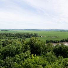
The monument sits in a quiet rural area near Rulo, Nebraska, with open fields stretching in all directions. The location is easy to find when approaching the border region where Nebraska and Kansas meet.
The monument marks where three historical boundaries meet and sits exactly on the 40th parallel north, a line that extends across multiple states. This point was crucial for defining the modern state borders in this region.
The community of curious travelers
AroundUs brings together thousands of curated places, local tips, and hidden gems, enriched daily by 60,000 contributors worldwide.