Enable Location

We need your location to show you interesting places around you

Discover nearby places

Find interesting locations and hidden gems around you

Precise directions

Get accurate directions and distances to places

Your location is never shared with other users. It's only used when you tap the location button.

Fayette Street Bridge

Log in to your account

Start exploring — it's free

Trusted by 62,341 travelers worldwide

Continue with Google
Continue with Apple
or

We will send you a code to connect

By continuing, you accept our Terms and Conditions and our Privacy Policy

Check your inbox

We've sent a pincode in your inbox. Please enter the code below.

Fayette Street Bridge

Fayette Street Bridge, road bridge over the Schuylkill River in Montgomery County, Pennsylvania

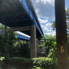
Fayette Street Bridge is a road bridge that connects Conshohocken and West Conshohocken across the Schuylkill River. The steel structure spans over 1,000 feet and allows cars and trucks to pass side by side with plenty of room.

The bridge opened in 1918 and has served as a vital link between both towns since then. A major renewal took place in 1987 to ensure driver safety and preserve the structure for future generations.

Fayette Street takes its name from General Lafayette, who passed through the area during the American Revolution. The street name connects the town to a pivotal moment in the nation's independence movement and shows how Conshohocken honors its historical roots through street naming.

The bridge serves as a major crossing point and sees steady use throughout the day, especially during rush hours and local events. It provides a safe route for cars, trucks, and sometimes bicycles to cross the river.

The structure is locally known by the alternative name Matsonford Bridge, named after a nearby street. This alternate name reflects how deeply rooted the bridge is in the local community and its history.

The community of curious travelers

AroundUs brings together thousands of curated places, local tips, and hidden gems, enriched daily by 60,000 contributors worldwide.

Start exploring
Location
Inception
1987
GPS coordinates
40.07075,-75.30930
Latest update
February 9, 2026 07:44
Around this place
Church of the Good Shepherd
United States of America

Church of the Good Shepherd

5.3 km
Woodmont
United States of America

Woodmont

1.3 km
United States of America

Villanova Stadium

4.8 km
Hovenden House, Barn and Abolition Hall
United States of America

Hovenden House, Barn and Abolition Hall

4.4 km
La Ronda
United States of America

La Ronda

2.4 km
St. Thomas of Villanova Church
United States of America

St. Thomas of Villanova Church

4.4 km
Bryn Mawr College Deanery
United States of America

Bryn Mawr College Deanery

4.9 km
Harriton House
United States of America

Harriton House

4 km
Arboretum Villanova
United States of America

Arboretum Villanova

4.7 km
Plymouth Friends Meetinghouse
United States of America

Plymouth Friends Meetinghouse

4.3 km
Old Library
United States of America

Old Library

4.9 km
Joseph Sinnott Mansion
United States of America

Joseph Sinnott Mansion

4.5 km
Schuylkill River Bridge
United States of America

Schuylkill River Bridge

3.8 km
Idlewild Farm Complex
United States of America

Idlewild Farm Complex

4.1 km
Upper Roxborough Historic District
United States of America

Upper Roxborough Historic District

5.1 km
Mill Creek Historic District
United States of America

Mill Creek Historic District

5.4 km
Dove Lake
United States of America

Dove Lake

4.7 km
Gladwyne Historic District
United States of America

Gladwyne Historic District

4.5 km
Bridge in Upper Merion Township
United States of America

Bridge in Upper Merion Township

2.7 km
Mount Joy
United States of America

Mount Joy

2 km
Henry Foundation for Botanical Research
United States of America

Henry Foundation for Botanical Research

4.7 km
Appleford/Parsons-Banks Arboretum
United States of America

Appleford/Parsons-Banks Arboretum

2.4 km
Miller's House at Spring Mill
United States of America

Miller's House at Spring Mill

2 km
Seville Theatre
United States of America

Seville Theatre

5.3 km
Poplar Lane
United States of America

Poplar Lane

2.5 km
Globe Knitting Mills
United States of America

Globe Knitting Mills

4.9 km
Pearl Harbor Memorial Bridge
United States of America

Pearl Harbor Memorial Bridge

1.1 km
Bryn Mawr College Historic District
United States of America

Bryn Mawr College Historic District

5 km
Show the full map
« Fayette Street Bridge - road bridge over the Schuylkill River in Montgomery County, Pennsylvania » is provided by Around Us (aroundus.com). Images and texts are derived from Wikimedia project under a Creative Commons license. You are allowed to copy, distribute, and modify copies of this page, under the conditions set by the license, as long as this note is clearly visible.

Discover hidden gems everywhere you go!

From secret cafés to breathtaking viewpoints, skip the crowded tourist spots and find places that match your style. Our app makes it easy with voice search, smart filtering, route optimization, and insider tips from travelers worldwide. Download now for the complete mobile experience.

Around Us App Screenshot

A unique approach to discovering new places

Le Figaro

All the places worth exploring

France Info

A tailor-made excursion in just a few clicks

20 Minutes

Around Us
Travel Guide & Maps
Download

Send to your phone

QR Code
1

Open the camera app on your mobile.

2

Point at the QR code with your camera. A notification will appear.

3

Tap the notification to open the link.