Enable Location

We need your location to show you interesting places around you

Discover nearby places

Find interesting locations and hidden gems around you

Precise directions

Get accurate directions and distances to places

Your location is never shared with other users. It's only used when you tap the location button.

Plymouth Friends Meetinghouse

Log in to your account

Start exploring — it's free

Trusted by 61,472 travelers worldwide

Continue with Google
Continue with Apple
or

We will send you a code to connect

By continuing, you accept our Terms and Conditions and our Privacy Policy

Check your inbox

We've sent a pincode in your inbox. Please enter the code below.

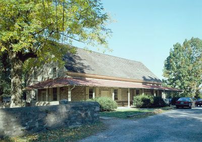
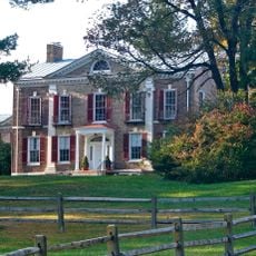
Plymouth Friends Meetinghouse, Quaker meetinghouse in Plymouth Meeting, Pennsylvania, United States.

Description

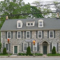
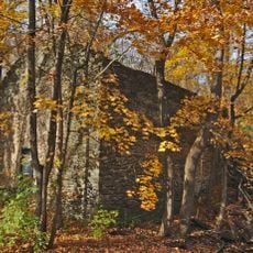
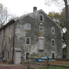
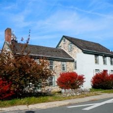
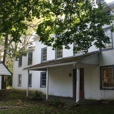
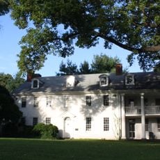
The Plymouth Friends Meetinghouse is a limestone Quaker meetinghouse in Pennsylvania located at the intersection of Germantown Pike and Butler Pike. The symmetrical Colonial structure received an addition in 1780 and continues to function as a religious gathering place.

History

The meetinghouse was established in 1708 and became an important religious center for Quakers in the region. During the American Revolutionary War, General George Washington's troops used the building as a temporary military hospital before the Battle of Barren Hill in 1778.

Culture

The building has served as a place of worship and gathering for the Quaker community for more than 300 years. Its simple, honest design reflects Quaker values and continues to draw people seeking quiet reflection and community connection.

Practical

The site sits at a convenient road intersection and is surrounded by a cemetery that is easily accessible to visitors. The Plymouth Meeting Friends School shares the grounds, making this location serve both spiritual and educational purposes for the local community.

Did you know?

The meetinghouse cemetery holds the grave of Thomas Hovenden, a 19th-century artist whose paintings documented Underground Railroad activities in the area. His works preserve an important chapter of regional history and demonstrate this community's involvement in supporting freedom seekers.

Location
GPS coordinates
40.10222,-75.28000
Latest update
December 14, 2025 09:42

AroundUs brings together thousands of curated places, local tips, and hidden gems, enriched daily by 60,000 contributors worldwide. Discover all places nearby (Pennsylvania).

Around this place
Woodmont
United States of America

Woodmont

4 km
Woodmere Art Museum
United States of America

Woodmere Art Museum

5.6 km
Elmwood Park Zoo
United States of America

Elmwood Park Zoo

6 km
Hovenden House, Barn and Abolition Hall
United States of America

Hovenden House, Barn and Abolition Hall

174 m
Fort Washington State Park
United States of America

Fort Washington State Park

4.4 km
Erdenheim Farm
United States of America

Erdenheim Farm

3.7 km
Hope Lodge
United States of America

Hope Lodge

5.9 km
Farmar Mill
United States of America

Farmar Mill

5.7 km
Thomas Mill Covered Bridge
United States of America

Thomas Mill Covered Bridge

5.7 km
Plymouth Meeting Historic District
United States of America

Plymouth Meeting Historic District

1.4 km
St. George Coptic Orthodox Church
United States of America

St. George Coptic Orthodox Church

5.5 km
Carson College for Orphan Girls
United States of America

Carson College for Orphan Girls

5 km
Schuylkill River Bridge
United States of America

Schuylkill River Bridge

3.8 km
Upper Roxborough Historic District
United States of America

Upper Roxborough Historic District

5.5 km
Springfield Mill
United States of America

Springfield Mill

4.4 km
The Highlands
United States of America

The Highlands

5.5 km
Fayette Street Bridge
United States of America

Fayette Street Bridge

4.3 km
Yeakle and Miller Houses
United States of America

Yeakle and Miller Houses

5.9 km
Mount Joy
United States of America

Mount Joy

2.9 km
Central Norristown Historic District
United States of America

Central Norristown Historic District

5.3 km
Cold Point Historic District
United States of America

Cold Point Historic District

1.7 km
Miller's House at Spring Mill
United States of America

Miller's House at Spring Mill

3 km
Alan West Corson Homestead
United States of America

Alan West Corson Homestead

2 km
Poplar Lane
United States of America

Poplar Lane

6.1 km
Globe Knitting Mills
United States of America

Globe Knitting Mills

4.5 km
Pearl Harbor Memorial Bridge
United States of America

Pearl Harbor Memorial Bridge

4.2 km
Morris Arboretum
United States of America

Morris Arboretum

5 km
The Highlands Mansion and Gardens
United States of America

The Highlands Mansion and Gardens

5.5 km
Show the full map
« Plymouth Friends Meetinghouse - Quaker meetinghouse in Plymouth Meeting, Pennsylvania, United States » is provided by Around Us (aroundus.com). Images and texts are derived from Wikimedia project under a Creative Commons license. You are allowed to copy, distribute, and modify copies of this page, under the conditions set by the license, as long as this note is clearly visible.

Discover hidden gems everywhere you go!

From secret cafés to breathtaking viewpoints, skip the crowded tourist spots and find places that match your style. Our app makes it easy with voice search, smart filtering, route optimization, and insider tips from travelers worldwide. Download now for the complete mobile experience.

Around Us App Screenshot

A unique approach to discovering new places

Le Figaro

All the places worth exploring

France Info

A tailor-made excursion in just a few clicks

20 Minutes

Around Us
Travel Guide & Maps
Download

Send to your phone

QR Code
1

Open the camera app on your mobile.

2

Point at the QR code with your camera. A notification will appear.

3

Tap the notification to open the link.