Central Aguirre Historic District

Log in to your account

AroundUs is a community-driven map of interesting places, built by curious explorers like you. It grows with every review, story, and photo you share.
Connect to save your favorite spots, contribute locations, and create personalized routes.
By continuing, you accept our Terms and Conditions and our Privacy Policy
Add to collection
Map
Suggest a change
Share

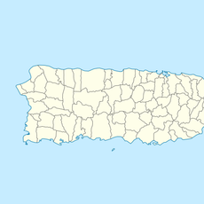
Central Aguirre Historic District, Former sugar mill district in Salinas, Puerto Rico

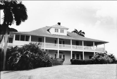
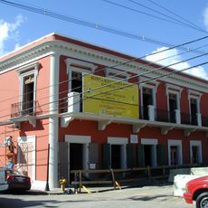
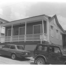
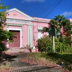
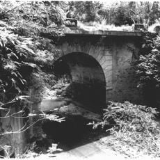
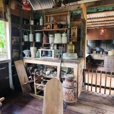
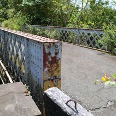
The Central Aguirre Historic District is a former sugar mill area in Salinas with over 300 buildings spread across a large site. The structures include administrative buildings, factories, warehouses, and residential areas arranged by function and social groups.

After the Spanish-American War in 1898, Ford & Company expanded the existing sugar mill into a large industrial complex. The site became Puerto Rico's second-largest sugar production facility and shaped the region for decades.

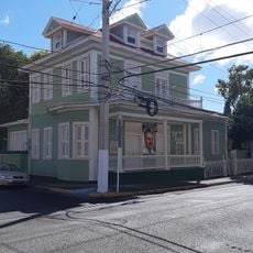
The architecture shows the social divisions of that era through separate residential areas: refined wooden cottages for American administrators stood alongside basic houses for Puerto Rican workers. This spatial separation remains visible today in the types and arrangement of buildings that still stand.

The site can be accessed via Road PR-705, though many buildings show signs of deterioration and should be observed from a safe distance. It is best to explore the grounds during daylight hours and stay on marked paths, as some structures may be unsafe.

The site is a complete early 20th-century industrial town with its own wharf, railroad system, hospital, theater, golf course, and recreation facilities. This extensive infrastructure shows how worker communities of that era were planned as nearly self-contained systems.

Location: Salinas

Location: Puerto Rico

GPS coordinates: 17.95556,-66.22472

Latest update: December 12, 2025 14:40

Photos
Around this place
Monumento al Jíbaro Puertorriqueño
United States of America

Monumento al Jíbaro Puertorriqueño

13 km
Carite State Forest
United States of America

Carite State Forest

24.8 km
Casa Cautiño
United States of America

Casa Cautiño

12.3 km
Isla Caja de Muertos Lighthouse
United States of America

Isla Caja de Muertos Lighthouse

32.2 km
San Ramón Nonato Church
United States of America

San Ramón Nonato Church

31.6 km
Caja de Muertos Nature Reserve
United States of America

Caja de Muertos Nature Reserve

32.1 km
Arenas Bridge
United States of America

Arenas Bridge

21.9 km
San Blas de Illescas Church (Coamo)
United States of America

San Blas de Illescas Church (Coamo)

19.7 km
La Robleda Natural Protected Area
United States of America

La Robleda Natural Protected Area

16.2 km
Punta de las Figuras Light
United States of America

Punta de las Figuras Light

18.8 km
Cayey Bridge
United States of America

Cayey Bridge

12.7 km
Planadas-Yeyesa Nature Reserve
United States of America

Planadas-Yeyesa Nature Reserve

14.4 km
Punta Petrona
United States of America

Punta Petrona

17 km
La Liendre Bridge
United States of America

La Liendre Bridge

22.2 km
Puente de las Calabazas
United States of America

Puente de las Calabazas

17.5 km
Pico Pomar Residence
United States of America

Pico Pomar Residence

19.8 km
Casa Natal de Luis Muñoz Rivera
United States of America

Casa Natal de Luis Muñoz Rivera

27.5 km
Eleuterio Derkes Grammar School
United States of America

Eleuterio Derkes Grammar School

12.3 km
Río Hondo Bridge
United States of America

Río Hondo Bridge

28.2 km
General Méndez Vigo Bridge
United States of America

General Méndez Vigo Bridge

19.9 km
Hacienda Los Maldonado
Puerto Rico

Hacienda Los Maldonado

11.2 km
Charco Azul
Puerto Rico

Charco Azul

25.6 km
La Casa del Cuento y de la Historia Cayeyana Ramón "Moncho" Gómez
United States of America

La Casa del Cuento y de la Historia Cayeyana Ramón "Moncho" Gómez

18.7 km
Casa y Museo del Poeta Luis Palés Matos
Puerto Rico

Casa y Museo del Poeta Luis Palés Matos

12.3 km
Carretera Central historic district
United States of America

Carretera Central historic district

20.1 km
Lago Toa Vaca
United States of America

Lago Toa Vaca

30.9 km
Lago Patillas
United States of America

Lago Patillas

22.8 km
Lago Guayabal
United States of America

Lago Guayabal

33.3 km
Show the full map
Reviews

Visited this place? Tap the stars to rate it and share your experience / photos with the community! Try now! You can cancel it anytime.

« Central Aguirre Historic District - Former sugar mill district in Salinas, Puerto Rico » is provided by Around Us (aroundus.com). Images and texts are derived from Wikimedia project under a Creative Commons license. You are allowed to copy, distribute, and modify copies of this page, under the conditions set by the license, as long as this note is clearly visible.

Discover hidden gems everywhere you go!

From secret cafés to breathtaking viewpoints, skip the crowded tourist spots and find places that match your style. Our app makes it easy with voice search, smart filtering, route optimization, and insider tips from travelers worldwide. Download now for the complete mobile experience.

Around Us App Screenshot

A unique approach to discovering new places

Le Figaro

All the places worth exploring

France Info

A tailor-made excursion in just a few clicks

20 Minutes