Manheim Borough Historic District

Log in to your account

AroundUs is a community-driven map of interesting places, built by curious explorers like you. It grows with every review, story, and photo you share.
Connect to save your favorite spots, contribute locations, and create personalized routes.
Continue with Google
Continue with Apple
Continue with X
Continue with Facebook
Continue with email
By continuing, you accept our Terms and Conditions and our Privacy Policy
Create an account
Add to collection
Map
Suggest a change
Share

Manheim Borough Historic District, Historic district in Manheim, Pennsylvania.

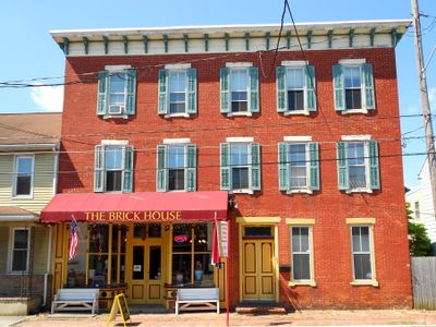
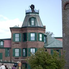
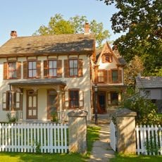
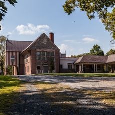
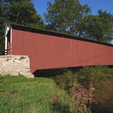
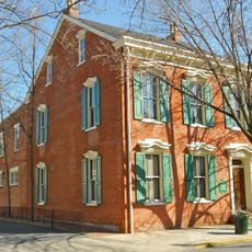
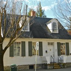
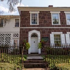
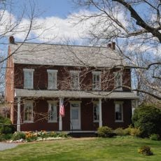
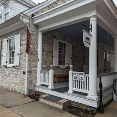
Manheim Borough Historic District is a neighborhood in Pennsylvania containing about 787 buildings that show Renaissance Revival and Italianate architectural styles. The buildings form a grid street pattern and still house shops on the ground floors with residences above, preserving the original mixed-use character.

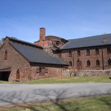
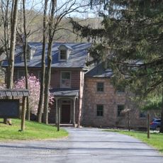
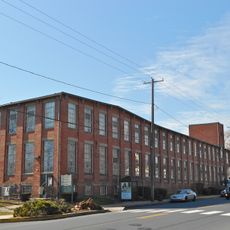
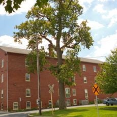
Glassmaker Henry William Stiegel founded the settlement in 1762 and established glassworks that sparked regional economic growth. Over the 1800s, additional factories emerged including cigar manufacturing and railroad connections, transforming the place into a regional trade hub.

The district reflects how a glassmaking founder shaped the town's identity, with later industries like cigar manufacturing becoming central to local pride and daily work. You can see this heritage in the way ground-floor shops still serve the community and how residents maintain the historic streets as a record of their past.

You can easily reach the district via Pennsylvania Route 72 and Route 772, which run directly through the area. The best way to explore it is on foot by walking the streets to see the building facades and architecture from all angles.

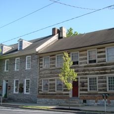
The Eisenlohr Cigar Factory still stands as a reminder of when cigar production was the economic heart of the settlement. This industrial legacy remains visible in how the building fits into the neighborhood and tells the story of workers and local commerce from that era.

Location: Pennsylvania

Architectural style: Renaissance Revival architecture

GPS coordinates: 40.16250,-76.39580

Latest update: December 14, 2025 18:08

Photos
Around this place
Cornwall Iron Furnace
United States of America

Cornwall Iron Furnace

12.1 km
Mount Hope Estate
United States of America

Mount Hope Estate

7.7 km
The Hess Homestead
United States of America

The Hess Homestead

9.4 km
Landis Valley Museum
United States of America

Landis Valley Museum

12.5 km
Speedwell Forge
United States of America

Speedwell Forge

8.1 km
Lititz Moravian Historic District
United States of America

Lititz Moravian Historic District

8.1 km
Siegrist's Mill Covered Bridge
United States of America

Siegrist's Mill Covered Bridge

11.6 km
Alden Villa
United States of America

Alden Villa

12.7 km
Stiegel-Coleman House
United States of America

Stiegel-Coleman House

11.9 km
Landis Mill Covered Bridge
United States of America

Landis Mill Covered Bridge

11.4 km
Erb's Covered Bridge
United States of America

Erb's Covered Bridge

12.9 km
Kauffman's Distillery Covered Bridge
United States of America

Kauffman's Distillery Covered Bridge

2 km
Johann Agust Sutter House
United States of America

Johann Agust Sutter House

7.6 km
Forry's Mill Covered Bridge
United States of America

Forry's Mill Covered Bridge

12.8 km
Schenck's Mill Covered Bridge
United States of America

Schenck's Mill Covered Bridge

5.8 km
Shearer's Covered Bridge
United States of America

Shearer's Covered Bridge

1.1 km
Buck Hill Farm Covered Bridge
United States of America

Buck Hill Farm Covered Bridge

8.8 km
Risser's Mill Covered Bridge
United States of America

Risser's Mill Covered Bridge

9.6 km
Shreiner Farm
United States of America

Shreiner Farm

13.6 km
United States of America

Nissly Swiss Chocolate Company

12.5 km
William Werner House
United States of America

William Werner House

7.7 km
Windom Mill Farm
United States of America

Windom Mill Farm

13.6 km
Colebrook Iron Master's House
United States of America

Colebrook Iron Master's House

13.1 km
George Brown's Sons Cotton and Woolen Mill
United States of America

George Brown's Sons Cotton and Woolen Mill

10.4 km
Brunnerville Road Bridge over Hammer Creek
United States of America

Brunnerville Road Bridge over Hammer Creek

10.6 km
Samuel N. Mumma Tobacco Warehouse
United States of America

Samuel N. Mumma Tobacco Warehouse

7.6 km
Christian Habeck Farm
United States of America

Christian Habeck Farm

11.6 km
Lititz Historical Foundation
United States of America

Lititz Historical Foundation

8 km
Show the full map
Reviews

Visited this place? Tap the stars to rate it and share your experience / photos with the community! Try now! You can cancel it anytime.

« Manheim Borough Historic District - Historic district in Manheim, Pennsylvania » is provided by Around Us (aroundus.com). Images and texts are derived from Wikimedia project under a Creative Commons license. You are allowed to copy, distribute, and modify copies of this page, under the conditions set by the license, as long as this note is clearly visible.

Discover hidden gems everywhere you go!

From secret cafés to breathtaking viewpoints, skip the crowded tourist spots and find places that match your style. Our app makes it easy with voice search, smart filtering, route optimization, and insider tips from travelers worldwide. Download now for the complete mobile experience.

Around Us App Screenshot

A unique approach to discovering new places

Le Figaro

All the places worth exploring

France Info

A tailor-made excursion in just a few clicks

20 Minutes