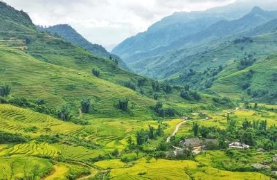
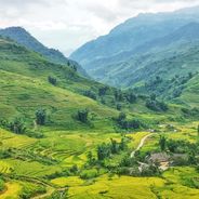
Y Tý, Mountain commune in Bát Xát, Vietnam
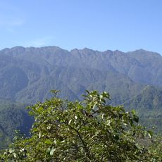
Y Tý is a mountain commune in the Hoang Lien Son range, sitting at 1,752 meters above sea level. The landscape shows rice terraces stepping down the hillsides in layers of green fields.
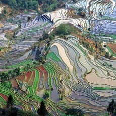
The Ha Nhi ethnic group developed the area's farming system by building terraced fields that follow the natural contours of steep slopes. This method allowed rice cultivation to thrive in mountainous terrain.
The Saturday market draws people from multiple ethnic communities who trade farm goods, traditional clothing, and handmade crafts. It remains a central gathering place where local practices and skills pass from one generation to the next.
Winters bring freezing temperatures below 0°C, so warm clothing and preparation are essential when visiting during cold months. Plan a trip from late August through mid-September to see the rice harvest and experience the busiest season in the fields.
Traditional earthen houses here feature mushroom-shaped roofs with clay walls and stone foundations that take roughly a month to build. This design reflects how residents work with local materials and adapt to mountain conditions.
Location: Bát Xát
Location: Lào Cai
Elevation above the sea: 1,752 m
GPS coordinates: 22.63472,103.60639
Latest update: December 6, 2025 17:40
Vietnam extends more than 1,000 miles (1,600 kilometers) from mountain regions in the north to the Mekong Delta in the south, offering travelers a wide range of natural and historical sites beyond urban centers. The country includes Buddhist temples like Bai Dinh and Thien Mu Pagoda, cave systems...
Fansipan
40.8 km
Bao Ha Temple
92.6 km
Honghe Hani Rice Terraces
104 km
Hoang Lien National Park
40.8 km
Zhou's House
84.5 km
Pa Uon Bridge
104.7 km
马鹿塘口岸
45.5 km
南湖瀛洲亭
84 km
Former Mengzi Customs House
84 km
Cốc Lếu Bridge
40 km
Bisezhai Railway Station
94.6 km
Faux Namti Bridge
66.9 km
Tianbao Port
131.9 kmPhu Si Lung
84.1 km
Cát Cát waterfall
41 km
Pho Lu Bridge
68.7 km
Kim Thanh Bridge
36.5 km
Datunhai reservoir
93.6 km
河口海关旧址
39.3 km
Datunhai reservoir
93.7 km
蒙自玉皇阁
84.6 km
Duoyishu Viewpoint
97.6 km
大王岩岩画
125.5 km
同盟会河口起义纪念馆
39.3 km
保兴桥
121.5 km
Hoang Su Phi Terraced Rice Fields
108 km
Honghe Hani and Yi Autonomous Prefecture Museum
85.2 km
Muong Hoa Valley
45.3 kmVisited this place? Tap the stars to rate it and share your experience / photos with the community! Try now! You can cancel it anytime.
Discover hidden gems everywhere you go!
From secret cafés to breathtaking viewpoints, skip the crowded tourist spots and find places that match your style. Our app makes it easy with voice search, smart filtering, route optimization, and insider tips from travelers worldwide. Download now for the complete mobile experience.
A unique approach to discovering new places❞
— Le Figaro
All the places worth exploring❞
— France Info
A tailor-made excursion in just a few clicks❞
— 20 Minutes