Dartmoor Training Area

Log in to your account

AroundUs is a community-driven map of interesting places, built by curious explorers like you. It grows with every review, story, and photo you share.
Connect to save your favorite spots, contribute locations, and create personalized routes.
By continuing, you accept our Terms and Conditions and our Privacy Policy

Dartmoor Training Area

Add to collection
Map
Suggest a change
Share

Dartmoor Training Area, Military training grounds in Devon, England

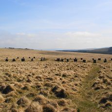
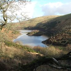
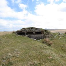
The Dartmoor Training Area is a large military training ground within Dartmoor National Park in Devon, containing multiple zones for different training exercises. The site includes both live firing ranges and dry training areas designed for varied military purposes.

The British military began its presence on Dartmoor in 1800, and later built Okehampton Artillery Practice Camp between 1892 and 1894. This early establishment made the area a key training center in southwest England.

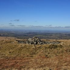
The land is shared between the military and local people, with walkers and nature enthusiasts exploring the moorland on non-training days. This mixed use shows how the military and community coexist on the same terrain.

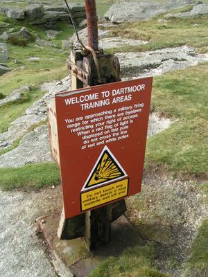
Red flags during daylight and red lamps at night signal active firing exercises, so check the training schedule before visiting. Be aware of safety boundaries and stick to designated access areas.

The grounds can handle large-scale military exercises up to brigade level and feature specialized facilities for armored vehicle operations. This capacity makes it one of the most demanding training sites for major military maneuvers.

GPS coordinates: 50.65330,-3.99486

Latest update: December 10, 2025 16:23

Photos
Around this place
Show the full map
Yes Tor
United Kingdom

Yes Tor

4.7 km
Grey Wethers
United Kingdom

Grey Wethers

5.4 km
Cranmere Pool
United Kingdom

Cranmere Pool

1.3 km
Shovel Down
United Kingdom

Shovel Down

6.4 km
Cut Hill Stone Row
United Kingdom

Cut Hill Stone Row

3 km
Fernworthy Circle
United Kingdom

Fernworthy Circle

6.6 km
Teignhead Clapper Bridge
United Kingdom

Teignhead Clapper Bridge

5 km
Two stone circles known as The Grey Wethers, three round cairns, two ring cairns and an oval enclosure in Great Stannon Newtake
United Kingdom

Two stone circles known as The Grey Wethers, three round cairns, two ring cairns and an oval enclosure in Great Stannon Newtake

5.6 km
Meldon Reservoir
United Kingdom

Meldon Reservoir

6.4 km
Scorhill stone circle, three cairns and a length of reave
United Kingdom

Scorhill stone circle, three cairns and a length of reave

6.6 km
Round cairn 780m south of the Thirlstone
United Kingdom

Round cairn 780m south of the Thirlstone

3.9 km
A partly enclosed stone hut circle settlement on Kennon Hill
United Kingdom

A partly enclosed stone hut circle settlement on Kennon Hill

6.1 km
Okehampton Artillery Range: Observation Post 7
United Kingdom

Okehampton Artillery Range: Observation Post 7

3.9 km
Stone circle 400m south west of Buttern Hill
United Kingdom

Stone circle 400m south west of Buttern Hill

6.5 km
Length of boundary wall and seven stone hut circles forming part of a large enclosure north-east of Ger Tor
United Kingdom

Length of boundary wall and seven stone hut circles forming part of a large enclosure north-east of Ger Tor

4.8 km
Round cairn 340m north of Hare Tor
United Kingdom

Round cairn 340m north of Hare Tor

4 km
Ring cairn 230m south east of Cullever Steps
United Kingdom

Ring cairn 230m south east of Cullever Steps

6.5 km
Stone circle and cairn 330m south of Little Hound Tor
United Kingdom

Stone circle and cairn 330m south of Little Hound Tor

5.8 km
Kerbed cairn and cist 635m south west of The Grey Wethers
United Kingdom

Kerbed cairn and cist 635m south west of The Grey Wethers

5.3 km
Round cairn and stone cist 310m south of Walla Brook
United Kingdom

Round cairn and stone cist 310m south of Walla Brook

5.5 km
Round cairn 190m east of Doe Tor summit
United Kingdom

Round cairn 190m east of Doe Tor summit

4.8 km
Round cairn and shelter 140m north west of Yes Tor summit
United Kingdom

Round cairn and shelter 140m north west of Yes Tor summit

4.7 km
White Moor Stone
United Kingdom

White Moor Stone

5.7 km
The North Teign coaxial field system (western part) and associated later remains at Shovel Down, Stonetor Hill and Long Ridge
United Kingdom

The North Teign coaxial field system (western part) and associated later remains at Shovel Down, Stonetor Hill and Long Ridge

6.2 km
Tinners' building in Great Stannon Newtake, 810m north west of Stannon Tor
United Kingdom

Tinners' building in Great Stannon Newtake, 810m north west of Stannon Tor

6.4 km
Milestone, 30m N of Shortacombe
United Kingdom

Milestone, 30m N of Shortacombe

6.6 km
Round cairn on Watern Tor
United Kingdom

Round cairn on Watern Tor

4 km
Guidestone, Sourton Common
United Kingdom

Guidestone, Sourton Common

6 km
Show the full map
Reviews

Visited this place? Tap the stars to rate it and share your experience / photos with the community! Try now! You can cancel it anytime.

« Dartmoor Training Area - Military training grounds in Devon, England » is provided by Around Us (aroundus.com). Images and texts are derived from Wikimedia project under a Creative Commons license. You are allowed to copy, distribute, and modify copies of this page, under the conditions set by the license, as long as this note is clearly visible.

Discover hidden gems everywhere you go!

From secret cafés to breathtaking viewpoints, skip the crowded tourist spots and find places that match your style. Our app makes it easy with voice search, smart filtering, route optimization, and insider tips from travelers worldwide. Download now for the complete mobile experience.

Around Us App Screenshot

A unique approach to discovering new places

Le Figaro

All the places worth exploring

France Info

A tailor-made excursion in just a few clicks

20 Minutes