Auchendavy Roman fort, Roman fort in East Dunbartonshire, Scotland
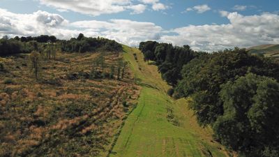
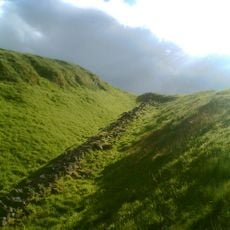
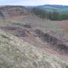
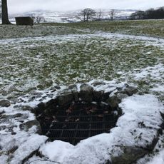
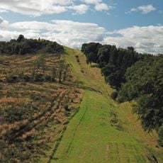
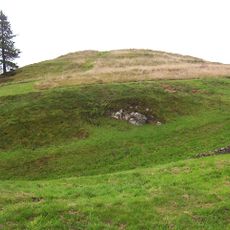
Auchendavy Roman fort is an ancient military installation that appears today as an earthen mound situated between a canal and a road in Scotland. The fortification had the typical layout of a Roman military camp and served as a garrison for troops along the frontier.
The fort was founded in the 2nd century to secure the Roman frontier in Britain with legionary troops stationed there. It was part of a chain of fortifications that stretched across hundreds of kilometers.
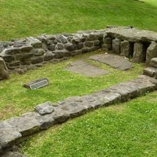
The ruins reveal traces of temples and religious practices that offer insights into how Roman soldiers worshiped at this outpost. You can see today how this place served as more than just a military base.
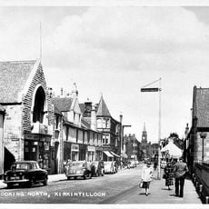
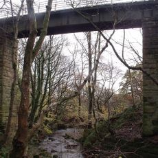
The site lies north of Kirkintilloch and is easily reached by road. The earthen mound is visible from public paths that run nearby, making it accessible without formal entry requirements.
The remains were severely damaged during 18th century canal construction, destroying significant archaeological portions. This destruction reveals how modern infrastructure altered historical sites and limited what we can learn about them.
Location: East Dunbartonshire
Location: Kirkintilloch
Part of: Antonine Wall and fort, 130m NE to 375m WSW of Auchendavie Farm
GPS coordinates: 55.94906,-4.11919
Latest update: December 14, 2025 11:01
Antonine Wall
3.8 km
Bar Hill Roman fort
3.1 km
Bedlay Castle
5.1 km
Croy Hill Roman fort
5.7 km
Adamslie Park
3.5 km
Auld Aisle Cemetery, Kirkintilloch
2.2 km
Lenzie Moss
4.2 km
St Cyprian's Church, Lenzie
3.3 km
Kirkintilloch Town Hall
2.6 km
Forth And Clyde Canal, Luggie Water Aqueduct
2.2 km
Lenzie Old Parish Church
3.7 km
Campsie High Church
5.8 km
Market Chambers, Kilsyth
5 km
Old Parish Church of St. Mary
2.7 km
Kilsyth, Howe Street, Burial-ground
4.5 km
48–50 Market Street, Kilsyth
5.1 km
Kilsyth Parish Church
4.8 km
Pump, Market Square, Kilsyth
5 km
Garrel Mill
5.4 km
Warwick Croft
4.2 km
Kilsyth, Garrel Mill House
5.4 km
Kirkintilloch, Cowgate, St Mary's Parish Church
2.5 km
Kirkintilloch, Union Street, Holy Family And St Ninian's R.c. Church
2.7 km
Bar Hill, Roman temporary camp SW of
3 km
Antonine Wall, Bar Hill, rampart, ditch, fort and Military Way
3.2 km
Castle Hill
3.4 km
Garrel Viaduct
5.5 km
Birkenburn Reservoir
5.6 kmVisited this place? Tap the stars to rate it and share your experience / photos with the community! Try now! You can cancel it anytime.
Discover hidden gems everywhere you go!
From secret cafés to breathtaking viewpoints, skip the crowded tourist spots and find places that match your style. Our app makes it easy with voice search, smart filtering, route optimization, and insider tips from travelers worldwide. Download now for the complete mobile experience.
A unique approach to discovering new places❞
— Le Figaro
All the places worth exploring❞
— France Info
A tailor-made excursion in just a few clicks❞
— 20 Minutes