Enable Location

We need your location to show you interesting places around you

Discover nearby places

Find interesting locations and hidden gems around you

Precise directions

Get accurate directions and distances to places

Your location is never shared with other users. It's only used when you tap the location button.

Log in to your account

Start exploring — it's free

Trusted by 61,566 travelers worldwide

Continue with Google
Continue with Apple
or

We will send you a code to connect

By continuing, you accept our Terms and Conditions and our Privacy Policy

Check your inbox

We've sent a pincode in your inbox. Please enter the code below.

Сиреневый Камень

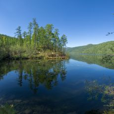
Сиреневый Камень, Natural stone formation in Eastern Siberia, Russia.

Description

Sirenevyi Kamen is a natural stone formation in Eastern Siberia with a surface displaying various shades of purple. The structure rises from the ground and derives its coloring from its mineral composition.

History

The formation was recognized as a protected natural monument during the Soviet era and has remained protected since then. This status marked an important moment in the region's conservation history.

Culture

Local people have long told stories about this stone and connected its purple color to something special and mysterious. These traditions shape how visitors experience the place when they arrive today.

Practical

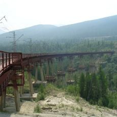
The site can be reached using marked trails that lead through the surrounding terrain. Camping areas and rest spots are available nearby for those planning to spend time at the location.

Did you know?

The stone contains rare mineral deposits that create its distinctive purple color and occur nowhere else in this part of Siberia. This geological rarity catches the attention of both visitors and researchers.

GPS coordinates
58.34180,119.07770
Latest update
December 12, 2025 14:22

AroundUs brings together thousands of curated places, local tips, and hidden gems, enriched daily by 60,000 contributors worldwide. Discover all places nearby (Russian Federation).

Around this place
Patomskiy crater
Russian Federation

Patomskiy crater

177.7 km
Chara Sands
Russian Federation

Chara Sands

176.1 km
Devil's Bridge
Russian Federation

Devil's Bridge

413.7 km
Highland of Aldan
Russian Federation

Highland of Aldan

367.7 km
Olyokma Nature Reserve
Russian Federation

Olyokma Nature Reserve

188.2 km
Vitim Nature Reserve
Russian Federation

Vitim Nature Reserve

185 km
Pik BAM
Russian Federation

Pik BAM

187.2 km
Kodar National Park
Russian Federation

Kodar National Park

188.9 km
Russian Federation

Aku Volcano

259.8 km
Udokan Plateau
Russian Federation

Udokan Plateau

242.6 km
Lenskiye Shchyoki
Russian Federation

Lenskiye Shchyoki

477 km
Памятник воинам-землякам, погибшим в годы Великой Отечественной войны (Томмот)
Russian Federation

Памятник воинам-землякам, погибшим в годы Великой Отечественной войны (Томмот)

422.2 km
Mamakan Reservoir
Russian Federation

Mamakan Reservoir

302.8 km
Ayachi, Amur Oblast
Russian Federation

Ayachi, Amur Oblast

500.7 km
Lensk war memorial
Russian Federation

Lensk war memorial

353.7 km
Текан (Амурська область)
Russian Federation

Текан (Амурська область)

507 km
Мемориал Славы (Нерюнгри)
Russian Federation

Мемориал Славы (Нерюнгри)

384.8 km
Мемориал воинской Славы (Витим)
Russian Federation

Мемориал воинской Славы (Витим)

393.2 km
Памятник И. Н. Кульбертинову (Олёкминск)
Russian Federation

Памятник И. Н. Кульбертинову (Олёкминск)

238.3 km
Ягодний (Амурська область)
Russian Federation

Ягодний (Амурська область)

518.1 km
Orthodox church of the New Martyrs and Confessors of Russia in Aldan
Russian Federation

Orthodox church of the New Martyrs and Confessors of Russia in Aldan

368.3 km
Road bridge over Aldan River in Tommot
Russian Federation

Road bridge over Aldan River in Tommot

422.8 km
Railway bridge through Aldan river in Tommot
Russian Federation

Railway bridge through Aldan river in Tommot

422.8 km
Railway bridge through Amga river in Verkhnyaya Amga
Russian Federation

Railway bridge through Amga river in Verkhnyaya Amga

483.2 km
Lensk Troyka monument
Russian Federation

Lensk Troyka monument

353.1 km
Road bridge over Amga River in Verkhnyaya Amga
Russian Federation

Road bridge over Amga River in Verkhnyaya Amga

483.1 km
Rail bridge over Ulu river
Russian Federation

Rail bridge over Ulu river

521.8 km
Road bridge over Ulu River in Ulu
Russian Federation

Road bridge over Ulu River in Ulu

522 km
Show the full map
« Сиреневый Камень - Natural stone formation in Eastern Siberia, Russia » is provided by Around Us (aroundus.com). Images and texts are derived from Wikimedia project under a Creative Commons license. You are allowed to copy, distribute, and modify copies of this page, under the conditions set by the license, as long as this note is clearly visible.

Discover hidden gems everywhere you go!

From secret cafés to breathtaking viewpoints, skip the crowded tourist spots and find places that match your style. Our app makes it easy with voice search, smart filtering, route optimization, and insider tips from travelers worldwide. Download now for the complete mobile experience.

Around Us App Screenshot

A unique approach to discovering new places

Le Figaro

All the places worth exploring

France Info

A tailor-made excursion in just a few clicks

20 Minutes

Around Us
Travel Guide & Maps
Download

Send to your phone

QR Code
1

Open the camera app on your mobile.

2

Point at the QR code with your camera. A notification will appear.

3

Tap the notification to open the link.