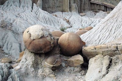
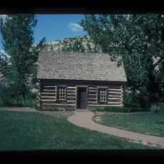
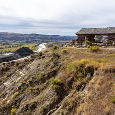
Cannonball Concretions Pullout, Geological formation in Theodore Roosevelt National Park, United States
Cannonball Concretions are perfectly round stone formations embedded within the sedimentary rock layers of the North Dakota badlands. These natural structures developed as minerals gradually accumulated around central cores over vast periods of geologic time.
These concretions formed during the deposition of sedimentary layers in an ancient marine basin millions of years ago. They persisted through subsequent geological changes and erosion to reveal the deep history of the region's landscape.
Native American tribes of the region incorporated these stone formations into their traditional stories about the formation of the landscape.
A designated pullout along the North Unit Scenic Drive provides straightforward access to view the formations. The site is relatively flat and easy to visit, though sturdy footwear helps when walking over uneven ground.
Each concretion displays distinct mineral patterns reflecting the environmental conditions under which it formed. These variations allow visitors to trace different phases of mineral deposition recorded within individual stones.
Location: McKenzie County
GPS coordinates: 47.59648,-103.33253
Latest update: December 6, 2025 19:08
Medora Musical
77.6 km
Elkhorn Ranch
45.8 km
Theodore Roosevelt's Maltese Cross Cabin
77.1 km
Fort Buford
66.2 km
Chateau de Mores
77.8 km
Four Bears Bridge
71.7 km
Snowden Bridge
72.6 km
Lake Ilo National Wildlife Refuge
56.5 km
Missouri-Yellowstone Confluence Interpretive Center
65.4 km
Fairview Lift Bridge
60.1 km
De Mores Packing Plant Ruins
77.2 km
Peaceful Valley Ranch
72.1 km
Von Hoffman House
77.3 km
Crow Flies High State Recreation Area
72.8 km
Lynch Quarry Site
59.9 km
Saints Peter and Paul Church
74.5 km
St. Mary's Catholic Church
77.3 km
Billings County Courthouse
77.4 km
Initial Rock
88 km
James Memorial Library
65.3 km
Peoples' Congregational Church
63.4 km
Old U.S. Post Office
65.1 km
Ray Opera House
84.2 km
Van Hook State Wildlife Management Area
86.9 km
Fort Union Trading Post National Historic Site
69.4 km
Fort Buford State Historic Site
66.3 km
Elkhorn Ranch State Historic Site
44.1 km
River Bend Overlook
3.7 kmVisited this place? Tap the stars to rate it and share your experience / photos with the community! Try now! You can cancel it anytime.
Discover hidden gems everywhere you go!
From secret cafés to breathtaking viewpoints, skip the crowded tourist spots and find places that match your style. Our app makes it easy with voice search, smart filtering, route optimization, and insider tips from travelers worldwide. Download now for the complete mobile experience.
A unique approach to discovering new places❞
— Le Figaro
All the places worth exploring❞
— France Info
A tailor-made excursion in just a few clicks❞
— 20 Minutes