Enable Location

We need your location to show you interesting places around you

Discover nearby places

Find interesting locations and hidden gems around you

Precise directions

Get accurate directions and distances to places

Your location is never shared with other users. It's only used when you tap the location button.

Log in to your account

Start exploring — it's free

Trusted by 61,910 travelers worldwide

Continue with Google
Continue with Apple
or

We will send you a code to connect

By continuing, you accept our Terms and Conditions and our Privacy Policy

Check your inbox

We've sent a pincode in your inbox. Please enter the code below.

Lewis and Clark State Park

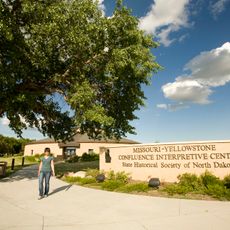
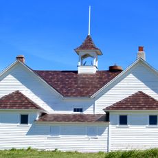
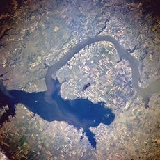
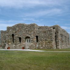
Lewis and Clark State Park, State park on Lake Sakakawea in Williston, United States.

Lewis and Clark State Park covers 525 acres with several bays along Lake Sakakawea, bordered by high ridges and grassy hills across North Dakota's natural terrain. The shoreline offers different views and access points to the large lake.

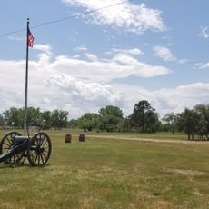
The Corps of Discovery expedition led by Meriwether Lewis and William Clark set up camp near the current park location in April 1805. This spot marks a key point along their historical journey through the American interior.

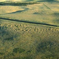
The park protects a section of mixed-grass prairie that represents the natural landscape found across North Dakota. You can walk through these grasslands and see the plants that have grown here for centuries.

The park offers four boat ramps, slip rentals at the marina, and modern cabins with air conditioning and refrigerators for overnight stays. The facilities are well-marked and easy to find, especially for boaters and campers.

The park displays different geological formations with interpretive trails explaining how North Dakota's distinctive ridges and prairies were shaped. This natural geology gives visitors insight into millions of years of Earth's formation process.

The community of curious travelers

AroundUs brings together thousands of curated places, local tips, and hidden gems, enriched daily by 60,000 contributors worldwide.

Start exploring
Location
Inception
1973
GPS coordinates
48.11560,-103.24300
Latest update
December 14, 2025 16:40
Around this place
Bakken formation
Canada

Bakken formation

38.2 km
Fort Buford
United States of America

Fort Buford

58.2 km
Four Bears Bridge
United States of America

Four Bears Bridge

52.9 km
Snowden Bridge
United States of America

Snowden Bridge

64.8 km
Lake Ilo National Wildlife Refuge
United States of America

Lake Ilo National Wildlife Refuge

96.2 km
Missouri-Yellowstone Confluence Interpretive Center
United States of America

Missouri-Yellowstone Confluence Interpretive Center

57.4 km
Fairview Lift Bridge
United States of America

Fairview Lift Bridge

57.7 km
Grassy Butte Post Office
United States of America

Grassy Butte Post Office

80.3 km
Ambrose–Torquay Border Crossing
Canada

Ambrose–Torquay Border Crossing

100 km
Crow Flies High State Recreation Area
United States of America

Crow Flies High State Recreation Area

53.9 km
Great Northern Railway Underpass
United States of America

Great Northern Railway Underpass

67.2 km
Lynch Quarry Site
United States of America

Lynch Quarry Site

96.7 km
Alkabo School
United States of America

Alkabo School

96.1 km
United States of America

Lostwood Wilderness

83.5 km
James Memorial Library
United States of America

James Memorial Library

28.6 km
Peoples' Congregational Church
United States of America

Peoples' Congregational Church

81.6 km
Niels Nielsen Fourteen-Side Barn Farm
United States of America

Niels Nielsen Fourteen-Side Barn Farm

82.4 km
Divide County Courthouse
United States of America

Divide County Courthouse

89.1 km
Old U.S. Post Office
United States of America

Old U.S. Post Office

28.6 km
Ray Opera House
United States of America

Ray Opera House

26.1 km
Mountrail County Courthouse
United States of America

Mountrail County Courthouse

67.2 km
Wabek Consolidated School
United States of America

Wabek Consolidated School

97 km
Van Hook State Wildlife Management Area
United States of America

Van Hook State Wildlife Management Area

72.1 km
Fort Union Trading Post National Historic Site
United States of America

Fort Union Trading Post National Historic Site

60.7 km
First English Free Lutheran Church (Lostwood)
United States of America

First English Free Lutheran Church (Lostwood)

72.8 km
Paul Broste Rock Museum
United States of America

Paul Broste Rock Museum

84.5 km
Fort Buford State Historic Site
United States of America

Fort Buford State Historic Site

58.1 km
Columbus Theatre
United States of America

Columbus Theatre

94.2 km
Show the full map
« Lewis and Clark State Park - State park on Lake Sakakawea in Williston, United States » is provided by Around Us (aroundus.com). Images and texts are derived from Wikimedia project under a Creative Commons license. You are allowed to copy, distribute, and modify copies of this page, under the conditions set by the license, as long as this note is clearly visible.

Discover hidden gems everywhere you go!

From secret cafés to breathtaking viewpoints, skip the crowded tourist spots and find places that match your style. Our app makes it easy with voice search, smart filtering, route optimization, and insider tips from travelers worldwide. Download now for the complete mobile experience.

Around Us App Screenshot

A unique approach to discovering new places

Le Figaro

All the places worth exploring

France Info

A tailor-made excursion in just a few clicks

20 Minutes

Around Us
Travel Guide & Maps
Download

Send to your phone

QR Code
1

Open the camera app on your mobile.

2

Point at the QR code with your camera. A notification will appear.

3

Tap the notification to open the link.