Theodore Roosevelt Wilderness

Log in to your account

AroundUs is a community-driven map of interesting places, built by curious explorers like you. It grows with every review, story, and photo you share.
Connect to save your favorite spots, contribute locations, and create personalized routes.
By continuing, you accept our Terms and Conditions and our Privacy Policy

Theodore Roosevelt Wilderness

Add to collection
Map
Suggest a change
Share

Theodore Roosevelt Wilderness, Protected wilderness area in Billings and McKenzie Counties, North Dakota.

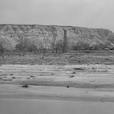
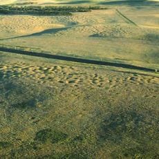
The Theodore Roosevelt Wilderness is a protected area in northwestern North Dakota featuring mixed grasslands, petrified wood remnants, and distinctive badlands formations shaped by the Little Missouri River. Three separate units compose the wilderness, connected by hiking trails and supporting herds of large mammals in their native setting.

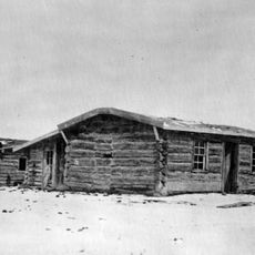
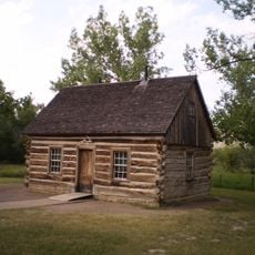
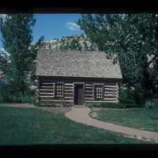
Congress established this wilderness in 1978 to preserve landscapes that shaped Theodore Roosevelt's conservation vision during his ranching years in the 1880s. The designation reflected a broader national commitment to protecting undeveloped lands across the country.

The wilderness preserves the badlands landscape that shaped Theodore Roosevelt's thinking about nature and conservation during his years as a rancher. Visitors walk through the same terrain that influenced one of America's most important environmental movements.

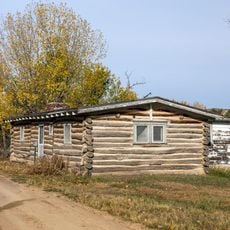
The area offers roughly 95 miles of hiking trails suitable for day trips and extended backpacking, with overnight visits requiring permits. Motorized vehicles are not allowed, so visitors explore on foot or horseback through the terrain.

The Maah Daah Hey Trail stitches together the three separate units into one continuous journey through badlands that few visitors fully explore. The route takes hikers through terrain that looks much as it did when Roosevelt roamed these grasslands over a century ago.

Location: Billings County

Location: McKenzie County

Inception: 1978

GPS coordinates: 47.56670,-103.40000

Latest update: December 12, 2025 09:05

Photos
Around this place
Medora Musical
United States of America

Medora Musical

73.4 km
Elkhorn Ranch
United States of America

Elkhorn Ranch

40.6 km
Theodore Roosevelt's Maltese Cross Cabin
United States of America

Theodore Roosevelt's Maltese Cross Cabin

73 km
Fort Buford
United States of America

Fort Buford

64.8 km
Chateau de Mores
United States of America

Chateau de Mores

73.7 km
Four Bears Bridge
United States of America

Four Bears Bridge

77.7 km
Snowden Bridge
United States of America

Snowden Bridge

71 km
Lake Ilo National Wildlife Refuge
United States of America

Lake Ilo National Wildlife Refuge

59.4 km
Missouri-Yellowstone Confluence Interpretive Center
United States of America

Missouri-Yellowstone Confluence Interpretive Center

64.1 km
Fairview Lift Bridge
United States of America

Fairview Lift Bridge

58.4 km
Grassy Butte Post Office
United States of America

Grassy Butte Post Office

22.4 km
De Mores Packing Plant Ruins
United States of America

De Mores Packing Plant Ruins

73.1 km
Peaceful Valley Ranch
United States of America

Peaceful Valley Ranch

68.1 km
Von Hoffman House
United States of America

Von Hoffman House

73.2 km
Crow Flies High State Recreation Area
United States of America

Crow Flies High State Recreation Area

78.9 km
Lynch Quarry Site
United States of America

Lynch Quarry Site

63.1 km
Saints Peter and Paul Church
United States of America

Saints Peter and Paul Church

74.1 km
St. Mary's Catholic Church
United States of America

St. Mary's Catholic Church

73.2 km
Billings County Courthouse
United States of America

Billings County Courthouse

73.4 km
Initial Rock
United States of America

Initial Rock

84.5 km
James Memorial Library
United States of America

James Memorial Library

67.1 km
Peoples' Congregational Church
United States of America

Peoples' Congregational Church

59.3 km
Golden Valley County Courthouse
United States of America

Golden Valley County Courthouse

85.9 km
Wibaux Commercial Historic District
United States of America

Wibaux Commercial Historic District

87.8 km
Old U.S. Post Office
United States of America

Old U.S. Post Office

66.8 km
Fort Union Trading Post National Historic Site
United States of America

Fort Union Trading Post National Historic Site

67.9 km
Fort Buford State Historic Site
United States of America

Fort Buford State Historic Site

64.9 km
Elkhorn Ranch State Historic Site
United States of America

Elkhorn Ranch State Historic Site

38.8 km
Show the full map
Reviews

Visited this place? Tap the stars to rate it and share your experience / photos with the community! Try now! You can cancel it anytime.

« Theodore Roosevelt Wilderness - Protected wilderness area in Billings and McKenzie Counties, North Dakota » is provided by Around Us (aroundus.com). Images and texts are derived from Wikimedia project under a Creative Commons license. You are allowed to copy, distribute, and modify copies of this page, under the conditions set by the license, as long as this note is clearly visible.

Discover hidden gems everywhere you go!

From secret cafés to breathtaking viewpoints, skip the crowded tourist spots and find places that match your style. Our app makes it easy with voice search, smart filtering, route optimization, and insider tips from travelers worldwide. Download now for the complete mobile experience.

Around Us App Screenshot

A unique approach to discovering new places

Le Figaro

All the places worth exploring

France Info

A tailor-made excursion in just a few clicks

20 Minutes