Enable Location

We need your location to show you interesting places around you

Discover nearby places

Find interesting locations and hidden gems around you

Precise directions

Get accurate directions and distances to places

Your location is never shared with other users. It's only used when you tap the location button.

Plage de la Pointe aux Chevaux

Log in to your account

Start exploring — it's free

Trusted by 61,380 travelers worldwide

Continue with Google
Continue with Apple
or

We will send you a code to connect

By continuing, you accept our Terms and Conditions and our Privacy Policy

Check your inbox

We've sent a pincode in your inbox. Please enter the code below.

Plage de la Pointe aux Chevaux

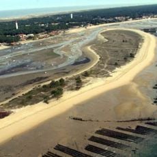
Plage de la Pointe aux Chevaux, Beach in Lège-Cap-Ferret, France

Description

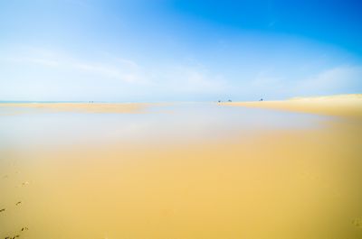
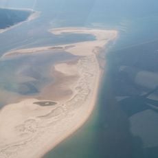
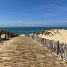
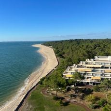
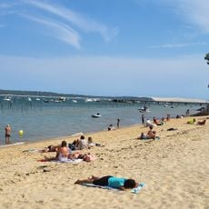
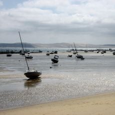
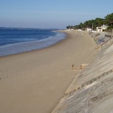
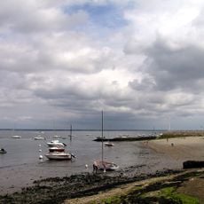
Plage de la Pointe aux Chevaux is a sandy beach fronting the Bassin d'Arcachon with views toward the Ile aux Oiseaux and rimmed by residential villas and working oyster cabins. The water here runs clear, and the shoreline displays a distinctive blend of private homes and functional wooden structures that extend into the basin.

History

In the 19th century, farmers drove their horses to this location at low tide to cross the basin and graze on salt marsh grass. This practice faded as oyster farming took root in the region and gradually claimed the water space for its own purposes.

Culture

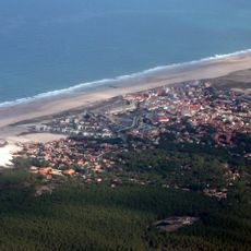
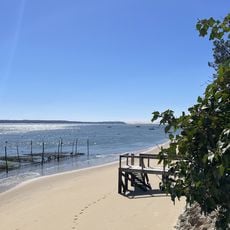
The beach is woven into the oyster-farming tradition of the region, where wooden cabins along the shore remain active centers of daily work and local livelihood. The way these structures blend into the landscape shows how families here have built their lives around the sea for generations.

Practical

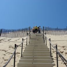
The beach is most easily reached via Impasse de la Source from Petit Piquey, with clear access paths leading toward Avenue de la Pointe aux Chevaux. The walkways are straightforward, and the sandy area is directly accessible from the residential neighborhood.

Did you know?

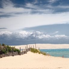
The location serves as a natural vantage point where visitors can watch how tides reshape the Bassin d'Arcachon twice daily, with water levels rising and falling dramatically. The same patch of ground shifts from submerged to exposed, creating a constantly changing shoreline that tells a different story each time you visit.

Location
GPS coordinates
44.62180,-1.25240
Latest update
December 6, 2025 19:05

AroundUs brings together thousands of curated places, local tips, and hidden gems, enriched daily by 60,000 contributors worldwide. Discover all places nearby (Lège-Cap-Ferret).

Photography around Bassin d'Arcachon: beaches, oyster villages, Dune du Pilat

The Bassin d'Arcachon covers 155 square kilometers along the French Atlantic coast and offers numerous subjects for photography. The Dune du Pilat rises 110 meters above sea level and forms the tallest sand dune in Europe. Oyster farming villages such as Gujan-Mestras, L'Herbe, and Le Canon display...

« Plage de la Pointe aux Chevaux - Beach in Lège-Cap-Ferret, France » is provided by Around Us (aroundus.com). Images and texts are derived from Wikimedia project under a Creative Commons license. You are allowed to copy, distribute, and modify copies of this page, under the conditions set by the license, as long as this note is clearly visible.

Discover hidden gems everywhere you go!

From secret cafés to breathtaking viewpoints, skip the crowded tourist spots and find places that match your style. Our app makes it easy with voice search, smart filtering, route optimization, and insider tips from travelers worldwide. Download now for the complete mobile experience.

Around Us App Screenshot

A unique approach to discovering new places

Le Figaro

All the places worth exploring

France Info

A tailor-made excursion in just a few clicks

20 Minutes

Around Us
Travel Guide & Maps
Download

Send to your phone

QR Code
1

Open the camera app on your mobile.

2

Point at the QR code with your camera. A notification will appear.

3

Tap the notification to open the link.