Enable Location

We need your location to show you interesting places around you

Discover nearby places

Find interesting locations and hidden gems around you

Precise directions

Get accurate directions and distances to places

Your location is never shared with other users. It's only used when you tap the location button.

Relief Map

Log in to your account

Start exploring — it's free

Trusted by 61,652 travelers worldwide

Continue with Google
Continue with Apple
or

We will send you a code to connect

By continuing, you accept our Terms and Conditions and our Privacy Policy

Check your inbox

We've sent a pincode in your inbox. Please enter the code below.

Relief Map

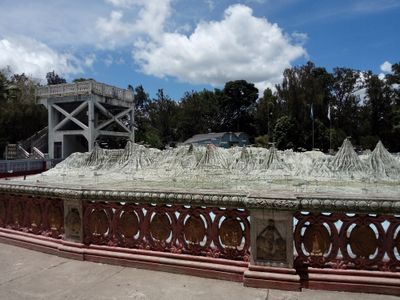
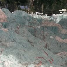
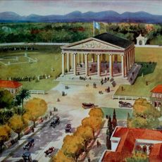
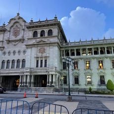
Relief Map, Open-air museum in Guatemala City, Guatemala

Description

The Relief Map is a large-scale three-dimensional model of Guatemala that shows mountains, valleys, rivers, lakes, and cities in their actual topographical relationships. Visitors can view the entire display from elevated platforms positioned around the model to see all regions clearly.

History

Engineers Francisco Vela and Claudio Urrutia completed this model in 1905 after spending 15 years surveying Guatemala by horseback to gather precise measurements. Their fieldwork across mountains and remote areas created the foundation for this accurate geographical representation.

Culture

The map displays Guatemala's natural divisions and helps visitors understand the country's physical geography at a glance. Schools and families visit to learn about how mountains, valleys, and water systems shape the different regions.

Practical

The model is located in Parque Minerva in Zone 2 and can be viewed easily from elevated observation platforms. Plan enough time to walk around the full perimeter and see different regions from various angles for a complete understanding of the geography.

Did you know?

The creators used a specialized measuring technique called the Mira Urrutia, invented specifically for this project, to achieve extremely accurate surveying of the landscape. This custom tool allowed them to capture the terrain with a level of precision that was exceptional for the early 1900s.

Location
Address
MF6R+8GG Ciudad de, Av. Simeón Cañas, Cdad. de Guatemala 01002
Phone
GPS coordinates
14.66046,-90.50859
Latest update
December 6, 2025 17:45

AroundUs brings together thousands of curated places, local tips, and hidden gems, enriched daily by 60,000 contributors worldwide. Discover all places nearby (Guatemala City).

Explore Guatemala City

Guatemala City is a cultural hub where you can explore layer upon layer of history. The colonial center contains the Plaza de la Constitución, the National Palace, and the Metropolitan Cathedral, where Spanish architecture still shapes how the city looks. Several museums preserve Maya artifacts and...

« Relief Map - Open-air museum in Guatemala City, Guatemala » is provided by Around Us (aroundus.com). Images and texts are derived from Wikimedia project under a Creative Commons license. You are allowed to copy, distribute, and modify copies of this page, under the conditions set by the license, as long as this note is clearly visible.

Discover hidden gems everywhere you go!

From secret cafés to breathtaking viewpoints, skip the crowded tourist spots and find places that match your style. Our app makes it easy with voice search, smart filtering, route optimization, and insider tips from travelers worldwide. Download now for the complete mobile experience.

Around Us App Screenshot

A unique approach to discovering new places

Le Figaro

All the places worth exploring

France Info

A tailor-made excursion in just a few clicks

20 Minutes

Around Us
Travel Guide & Maps
Download

Send to your phone

QR Code
1

Open the camera app on your mobile.

2

Point at the QR code with your camera. A notification will appear.

3

Tap the notification to open the link.