Cape Arago Highway

Log in to your account

AroundUs is a community-driven map of interesting places, built by curious explorers like you. It grows with every review, story, and photo you share.
Connect to save your favorite spots, contribute locations, and create personalized routes.
By continuing, you accept our Terms and Conditions and our Privacy Policy

Cape Arago Highway

Add to collection
Map
Suggest a change
Share

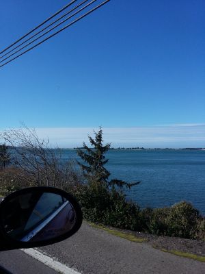
Cape Arago Highway, Coastal road in Coos County, Oregon.

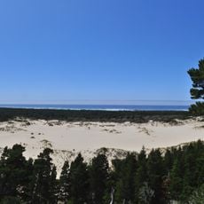
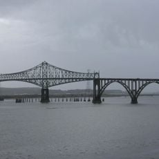
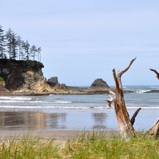
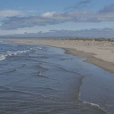
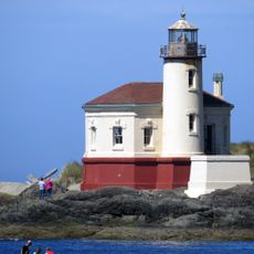
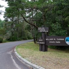
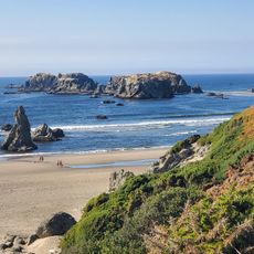
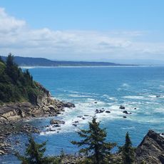
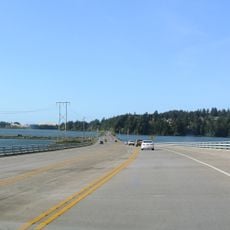
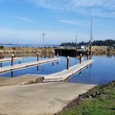
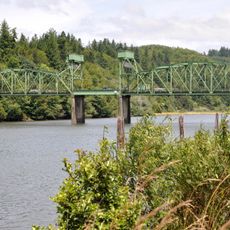
Cape Arago Highway is a road that runs from Coos Bay through Charleston to Cape Arago, providing access to bays and several coastal areas. The route passes through forested sections and open coastal regions with views of offshore rocks and sandy beaches.

The road was built in 1931 and created a connection between coastal communities that were previously difficult to reach. It follows a region where explorers centuries ago navigated the coastline.

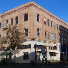
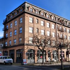
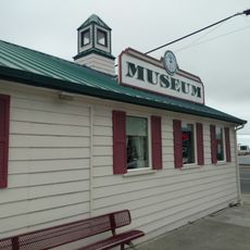
The road connects several small coastal towns where residents and visitors move between the ocean and inland areas, with stopping points that have become traditional gathering spots. Local people use it daily for work and errands, while travelers often pause to watch for wildlife from designated lookout areas.

The road is accessible by car and remains open year-round, though expect more traffic during summer months. Visitors should know that parking areas are located along the route near the viewpoints.

Several observation points along the route offer chances to watch seals in their natural setting and see whales during their yearly migrations. These viewing spots are easily reached from the car, making wildlife watching accessible to passing travelers.

Location: Coos County

Inception: January 1, 1931

Operator: Oregon Department of Transportation

Address: Cape Arago Hwy, Oregon, USA

GPS coordinates: 43.37233,-124.29569

Latest update: December 15, 2025 13:20

Photos
Around this place
Oregon Dunes National Recreation Area
United States of America

Oregon Dunes National Recreation Area

40.3 km
Bandon Dunes Golf Resort
United States of America

Bandon Dunes Golf Resort

21.9 km
Shore Acres State Park
United States of America

Shore Acres State Park

8.8 km
Conde McCullough Memorial Bridge
United States of America

Conde McCullough Memorial Bridge

8.5 km
Sunset Bay State Park
United States of America

Sunset Bay State Park

7.5 km
Bullards Beach State Park
United States of America

Bullards Beach State Park

25.8 km
Coquille River Lighthouse
United States of America

Coquille River Lighthouse

29.6 km
William M. Tugman State Park
United States of America

William M. Tugman State Park

27.3 km
Coast Guard Air Station North Bend
United States of America

Coast Guard Air Station North Bend

6.1 km
Egyptian Theatre
United States of America

Egyptian Theatre

6.7 km
Bandon Marsh National Wildlife Refuge
United States of America

Bandon Marsh National Wildlife Refuge

29.7 km
Bullards Bridge
United States of America

Bullards Bridge

26.4 km
Bullards Beach State Park

Bullards Beach State Park

25.6 km
Cape Arago State Park
United States of America

Cape Arago State Park

10.9 km
Port of Bandon
United States of America

Port of Bandon

29.6 km
Cape Arago Lighthouse
United States of America

Cape Arago Lighthouse

7.3 km
Haynes Inlet Bridge
United States of America

Haynes Inlet Bridge

9.7 km
St. James Episcopal Church
United States of America

St. James Episcopal Church

23.5 km
Coos Bay National Bank Building
United States of America

Coos Bay National Bank Building

6.6 km
Coos History Museum
United States of America

Coos History Museum

6.7 km
Marine life center
United States of America

Marine life center

4 km
J. S. Coke Building
United States of America

J. S. Coke Building

6.6 km
Washed Ashore Gallery & Volunteer Workshop
United States of America

Washed Ashore Gallery & Volunteer Workshop

29.7 km
Chandler Hotel and Annex
United States of America

Chandler Hotel and Annex

6.6 km
Bandon Historical Society Museum
United States of America

Bandon Historical Society Museum

29.7 km
Port Theater
United States of America

Port Theater

6.9 km
Liberty Theatre
United States of America

Liberty Theatre

6.9 km
Chandler Bridge
United States of America

Chandler Bridge

11.6 km
Show the full map
Reviews

Visited this place? Tap the stars to rate it and share your experience / photos with the community! Try now! You can cancel it anytime.

« Cape Arago Highway - Coastal road in Coos County, Oregon » is provided by Around Us (aroundus.com). Images and texts are derived from Wikimedia project under a Creative Commons license. You are allowed to copy, distribute, and modify copies of this page, under the conditions set by the license, as long as this note is clearly visible.

Discover hidden gems everywhere you go!

From secret cafés to breathtaking viewpoints, skip the crowded tourist spots and find places that match your style. Our app makes it easy with voice search, smart filtering, route optimization, and insider tips from travelers worldwide. Download now for the complete mobile experience.

Around Us App Screenshot

A unique approach to discovering new places

Le Figaro

All the places worth exploring

France Info

A tailor-made excursion in just a few clicks

20 Minutes