Old agricultural devices
Location: Kittitas County
GPS coordinates: 46.97215,-120.46758
Latest update: October 27, 2025 19:18

Iron Horse State Park
22.1 km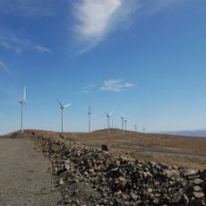
Wild Horse Wind and Solar Facility
19.8 km
Whiskey Dick Mountain
18.8 km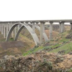
Fred G. Redmon Bridge
30.4 km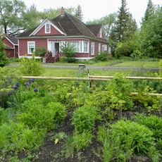
Olmstead Place State Park
388 m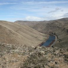
Umtanum Ridge Water Gap
14.8 km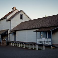
Thorp Mill
20 km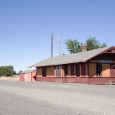
Chicago, Milwaukee, St. Paul & Pacific Railroad-Kittitas Depot
3.9 km
Wellington Wildcat Statue
6.3 km
Work of art, graffiti
4.6 km
Rock n Tomahawk Ranch
24.5 km
Nuwave Gallery
6.6 km
Gallery One
6.6 km
Washoe Statue
6.6 km
Ellensburg Rodeo Grounds
5.7 km
Ellensburg Bull
6.6 km
Dick and Jane's Spot
6.5 km
Farm Equipment Displays
674 m
Installation artwork, Work of art
6.2 km
Selah Creek Safety Rest Area
30.5 km
Scenic viewpoint
32.4 km
Scenic viewpoint
13 km
Scenic viewpoint
25.5 km
Scenic viewpoint
32.3 km
Manastash Vista Point
10.1 km
Manastash View Point
9.6 km
Scenic viewpoint
19.6 km
Scenic viewpoint
29.3 kmReviews
Visited this place? Tap the stars to rate it and share your experience / photos with the community! Try now! You can cancel it anytime.
Discover hidden gems everywhere you go!
From secret cafés to breathtaking viewpoints, skip the crowded tourist spots and find places that match your style. Our app makes it easy with voice search, smart filtering, route optimization, and insider tips from travelers worldwide. Download now for the complete mobile experience.

A unique approach to discovering new places❞
— Le Figaro
All the places worth exploring❞
— France Info
A tailor-made excursion in just a few clicks❞
— 20 Minutes