Enable Location

We need your location to show you interesting places around you

Discover nearby places

Find interesting locations and hidden gems around you

Precise directions

Get accurate directions and distances to places

Your location is never shared with other users. It's only used when you tap the location button.

El Faro, Satevó

Log in to your account

Start exploring — it's free

Trusted by 62,528 travelers worldwide

Continue with Google
Continue with Apple
or

We will send you a code to connect

By continuing, you accept our Terms and Conditions and our Privacy Policy

Check your inbox

We've sent a pincode in your inbox. Please enter the code below.

El Faro, Satevó

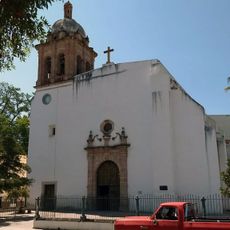
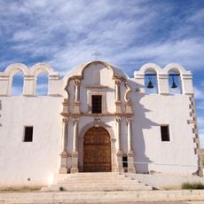
El Faro, Satevó, Historic lighthouse in Satevó, Mexico

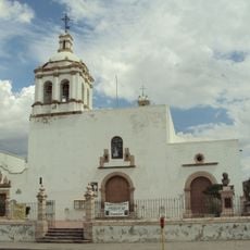
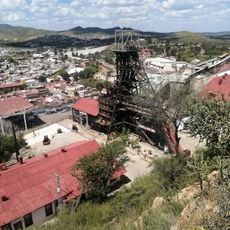
El Faro is a historic structure in Satevó, Chihuahua, built as a control point overlooking the surrounding territory. The building sits on elevated ground and commands views across the mountain landscape of the region.

The structure was established after the 1652 indigenous uprising, when Spanish authorities built control points across the region. This network helped colonial administrators monitor the distant territories more effectively.

The lighthouse blends Spanish colonial architecture with local building traditions rooted in the Tarahumara region. The structure reflects how different cultural influences shaped construction practices in the northern mountains.

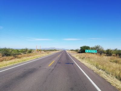
The site sits in a remote location and is reached through the nearby settlement of San José del Sitio. Visitors should prepare for rural conditions and hilly terrain when making the journey.

The location overlooks an area now shaped by the Los Gatos silver mine, a major mining operation in the region. This connection between colonial history and modern resource extraction reveals how the site's economic role has changed over time.

The community of curious travelers

AroundUs brings together thousands of curated places, local tips, and hidden gems, enriched daily by 60,000 contributors worldwide.

Start exploring
Location
Address
33155 Chihuahua, Chih., Mexico
GPS coordinates
27.73283,-106.07687
Latest update
December 6, 2025 19:10
Hidden gems of Chihuahua: canyons, waterfalls, colonial churches

The Mexican state of Chihuahua extends from desert plains to pine forests in the Sierra Madre Occidental, reaching elevations above 2000 meters. The region preserves a rich cultural and natural heritage that includes pre-Columbian rock art, colonial-era mining facilities, and religious buildings...

« El Faro, Satevó - Historic lighthouse in Satevó, Mexico » is provided by Around Us (aroundus.com). Images and texts are derived from Wikimedia project under a Creative Commons license. You are allowed to copy, distribute, and modify copies of this page, under the conditions set by the license, as long as this note is clearly visible.

Discover hidden gems everywhere you go!

From secret cafés to breathtaking viewpoints, skip the crowded tourist spots and find places that match your style. Our app makes it easy with voice search, smart filtering, route optimization, and insider tips from travelers worldwide. Download now for the complete mobile experience.

Around Us App Screenshot

A unique approach to discovering new places

Le Figaro

All the places worth exploring

France Info

A tailor-made excursion in just a few clicks

20 Minutes

Around Us
Travel Guide & Maps
Download

Send to your phone

QR Code
1

Open the camera app on your mobile.

2

Point at the QR code with your camera. A notification will appear.

3

Tap the notification to open the link.