Enable Location

We need your location to show you interesting places around you

Discover nearby places

Find interesting locations and hidden gems around you

Precise directions

Get accurate directions and distances to places

Your location is never shared with other users. It's only used when you tap the location button.

Bentonite Hills

Log in to your account

Start exploring — it's free

Trusted by 63,411 travelers worldwide

Continue with Google
Continue with Apple
or

We will send you a code to connect

By continuing, you accept our Terms and Conditions and our Privacy Policy

Check your inbox

We've sent a pincode in your inbox. Please enter the code below.

Bentonite Hills
Discussion Reviews 3 Photos
100+ Popularity

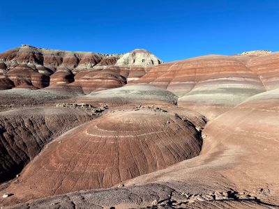
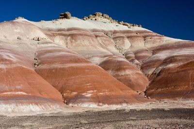
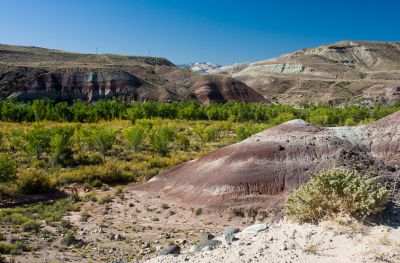
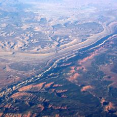
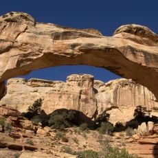
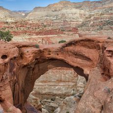
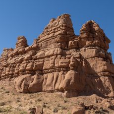
Bentonite Hills, Scenic viewpoint in Wayne County, Utah featuring colorful geological formations composed of bentonite clay and volcanic ash deposits.

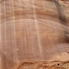
The Bentonite Hills showcase layers of diverse colors including browns, reds, purples, grays, and greens created by the Brushy Basin shale member formations that create an otherworldly landscape resembling extraterrestrial terrain.

These geological formations were created during the Jurassic period approximately 140 million years ago when swampy and lacustrine environments led to the deposition of mud, silt, fine sand, and volcanic ash that eventually lithified into distinctive shale layers.

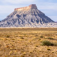
Often called Utah's Rainbow Mountains or simply Mars by visitors and social media users, these hills have gained recognition for their resemblance to Martian landscapes and serve as a filming location for space-related productions.

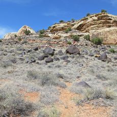
Access requires high-clearance vehicles via Hartnet Road, and visitors should check road conditions before traveling as bentonite clay becomes extremely slippery and impassable when wet, especially after rainfall or snowmelt.

The bentonite clay develops a distinctive popcorn-like texture through repeated cycles of wetting and drying, causing the surface to expand and contract while creating the nickname popcorn hills among local geologists.

The community of curious travelers

AroundUs brings together thousands of curated places, local tips, and hidden gems, enriched daily by 60,000 contributors worldwide.

Start exploring
Location
Address
Hartnet Road, UT, USA
GPS coordinates
38.36167,-111.12797
Latest update
October 24, 2025 17:38
Around this place
Capitol Reef National Park
United States of America

Capitol Reef National Park

18.3 km
Goblin Valley State Park
United States of America

Goblin Valley State Park

43 km
Waterpocket Fold
United States of America

Waterpocket Fold

12.9 km
Factory Butte
United States of America

Factory Butte

20.5 km
Mount Ellen
United States of America

Mount Ellen

39.3 km
Golden Throne
United States of America

Golden Throne

16.6 km
Elijah Cutler Behunin Cabin
United States of America

Elijah Cutler Behunin Cabin

9.6 km
Navajo Dome
United States of America

Navajo Dome

11.2 km
Fruita Schoolhouse
United States of America

Fruita Schoolhouse

13.3 km
Hanks' Dugouts
United States of America

Hanks' Dugouts

21.3 km
Fruita Rural Historic District
United States of America

Fruita Rural Historic District

13.5 km
Torrey Log Church-Schoolhouse
United States of America

Torrey Log Church-Schoolhouse

26.4 km
Ekker Butte
United States of America

Ekker Butte

15.1 km
Cathedral Valley Corral
United States of America

Cathedral Valley Corral

23.7 km
Civilian Conservation Corps Powder Magazine
United States of America

Civilian Conservation Corps Powder Magazine

14.4 km
Hans Peter Nielson Gristmill
United States of America

Hans Peter Nielson Gristmill

33.9 km
Lesley Morrell Line Cabin and Corral
United States of America

Lesley Morrell Line Cabin and Corral

24.8 km
Charles W. and Leah Lee House
United States of America

Charles W. and Leah Lee House

26.9 km
Hickman Natural Bridge
United States of America

Hickman Natural Bridge

12.3 km
Cassidys Arch
United States of America

Cassidys Arch

14.1 km
Fruita Ranger Station
United States of America

Fruita Ranger Station

14.1 km
Pioneer Register
United States of America

Pioneer Register

17 km
Capitol Reef National Park Visitor Center
United States of America

Capitol Reef National Park Visitor Center

14.1 km
Kathline Rock
United States of America

Kathline Rock

41.1 km
Hickman Bridge Trail
United States of America

Hickman Bridge Trail

11.9 km
Little Wild Horse Canyon
United States of America

Little Wild Horse Canyon

29.3 km
Carl’s Critter Garden
United States of America

Carl’s Critter Garden

36.4 km
Bell Canyon
United States of America

Bell Canyon

37.8 km
Show the full map
Reviews
Share your experience

No review yet

Discussions
Start a discussion...

No discussion yet

« Bentonite Hills » is provided by Around Us (aroundus.com). Images and texts are derived from Wikimedia project under a Creative Commons license. You are allowed to copy, distribute, and modify copies of this page, under the conditions set by the license, as long as this note is clearly visible.

Discover hidden gems everywhere you go!

From secret cafés to breathtaking viewpoints, skip the crowded tourist spots and find places that match your style. Our app makes it easy with voice search, smart filtering, route optimization, and insider tips from travelers worldwide. Download now for the complete mobile experience.

Around Us App Screenshot

A unique approach to discovering new places

Le Figaro

All the places worth exploring

France Info

A tailor-made excursion in just a few clicks

20 Minutes

Around Us
Travel Guide & Maps
Download

Send to your phone

QR Code
1

Open the camera app on your mobile.

2

Point at the QR code with your camera. A notification will appear.

3

Tap the notification to open the link.