Enable Location

We need your location to show you interesting places around you

Discover nearby places

Find interesting locations and hidden gems around you

Precise directions

Get accurate directions and distances to places

Your location is never shared with other users. It's only used when you tap the location button.

Důl Alexander

Log in to your account

Start exploring — it's free

Trusted by 62,505 travelers worldwide

Continue with Google
Continue with Apple
or

We will send you a code to connect

By continuing, you accept our Terms and Conditions and our Privacy Policy

Check your inbox

We've sent a pincode in your inbox. Please enter the code below.

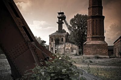
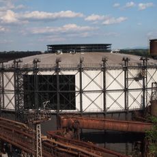
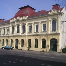
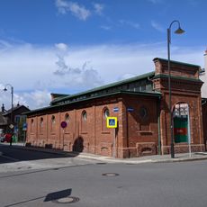
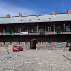
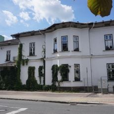
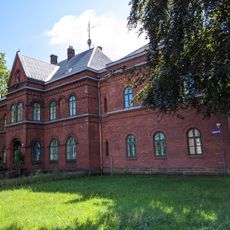
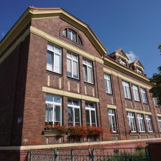
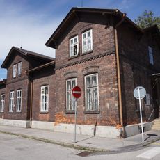
Důl Alexander, Cultural monument mine in Kunčičky, Czech Republic

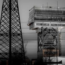
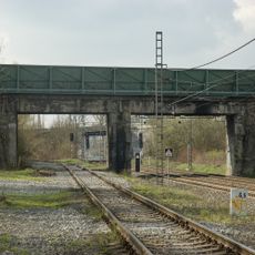
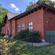
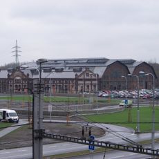
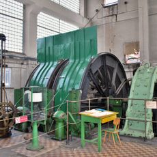
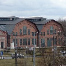
Důl Alexander is a former coal mine in the Kunčičky area that retains its original mining infrastructure including towers and industrial buildings. The site contains the physical layout and equipment typical of deep mining operations from the late 19th and 20th centuries.

A railway company began construction in 1896 and started operations in 1898, developing it into a major coal extraction site for the region throughout the 20th century. Operations ceased in 1992 after nearly a century of activity.

The site was named after a nobleman who led the railway company that built it, reflecting the industrial ties between ownership and regional development. Walking through the grounds shows how mining shaped both the landscape and the identity of the surrounding area.

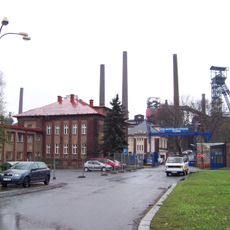
The site now serves as headquarters for a charitable organization and is accessible only through guided tours arranged by local groups. Contact local organizations in advance to schedule a visit.

The deep mining method allowed extraction from depths that surface operations could not reach, making it one of the longest-running mines in the region. This technical approach set it apart from competing operations of its era.

The community of curious travelers

AroundUs brings together thousands of curated places, local tips, and hidden gems, enriched daily by 60,000 contributors worldwide.

Start exploring
Location
Inception
1896
GPS coordinates
49.81110,18.29750
Latest update
December 14, 2025 12:27
Around this place
Lower Vítkovice
Czech Republic

Lower Vítkovice

1.7 km
Bolt Tower
Czech Republic

Bolt Tower

1.6 km
Důl Hlubina
Czech Republic

Důl Hlubina

1.8 km
Gong
Czech Republic

Gong

1.6 km
Mine Jeremenko
Czech Republic

Mine Jeremenko

1.9 km
Kunčický bludný balvan
Czech Republic

Kunčický bludný balvan

2.1 km
Rothschild Palace in Vítkovice
Czech Republic

Rothschild Palace in Vítkovice

1.9 km
Český dům (budova : Vítkovice, Ostrava, Česko)
Czech Republic

Český dům (budova : Vítkovice, Ostrava, Česko)

1.7 km
Fountain (sad Jožky Jabůrkové)
Czech Republic

Fountain (sad Jožky Jabůrkové)

1.9 km
Tržnice
Czech Republic

Tržnice

2.1 km
Mírová 18
Czech Republic

Mírová 18

2.1 km
Energetická substance
Czech Republic

Energetická substance

1.9 km
Platan u fary na Mírovém náměstí
Czech Republic

Platan u fary na Mírovém náměstí

2.1 km
Obloukový železniční most Kunčice - Vítkovice
Czech Republic

Obloukový železniční most Kunčice - Vítkovice

1.4 km
1872 strike casualties memorial
Czech Republic

1872 strike casualties memorial

1.9 km
Most trati Nová huť – Vítkovické železárny přes trať Kunčice - Kunčičky
Czech Republic

Most trati Nová huť – Vítkovické železárny přes trať Kunčice - Kunčičky

1.1 km
Železniční most přes Těšínskou ulici
Czech Republic

Železniční most přes Těšínskou ulici

2.2 km
Mateřská škola
Czech Republic

Mateřská škola

2.1 km
Elektrocentrála koksovny Karolina
Czech Republic

Elektrocentrála koksovny Karolina

2.1 km
Ruská 11
Czech Republic

Ruská 11

1.9 km
Fara u kostela svatého Pavla apoštola
Czech Republic

Fara u kostela svatého Pavla apoštola

2.1 km
Zaopatřovací ústav
Czech Republic

Zaopatřovací ústav

2 km
Bývalý domov řádových sester, nyní vrátnice
Czech Republic

Bývalý domov řádových sester, nyní vrátnice

2.1 km
Vybavení jámy Louis
Czech Republic

Vybavení jámy Louis

1.8 km
Elektrocentrála Žofinské huti
Czech Republic

Elektrocentrála Žofinské huti

2.1 km
Torzo mostu přes Ostravici nad jezem Kunčičky
Czech Republic

Torzo mostu přes Ostravici nad jezem Kunčičky

974 m
Přemostění Místecké ulice jižně od Kauflandu v Moravské Ostravě
Czech Republic

Přemostění Místecké ulice jižně od Kauflandu v Moravské Ostravě

2.1 km
Most železniční vlečky Kunčice - Vítkovice
Czech Republic

Most železniční vlečky Kunčice - Vítkovice

1.4 km
Show the full map
« Důl Alexander - Cultural monument mine in Kunčičky, Czech Republic » is provided by Around Us (aroundus.com). Images and texts are derived from Wikimedia project under a Creative Commons license. You are allowed to copy, distribute, and modify copies of this page, under the conditions set by the license, as long as this note is clearly visible.

Discover hidden gems everywhere you go!

From secret cafés to breathtaking viewpoints, skip the crowded tourist spots and find places that match your style. Our app makes it easy with voice search, smart filtering, route optimization, and insider tips from travelers worldwide. Download now for the complete mobile experience.

Around Us App Screenshot

A unique approach to discovering new places

Le Figaro

All the places worth exploring

France Info

A tailor-made excursion in just a few clicks

20 Minutes

Around Us
Travel Guide & Maps
Download

Send to your phone

QR Code
1

Open the camera app on your mobile.

2

Point at the QR code with your camera. A notification will appear.

3

Tap the notification to open the link.