Chest opened
+${chestReward.xp} XP
Explorer
NOUVEAU ×${chestReward.collectible.quantity}
tapez pour fermer
Chest locked

Open chests in the app

Around Us is built for your phone — chests unlock when you walk, explore and capture nearby places.

Enable Location

We need your location to show you interesting places around you

Discover nearby places

Find interesting locations and hidden gems around you

Precise directions

Get accurate directions and distances to places

Your location is never shared with other users. It's only used when you tap the location button.

Log in to your account

Start exploring — it's free

Trusted by 72,918 travelers worldwide

Continue with Google
Continue with Apple
or

We will send you a code to connect

By continuing, you accept our Terms and Conditions and our Privacy Policy

Check your inbox

We've sent a pincode in your inbox. Please enter the code below.

Jofegan, California
Discussion Reviews Photo
1.4k Popularity

Jofegan, California, Military settlement in San Diego County, United States

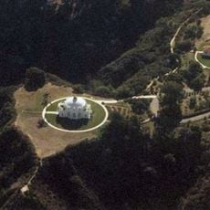
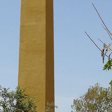
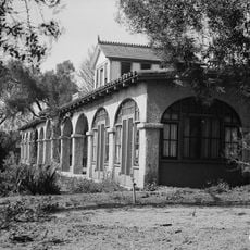
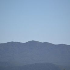
Jofegan is a military settlement in San Diego County, located west of Vandegrift Boulevard within Camp Pendleton Marine Corps Base. The area sits near Lake O'Neill and forms part of this large military installation.

The settlement takes its name from General Joseph Fegan, who commanded Camp Pendleton during the military base's early years. This naming reflects the influence of military leadership in shaping the area.

The location marks a transition point between civilian and military territories, reflecting the strong military presence in San Diego County's development.

The site sits remote within the military base and is not easily accessible to the general public. Visitors should understand that entry requires military authorization and most areas remain restricted.

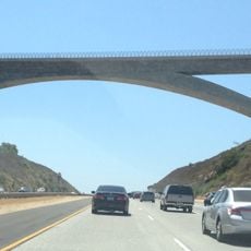
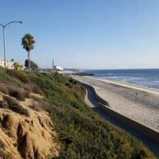
An abandoned railroad line runs alongside the settlement, showing remnants of earlier transportation infrastructure predating the modern military base. This old rail route offers a glimpse into how the area once connected different communities.

The community of curious travelers

AroundUs brings together thousands of curated places, local tips, and hidden gems, enriched daily by 60,000 contributors worldwide.

Start exploring
GPS coordinates
33.31510,-117.33200
Latest update
December 14, 2025 16:46
Around this place
Mission San Luis Rey de Francia
United States of America

Mission San Luis Rey de Francia

9.3 km
California Surf Museum
United States of America

California Surf Museum

13.9 km
Oceanside Pier
United States of America

Oceanside Pier

14.7 km
Carlsbad State Beach
United States of America

Carlsbad State Beach

18.7 km
Mount Ecclesia
United States of America

Mount Ecclesia

11.8 km
Lilac Road Bridge
United States of America

Lilac Road Bridge

17 km
Antique Gas and Steam Engine Museum
United States of America

Antique Gas and Steam Engine Museum

12 km
WWII/Korea LVT Museum
United States of America

WWII/Korea LVT Museum

12.4 km
Alta Vista Gardens
United States of America

Alta Vista Gardens

15.7 km
Rancho Guajome Adobe
United States of America

Rancho Guajome Adobe

11.7 km
Junior Seau Pier Amphitheatre
United States of America

Junior Seau Pier Amphitheatre

14.3 km
Harbor Beach
United States of America

Harbor Beach

13.6 km
Oceanside Museum of Art
United States of America

Oceanside Museum of Art

13.7 km
Margarita Peak
United States of America

Margarita Peak

15.4 km
Americanization School
United States of America

Americanization School

13.7 km
Tamarack Beach
United States of America

Tamarack Beach

18.4 km
Buccaneer Beach
United States of America

Buccaneer Beach

15.4 km
Boomers
United States of America

Boomers

14.7 km
Caruso Memorial Chapel
United States of America

Caruso Memorial Chapel

15.2 km
Georgina Cole Library
United States of America

Georgina Cole Library

16.8 km
California Surf Museum
United States of America

California Surf Museum

14 km
Ayuntamiento y Estación de Bomberos de Oceanside
United States of America

Ayuntamiento y Estación de Bomberos de Oceanside

13.7 km
Casa Charles Libby
United States of America

Casa Charles Libby

14.1 km
Finca y jardines Grand Tradition
United States of America

Finca y jardines Grand Tradition

10.9 km
Oceanside City Beach
United States of America

Oceanside City Beach

14.2 km
Reserva Botánica de Laguna Niguel
United States of America

Reserva Botánica de Laguna Niguel

8.2 km
Wave Waterpark
United States of America

Wave Waterpark

15.1 km
Deer Park Winery & Auto Museum
United States of America

Deer Park Winery & Auto Museum

19.1 km
Show the full map
Reviews
Share your experience

No review yet

Discussions
Start a discussion...

No discussion yet

« Jofegan, California - Military settlement in San Diego County, United States » is provided by Around Us (aroundus.com). Images and texts are derived from Wikimedia project under a Creative Commons license. You are allowed to copy, distribute, and modify copies of this page, under the conditions set by the license, as long as this note is clearly visible.

Discover hidden gems everywhere you go!

From secret cafés to breathtaking viewpoints, skip the crowded tourist spots and find places that match your style. Our app makes it easy with voice search, smart filtering, route optimization, and insider tips from travelers worldwide. Download now for the complete mobile experience.

Around Us App Screenshot

A unique approach to discovering new places

Le Figaro

All the places worth exploring

France Info

A tailor-made excursion in just a few clicks

20 Minutes

Around Us
Travel Guide & Maps
Download

Send to your phone

QR Code
1

Open the camera app on your mobile.

2

Point at the QR code with your camera. A notification will appear.

3

Tap the notification to open the link.