Chest opened
+${chestReward.xp} XP
Explorer
NOUVEAU ×${chestReward.collectible.quantity}
tapez pour fermer

See the monuments around you in AR Open chests in the app

Around Us is built for your phone — point your camera at the streets and discover the monuments and places around you in augmented reality. Around Us is built for your phone — chests unlock when you walk, explore and capture nearby places.

Enable Location

We need your location to show you interesting places around you

Discover nearby places

Find interesting locations and hidden gems around you

Precise directions

Get accurate directions and distances to places

Your location is never shared with other users. It's only used when you tap the location button.

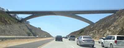
Lilac Road Bridge

Log in to your account

Start exploring — it's free

Trusted by 85,780 travelers worldwide

Continue with Google
Continue with Apple
or

We will send you a code to connect

By continuing, you accept our Terms and Conditions and our Privacy Policy

Check your inbox

We've sent a pincode in your inbox. Please enter the code below.

Lilac Road Bridge
Discussion Reviews 1 Photos
5.4k Popularity

Lilac Road Bridge, Road bridge in Escondido, United States

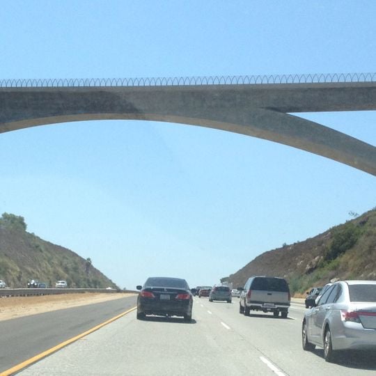
Lilac Road Bridge is a road bridge in Escondido that carries traffic across Interstate 15. It features a reinforced concrete arch design with a main span of approximately 455 feet and a total length of approximately 745 feet.

This bridge was constructed in the late 1970s and represented a significant infrastructure investment for the region at that time. It was built to improve transportation connections for areas north of San Diego.

The structure bears the official designation Walter F. Maxwell Memorial Bridge, marking its role in connecting local communities across San Diego County.

The bridge is easily accessible for vehicles traveling northward through the area. It connects directly to local roads near the State Route 76 exit and serves as an important through-passage in the region.

The bridge features continuously tapering dimensions that reflect varying stress requirements, making it one of two overcrossings with this specific arch design in San Diego County.

The community of curious travelers

AroundUs brings together thousands of curated places, local tips, and hidden gems, enriched daily by 60,000 contributors worldwide.
Start exploring
Location
Official opening
1978
Made from material
concrete
GPS coordinates
33.30030,-117.15000
Latest update
August 30, 2026 12:44
Around this place
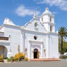
Mission San Luis Rey de Francia
United States of America

Mission San Luis Rey de Francia

10.9 mi
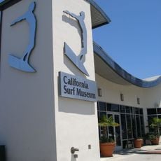
California Surf Museum
United States of America

California Surf Museum

15.1 mi
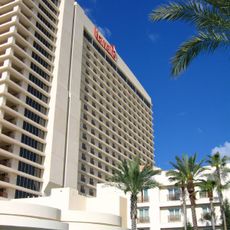
Harrah's Resort Southern California
United States of America

Harrah's Resort Southern California

11.4 mi
Agua Hedionda Lagoon
United States of America

Agua Hedionda Lagoon

15 mi
Mount Ecclesia
United States of America

Mount Ecclesia

13.6 mi
Deer Park Monastery
United States of America

Deer Park Monastery

8.9 mi
San Diego Aqueduct
United States of America

San Diego Aqueduct

3.2 mi
Agua Tibia Wilderness
United States of America

Agua Tibia Wilderness

12.1 mi
Temecula Valley
United States of America

Temecula Valley

12 mi
Double Peak
United States of America

Double Peak

13.3 mi
Antique Gas and Steam Engine Museum
United States of America

Antique Gas and Steam Engine Museum

7.8 mi
Alta Vista Gardens
United States of America

Alta Vista Gardens

7.4 mi
Craftsmanship Museum
United States of America

Craftsmanship Museum

12.7 mi
Rancho Guajome Adobe
United States of America

Rancho Guajome Adobe

7.6 mi
Rancho De Los Kiotes
United States of America

Rancho De Los Kiotes

13.4 mi
Oceanside Museum of Art
United States of America

Oceanside Museum of Art

15 mi
A.H. Beach House
United States of America

A.H. Beach House

13.4 mi
Escondido Public Library
United States of America

Escondido Public Library

13.1 mi
Temecula's Chapel of Memories
United States of America

Temecula's Chapel of Memories

13.6 mi
Kendall-Jackson Wine Estate and Gardens
United States of America

Kendall-Jackson Wine Estate and Gardens

15 mi
Thomas House
United States of America

Thomas House

13.2 mi
Georgina Cole Library
United States of America

Georgina Cole Library

14.5 mi
Palomar College Arboretum
United States of America

Palomar College Arboretum

11 mi
Ayuntamiento y Estación de Bomberos de Oceanside
United States of America

Ayuntamiento y Estación de Bomberos de Oceanside

15 mi
Casa Charles Libby
United States of America

Casa Charles Libby

14.6 mi
Finca y jardines Grand Tradition
United States of America

Finca y jardines Grand Tradition

7 mi
Wave Waterpark
United States of America

Wave Waterpark

8.9 mi
Deer Park Winery & Auto Museum
United States of America

Deer Park Winery & Auto Museum

4.2 mi
Show the full map
Reviews
Share your experience

No review yet

Discussions
Start a discussion...

No discussion yet

« Lilac Road Bridge - Road bridge in Escondido, United States » is provided by Around Us (aroundus.com). Images and texts are derived from Wikimedia project under a Creative Commons license. You are allowed to copy, distribute, and modify copies of this page, under the conditions set by the license, as long as this note is clearly visible.

Discover hidden gems everywhere you go!

From secret cafés to breathtaking viewpoints, skip the crowded tourist spots and find places that match your style. Our app makes it easy with voice search, smart filtering, route optimization, and insider tips from travelers worldwide. Download now for the complete mobile experience.

Around Us App Screenshot

A unique approach to discovering new places

Le Figaro

All the places worth exploring

France Info

A tailor-made excursion in just a few clicks

20 Minutes

Around Us
Travel Guide & Maps
Download

Send to your phone

QR Code
1

Open the camera app on your mobile.

2

Point at the QR code with your camera. A notification will appear.

3

Tap the notification to open the link.