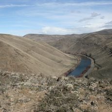
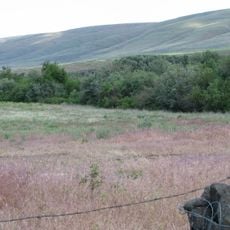
Yakima Fold Belt, Fold and thrust belt in south-central Washington, US
The Yakima Fold Belt is a series of ridges and valleys in south-central Washington created by tectonic compression. The landscape displays asymmetrical mountain ranges that resulted from the folding of rock layers over millions of years.
This tectonic formation developed about 20 million years ago when Columbia River basalt layers were compressed and folded upward. The geological structure was shaped by sustained pressure from the west over this extended timeframe.
Research at the Yakima Fold Belt contributes to understanding seismic risks near nuclear facilities and major dams along the Columbia and Snake Rivers.
The best access for observation is from Interstate 90, which runs along the formation. Hikers and researchers can view the folded rock layers from several vantage points along this route.
The region compresses approximately three millimeters annually due to Oregon's rotation around a point near Lewiston, Idaho, affecting local seismic patterns.
The community of curious travelers
AroundUs brings together thousands of curated places, local tips, and hidden gems, enriched daily by 60,000 contributors worldwide.