Chest opened
+${chestReward.xp} XP
Explorer
NOUVEAU ×${chestReward.collectible.quantity}
tapez pour fermer

See the monuments around you in AR Open chests in the app

Around Us is built for your phone — point your camera at the streets and discover the monuments and places around you in augmented reality. Around Us is built for your phone — chests unlock when you walk, explore and capture nearby places.

•

Enable Location

We need your location to show you interesting places around you

Discover nearby places

Find interesting locations and hidden gems around you

Precise directions

Get accurate directions and distances to places

Your location is never shared with other users. It's only used when you tap the location button.

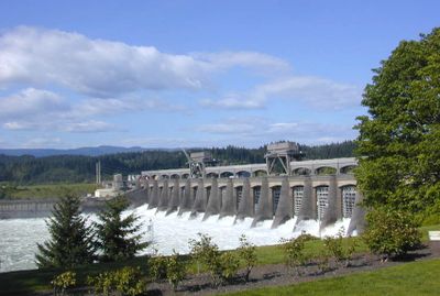
Priest Rapids Dam

Log in to your account

Start exploring — it's free

Trusted by 88,636 travelers worldwide

Continue with Google
Continue with Apple
or

We will send you a code to connect

By continuing, you accept our Terms and Conditions and our Privacy Policy

Check your inbox

We've sent a pincode in your inbox. Please enter the code below.

Discussion Reviews 1 Photos
6.4k Popularity

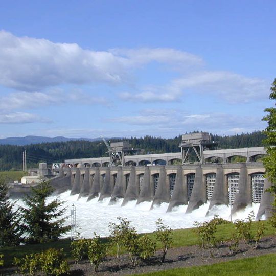
Priest Rapids Dam, Hydroelectric power station on Columbia River, Washington, US

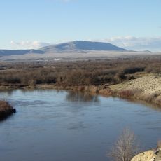
Priest Rapids Dam is a hydroelectric facility spanning the Columbia River between Yakima County and Grant County in Washington, equipped with ten power-generating turbines. The structure harnesses the river's flow to produce electricity for regional communities.

Construction started in 1956 following Congressional approval, with power generation beginning in 1959. The project was part of a larger effort to develop the Columbia River for energy production during the mid-20th century.

The dam's creation transformed the regional landscape from natural rapids to a controlled waterway, affecting both agricultural practices and Native American territories.

Access to this facility is limited since it is an active industrial installation. Visitors should expect distant views from the river or nearby public areas and must respect safety guidelines.

The dam's reservoir flooded the original Priest Rapids, submerging roughly 29 kilometers (18 miles) of river landscape. This now-hidden section was once a defining natural landmark of the region.

The community of curious travelers

AroundUs brings together thousands of curated places, local tips, and hidden gems, enriched daily by 60,000 contributors worldwide.

Start exploring
Location
Inception
1956
Length
3,079 m
Operator
PUD No 2 of Grant County
GPS coordinates
46.64585,-119.90700
Latest update
September 12, 2026 03:21
Around this place
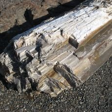
Ginkgo Petrified Forest State Park
United States of America

Ginkgo Petrified Forest State Park

21.4 mi
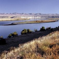
Hanford Reach National Monument
United States of America

Hanford Reach National Monument

19 mi
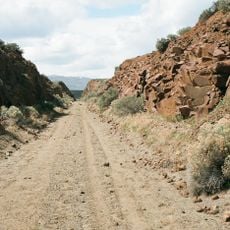
Iron Horse State Park
United States of America

Iron Horse State Park

22.5 mi
Rattlesnake Mountain
United States of America

Rattlesnake Mountain

21.7 mi
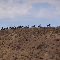
Grandfather Cuts Loose the Ponies
United States of America

Grandfather Cuts Loose the Ponies

22.3 mi
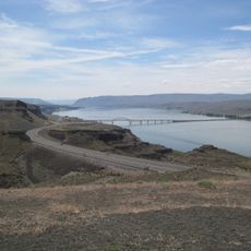
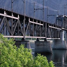
Vantage Bridge
United States of America

Vantage Bridge

20.8 mi
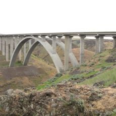
Fred G. Redmon Bridge
United States of America

Fred G. Redmon Bridge

25.6 mi
Columbia National Wildlife Refuge
United States of America

Columbia National Wildlife Refuge

22.6 mi
Beverly Railroad Bridge
United States of America

Beverly Railroad Bridge

13 mi
Yakima Sportsman State Park
United States of America

Yakima Sportsman State Park

26.7 mi
Vernita Bridge
United States of America

Vernita Bridge

8.3 mi
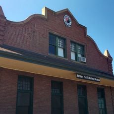
Northern Pacific Railway Museum Toppenish
United States of America

Northern Pacific Railway Museum Toppenish

26.7 mi
United States of America

Work of art

25.1 mi
United States of America

Scenic viewpoint

26.4 mi
United States of America

Ginkgo Petrified Forest Interpretive Center

21.7 mi
United States of America

Work of art

25 mi
United States of America

Wanapum Vista Viewpoint

22.2 mi
United States of America

Selah Creek Safety Rest Area

25.8 mi
United States of America

Echo Vista Viewpoint

22.9 mi
United States of America

Country Park Event Center & Fair Grounds

26.4 mi
United States of America

Scenic viewpoint

26.1 mi
United States of America

Scenic viewpoint

22.9 mi
United States of America

Scenic viewpoint

26.4 mi
United States of America

Scenic viewpoint

21.7 mi
United States of America

Scenic viewpoint

22.8 mi
United States of America

Scenic viewpoint

24.6 mi
United States of America

Scenic viewpoint

24.3 mi
United States of America

Waterfall

26.1 mi
Show the full map
Reviews
Share your experience

No review yet

Discussions
Start a discussion...

No discussion yet

« Priest Rapids Dam - Hydroelectric power station on Columbia River, Washington, US » is provided by Around Us (aroundus.com). Images and texts are derived from Wikimedia project under a Creative Commons license. You are allowed to copy, distribute, and modify copies of this page, under the conditions set by the license, as long as this note is clearly visible.

Discover hidden gems everywhere you go!

From secret cafés to breathtaking viewpoints, skip the crowded tourist spots and find places that match your style. Our app makes it easy with voice search, smart filtering, route optimization, and insider tips from travelers worldwide. Download now for the complete mobile experience.

Around Us App Screenshot
❝

A unique approach to discovering new places❞

— Le Figaro

❝

All the places worth exploring❞

— France Info

❝

A tailor-made excursion in just a few clicks❞

— 20 Minutes

Around Us
Travel Guide & Maps
Download

Send to your phone

QR Code
1

Open the camera app on your mobile.

2

Point at the QR code with your camera. A notification will appear.

3

Tap the notification to open the link.