Chest opened
+${chestReward.xp} XP
Explorer
NOUVEAU ×${chestReward.collectible.quantity}
tapez pour fermer
Chest locked

Open chests in the app

Around Us is built for your phone — chests unlock when you walk, explore and capture nearby places.

Enable Location

We need your location to show you interesting places around you

Discover nearby places

Find interesting locations and hidden gems around you

Precise directions

Get accurate directions and distances to places

Your location is never shared with other users. It's only used when you tap the location button.

Log in to your account

Start exploring — it's free

Trusted by 72,951 travelers worldwide

Continue with Google
Continue with Apple
or

We will send you a code to connect

By continuing, you accept our Terms and Conditions and our Privacy Policy

Check your inbox

We've sent a pincode in your inbox. Please enter the code below.

Stone's Ferry, Nevada
Discussion Reviews Photo
2.4k Popularity

Stone's Ferry, Nevada, Historic ferry crossing on Colorado River, Nevada.

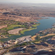
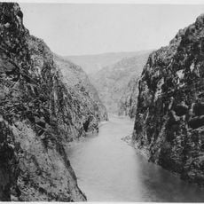
Stone's Ferry was a river crossing on the Colorado River near the Virgin River mouth, operating at several locations along the Nevada and Arizona border. The ferry provided travelers and trading caravans with a vital passage across the water.

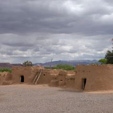
The ferry began as a Mormon settlement in the 1870s and was later converted into a commercial ferry operation by Daniel Bonelli for mining enterprises. This shift made the location a central hub for moving raw materials throughout the region.

The ferry landing served as a meeting point between Mormon communities and larger trading routes during western expansion. People used this location as an important connection for exchange between different settlements.

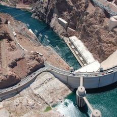
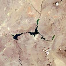
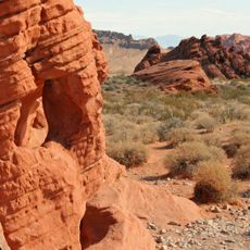
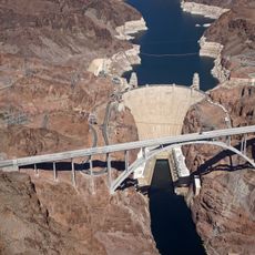
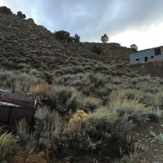
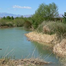
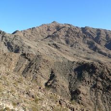
The original site now lies beneath Lake Mead's Virgin Basin, but can be accessed through nearby recreational areas and hiking trails. A visit works best when combined with exploration of the surrounding landscape and available shoreline paths.

The ferry carried salt transported by Captain L.C. Wilburn on barges, supplying silver ore processing plants nearby. This salt supply was vital for the mining industry operating in neighboring mining towns.

The community of curious travelers

AroundUs brings together thousands of curated places, local tips, and hidden gems, enriched daily by 60,000 contributors worldwide.

Start exploring
GPS coordinates
36.12830,-114.44800
Latest update
December 13, 2025 11:42
Around this place
Hoover Dam
United States of America

Hoover Dam

28.9 km
Lake Mead
United States of America

Lake Mead

14.5 km
Valley of Fire State Park
United States of America

Valley of Fire State Park

35.4 km
Sam Boyd Stadium
United States of America

Sam Boyd Stadium

51.4 km
Mike O'Callaghan–Pat Tillman Memorial Bridge
United States of America

Mike O'Callaghan–Pat Tillman Memorial Bridge

29.4 km
Lake Las Vegas
United States of America

Lake Las Vegas

42.3 km
Black Canyon of the Colorado
United States of America

Black Canyon of the Colorado

43.1 km
Lost City Museum
United States of America

Lost City Museum

44.9 km
El Dorado Canyon
United States of America

El Dorado Canyon

52.4 km
Clark County Wetlands Park
United States of America

Clark County Wetlands Park

51.8 km
Las Vegas Motor Speedway
United States of America

Las Vegas Motor Speedway

52.9 km
Eldorado Casino
United States of America

Eldorado Casino

49.3 km
Nevada Southern Railroad Museum
United States of America

Nevada Southern Railroad Museum

40.7 km
Klondike Sunset Casino
United States of America

Klondike Sunset Casino

51.5 km
Sunrise Mountain
United States of America

Sunrise Mountain

50.2 km
Acacia Demonstration Gardens
United States of America

Acacia Demonstration Gardens

52.2 km
Boulder City Historic District
United States of America

Boulder City Historic District

38.6 km
Gold Strike Hot Springs
United States of America

Gold Strike Hot Springs

30.1 km
Willow Beach Gauging Station
United States of America

Willow Beach Gauging Station

34.1 km
Mount Wilson
United States of America

Mount Wilson

20.8 km
Lost City Museum-Archaeology
United States of America

Lost City Museum-Archaeology

44.9 km
Shan-Gri-La Prehistoric Park (aka the Dinosaur House)
United States of America

Shan-Gri-La Prehistoric Park (aka the Dinosaur House)

49.5 km
Winged Figures of the Republic
United States of America

Winged Figures of the Republic

29 km
Hoover Dam Exhibits
United States of America

Hoover Dam Exhibits

28.9 km
Boulder Theatre
United States of America

Boulder Theatre

38.7 km
Hoover Dam Visitor Center
United States of America

Hoover Dam Visitor Center

29 km
Alan Bible Visitor Center
United States of America

Alan Bible Visitor Center

34 km
Little Finland
United States of America

Little Finland

41.4 km
Show the full map
Reviews
Share your experience

No review yet

Discussions
Start a discussion...

No discussion yet

« Stone's Ferry, Nevada - Historic ferry crossing on Colorado River, Nevada » is provided by Around Us (aroundus.com). Images and texts are derived from Wikimedia project under a Creative Commons license. You are allowed to copy, distribute, and modify copies of this page, under the conditions set by the license, as long as this note is clearly visible.

Discover hidden gems everywhere you go!

From secret cafés to breathtaking viewpoints, skip the crowded tourist spots and find places that match your style. Our app makes it easy with voice search, smart filtering, route optimization, and insider tips from travelers worldwide. Download now for the complete mobile experience.

Around Us App Screenshot

A unique approach to discovering new places

Le Figaro

All the places worth exploring

France Info

A tailor-made excursion in just a few clicks

20 Minutes

Around Us
Travel Guide & Maps
Download

Send to your phone

QR Code
1

Open the camera app on your mobile.

2

Point at the QR code with your camera. A notification will appear.

3

Tap the notification to open the link.