Chest opened
+${chestReward.xp} XP
Explorer
NOUVEAU ×${chestReward.collectible.quantity}
tapez pour fermer
Chest locked

Open chests in the app

Around Us is built for your phone — chests unlock when you walk, explore and capture nearby places.

Enable Location

We need your location to show you interesting places around you

Discover nearby places

Find interesting locations and hidden gems around you

Precise directions

Get accurate directions and distances to places

Your location is never shared with other users. It's only used when you tap the location button.

Log in to your account

Start exploring — it's free

Trusted by 72,884 travelers worldwide

Continue with Google
Continue with Apple
or

We will send you a code to connect

By continuing, you accept our Terms and Conditions and our Privacy Policy

Check your inbox

We've sent a pincode in your inbox. Please enter the code below.

Pembina Region
Discussion Reviews Photo
2.4k Popularity

Pembina Region, Historical territory in Minnesota, US.

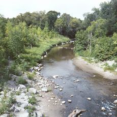
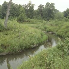
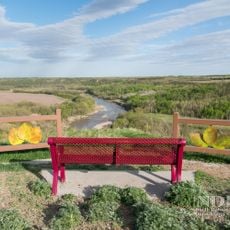
The Pembina Region covers areas within the Hudson Bay drainage basin across parts of present-day Minnesota, North Dakota, and South Dakota. The territory sits along major river systems and is marked by its flat to gently rolling landscape with forests and grasslands.

After the Treaty of 1818, this territory moved from British to United States control. Before and after this shift, it went through several changes in administrative boundaries and belonged at different times to Michigan, Iowa, and Wisconsin before becoming part of Minnesota and Dakota.

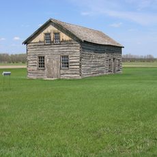
The region served as a center for fur trading and hunting where Anishinaabe, Métis, and French traders met and lived together. This blend of peoples shaped the daily practices and skills of those who settled here.

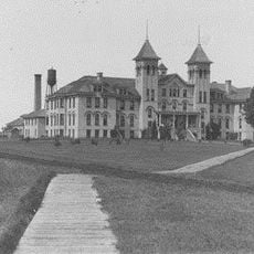
The region today spans multiple states, so it cannot be visited as a single place but rather explored as a historical concept. Those interested in the history can visit various towns and museums across Minnesota and the Dakotas to learn about early trade routes and settlements.

A missionary named Father Belcourt documented the extent of this region and described it as a vast area stretching across great distances. His records give us insight today into how people perceived this territory in the 1800s.

The community of curious travelers

AroundUs brings together thousands of curated places, local tips, and hidden gems, enriched daily by 60,000 contributors worldwide.

Start exploring
Location
Inception
1818
GPS coordinates
48.33333,-97.83333
Latest update
December 13, 2025 11:41
Around this place
Alerus Center
United States of America

Alerus Center

72.1 km
AN/FPQ-16 PARCS
United States of America

AN/FPQ-16 PARCS

41.1 km
North Dakota Mill and Elevator
United States of America

North Dakota Mill and Elevator

72.5 km
Turtle River State Park
United States of America

Turtle River State Park

50.4 km
Grand Forks Air Defense Sector
United States of America

Grand Forks Air Defense Sector

54.6 km
Icelandic State Park
United States of America

Icelandic State Park

50 km
Grafton State School
United States of America

Grafton State School

31.7 km
446th Missile Squadron
United States of America

446th Missile Squadron

52.4 km
Pembina Gorge State Recreation Area
United States of America

Pembina Gorge State Recreation Area

69.7 km
447th Missile Squadron
United States of America

447th Missile Squadron

52.4 km
448th Missile Squadron
United States of America

448th Missile Squadron

52.4 km
Gingras Trading Post State Historic Site
United States of America

Gingras Trading Post State Historic Site

67.3 km
United States of America

Vikur Lutheran Church at Mountain

38.8 km
St. Catherine's Church
United States of America

St. Catherine's Church

28.5 km
Roxy Theatre
United States of America

Roxy Theatre

61.7 km
St. Stanislaus Church Historic District
United States of America

St. Stanislaus Church Historic District

43.2 km
Strand Theatre
United States of America

Strand Theatre

32.7 km
Walla Theatre
United States of America

Walla Theatre

66.1 km
Avalon Theatre
United States of America

Avalon Theatre

50.1 km
Pembina County Courthouse
United States of America

Pembina County Courthouse

53.2 km
Walsh County Courthouse
United States of America

Walsh County Courthouse

33.1 km
Larimore City Hall
United States of America

Larimore City Hall

49.8 km
Forest River State Bank
United States of America

Forest River State Bank

30.1 km
United States of America

Minto School

34.3 km
Tofthagen Library and Museum
United States of America

Tofthagen Library and Museum

49.9 km
United States of America

State Bank of Edinburg

18.2 km
Edinburg WPA Auditorium
United States of America

Edinburg WPA Auditorium

18.2 km
Cavalier Theatre
United States of America

Cavalier Theatre

53.6 km
Show the full map
Reviews
Share your experience

No review yet

Discussions
Start a discussion...

No discussion yet

« Pembina Region - Historical territory in Minnesota, US » is provided by Around Us (aroundus.com). Images and texts are derived from Wikimedia project under a Creative Commons license. You are allowed to copy, distribute, and modify copies of this page, under the conditions set by the license, as long as this note is clearly visible.

Discover hidden gems everywhere you go!

From secret cafés to breathtaking viewpoints, skip the crowded tourist spots and find places that match your style. Our app makes it easy with voice search, smart filtering, route optimization, and insider tips from travelers worldwide. Download now for the complete mobile experience.

Around Us App Screenshot

A unique approach to discovering new places

Le Figaro

All the places worth exploring

France Info

A tailor-made excursion in just a few clicks

20 Minutes

Around Us
Travel Guide & Maps
Download

Send to your phone

QR Code
1

Open the camera app on your mobile.

2

Point at the QR code with your camera. A notification will appear.

3

Tap the notification to open the link.